🦁 Kenya · Narok County · Serengeti–Mara Ecosystem

The Masai Mara National Reserve

Kenya’s most celebrated wildland — 1,510 km² of open savannah between the Oloololo Escarpment and the Mara River, home to the Great Wildebeest Migration, the highest lion densities in Africa, and the Maasai people who have shared this land for centuries. This is the complete, conservation-led guide to the reserve — what it is, what lives here, and how to visit it well.

Gazetted 1961 · ~1,510 km² · 1°29′S, 35°08′E · Altitude 1,500–2,170 m
1,510km² core reserve
95+mammal species
570+bird species
1.3Mwildebeest in the migration
15+community conservancies
📍 The entity, defined

What the Masai Mara National Reserve actually is

The Masai Mara National Reserve is a 1,510 km² protected savannah in Narok County, south-western Kenya — the Kenyan northern sector of the transboundary Serengeti–Mara ecosystem, and the stage for the annual Great Wildebeest Migration.

It is a national reserve, not a national park. That single legal distinction explains most of what makes the Mara different: it is administered by the County Government of Narok and the Mara Conservancy rather than by the Kenya Wildlife Service, it is largely unfenced, and its boundaries sit directly against Maasai group ranches where people, cattle and wildlife still share ground.

The name itself is Maa. Mara means “spotted” — a description of the plains seen from the Oloololo Escarpment, dappled with acacia scrub, cloud shadow and moving herds. Masai (also written Maasai) names the pastoralist people whose ancestral rangelands became the reserve.

First protected in 1948 as a 520 km² wildlife sanctuary in the Mara Triangle, converted to a game reserve in 1961, expanded to some 1,821 km², and later reduced to today’s 1,510 km² when land was returned to local communities. Those returned lands are now the Mara conservancies — the most important conservation development in the ecosystem’s modern history.

Field note

“National reserve” is not a downgrade. It is the reason the Mara works: the wildlife moves freely across an unfenced boundary into Naboisho, Olare Motorogi, Mara North and on into Tanzania’s Serengeti National Park. Fence it, and the migration ends.

Masai Mara at a glance

Type
National Reserve (county-managed)
Country
Kenya — Narok County
Area
~1,510 km² core; ~7,000 km² Greater Mara
Established
1948 sanctuary · 1961 game reserve
Coordinates
1°29′S, 35°08′E
Altitude
1,500–2,170 m above sea level
Managed by
Narok County Govt · Mara Conservancy (Triangle)
Borders
Serengeti National Park, Tanzania
Rivers
Mara · Talek · Sand
Main gates
Sekenani · Talek · Oloololo · Musiara · Sand River · Oloolaimutia
Known for
Great Migration · Big Five · big-cat density
From Nairobi
~230 km · 5–6 hrs road · 45 min flight
Maasai MaraMMNRMara Reserve The MaraMasai Mara Game Reserve
🗺️ Geography & landscape

The land that makes the Mara the Mara

Almost every famous Mara sighting is explained by a landform. Learn the geography and you stop chasing sightings at random — you start reading the country.

Watercourse

The Mara River

The ecosystem’s artery, rising in Kenya’s Mau Forest Complex and flowing south-west into Lake Victoria. It never fully dries, which is precisely why the migration comes. Home to enormous Nile crocodile and hippopotamus populations, and the site of the famous Mara River crossings.

Watercourse

The Talek River

The Mara’s main tributary, dividing the northern reserve and giving its name to Talek Gate and Talek town. Its riverine forest is prime leopard country and the traditional territory of the Talek lion prides.

Watercourse

The Sand River

Seasonal river marking the Kenya–Tanzania boundary near Sand River Gate. Early wildebeest columns often enter here from the Serengeti weeks before the first Mara River crossing.

Escarpment

Oloololo (Siria) Escarpment

The 400 m wall of the Great Rift Valley forming the reserve’s western edge and the boundary of the Mara Triangle. Its rim carries the classic panorama of the entire western Mara.

Plains

Paradise Plain & Rhino Ridge

Paradise Plain holds the most photographed crossing points on the Mara River. Rhino Ridge is elevated grassland offering long sightlines — the reserve’s most reliable black rhino and cheetah country.

Wetland

Musiara Marsh

Permanent swamp fed by springs near Musiara Gate — the territory made famous by the Marsh Pride of lions in Big Cat Diary, and a magnet for elephant, buffalo and waterbirds in the dry months.

Hills

Ngama Hills & Lookout Hill

The eastern Ngama Hills carry sandy soils and dense leleshwa bush — the reserve’s best black rhino refuge. Lookout Hill is the classic sundowner viewpoint over the central plains.

Grasslands

Loita Plains & Burrangat

North-east of the reserve, the Loita Plains host the resident Loita wildebeest migration — a separate, smaller Kenyan migration that most visitors never hear about.

Boundary

The Serengeti frontier

The southern boundary is an open, unfenced line with Serengeti National Park. Wildlife, and the migration, treats it as if it does not exist — which ecologically, it does not.

Habitat mosaic — a savannah, not a jungle

Roughly 70% of the reserve is open grassland dominated by Themeda triandra (red oat grass), which is exactly what a million grazing wildebeest require. The remaining 30% is what creates the diversity:

  • Open savannah grassland — the migration’s engine and cheetah’s hunting ground.
  • Acacia woodlandVachellia and Balanites stands used by giraffe, elephant and resting lion.
  • Riverine forest — figs and croton along the Mara and Talek, holding leopard, baboon and turaco.
  • Swamps & marshlandMusiara Marsh and spring lines that hold water and life through drought.
  • Rocky escarpment & hills — klipspringer, rock hyrax, and the raptors that nest above them.
  • Leleshwa (Croton) thicket — the Ngama Hills cover that shelters rhino and serval.
Why it matters

The Mara’s productivity comes from volcanic soils, reliable rainfall (~800–1,200 mm/yr) and grazing lawns cropped short by resident topi, zebra and Thomson’s gazelle. Those short lawns are why the migration can feed here at all.

Open savannah grassland of the Masai Mara National Reserve beneath the Oloololo Escarpment
🧭 Inside the boundary

The reserve’s sectors, gates and airstrips

The Mara is not one uniform place. Which sector you sleep in decides your drive times, your crowds and, honestly, your photographs.

Sector 01

The Mara Triangle

The western third, bounded by the Mara River, the Oloololo Escarpment and the Tanzanian border. Managed separately by the Mara Conservancy on behalf of the Trans Mara County community — the best-policed, least crowded and best-maintained part of the whole reserve. Strict off-road rules, excellent anti-poaching, superb crossings at Purungat and Serena.

Sector 02

Sekenani & the Central Plains

The eastern gateway sector around Sekenani Gate and Keekorok. Most road arrivals from Nairobi enter here. High lodge density, easy access, big herds — and the highest vehicle concentrations at cat sightings.

Sector 03

Musiara & the Marsh

Northern sector around Musiara Gate, Musiara Marsh and Governors’ area. Classic Marsh Pride country, superb dry-season game, quick access to Paradise Plain crossings.

Sector 04

Talek & the Northern Reserve

Centred on Talek Gate and the Talek River. Riverine forest, strong leopard record, and the shortest hop to the Olare Motorogi and Naboisho conservancies.

Sector 05

Sand River & the Southern Border

The quiet far south at the Serengeti frontier. Fewer camps, long empty horizons, and the earliest migration arrivals crossing the Sand River.

Sector 06

Ngama Hills & the East

Broken hill country, sandy soils and dense leleshwa — the reserve’s black rhino stronghold, and rewarding for serval, caracal and bat-eared fox.

The six main gates

GateSectorBest for
Sekenani GateEastern / centralMain road arrivals from Nairobi via Narok
Talek GateNorthern / centralTalek camps, conservancy transfers
Oloolaimutia GateSouth-eastKeekorok, Sopa and eastern lodges
Musiara GateNorthMarsh area, Governors’ camps
Oloololo GateNorth-westThe Mara Triangle, Kichwa Tembo, Angama
Sand River GateSouthTanzania border crossings to the Serengeti

Gates open 06:00 and close 18:30. Entry tickets run on a 24-hour cycle from time of entry, and are issued through the Mara digital ticketing system — cash is no longer accepted at the gate.

Airstrips

AirstripServes
KeekorokCentral & south-eastern reserve
Ol KiomboTalek, central reserve, Olare Motorogi
MusiaraMarsh area & northern reserve
Mara SerenaThe Mara Triangle
Kichwa Tembo / AngamaNorth-west & escarpment camps
Mara North / NgerendeNorthern conservancies
Siana & NaboishoEastern conservancies

Scheduled flights from Wilson Airport, Nairobi take 45–50 minutes on Safarilink, AirKenya and Mombasa Air Safari; most routes touch two or three airstrips before yours.

🐾 Wildlife of the Mara

One of Africa’s densest large-mammal communities

Over 95 mammal species and 570+ recorded birds. The Mara’s real distinction is not the species list — it is predator density: the reserve and its conservancies hold one of the highest concentrations of African lion anywhere on Earth.

SpeciesStatus in the MaraWhere to look
African lionAbundant — among the highest densities in Africa; famous prides include the Marsh Pride, Topi Pride and Paradise PrideMusiara Marsh, Paradise Plain, Talek, Rhino Ridge
African leopardCommon but secretive; excellent habituated individuals along the riversTalek River, Mara River riverine forest, Olare Orok
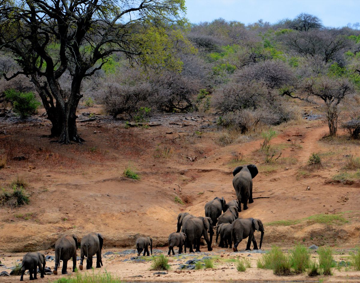
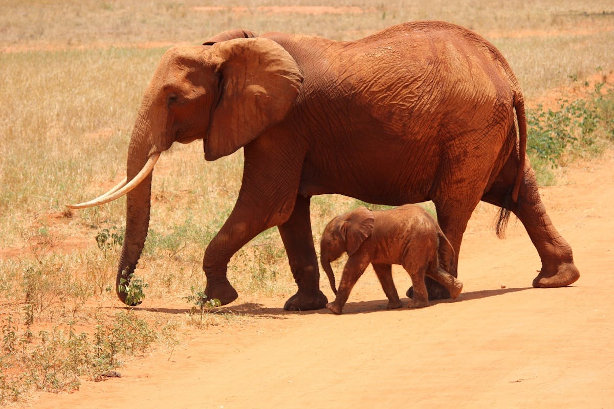
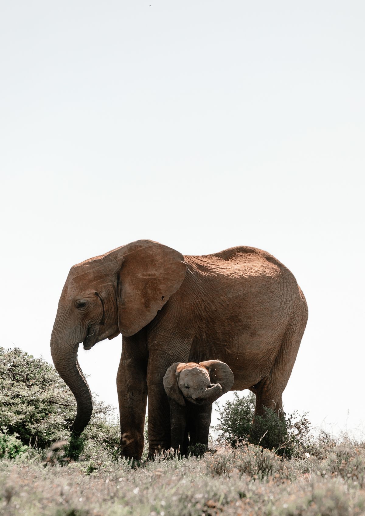
African bush elephantResident and seasonal; herds move between reserve, conservancies and the Loita and Nyakweri forestsMusiara Marsh, Mara Triangle, Ngama Hills
Cape buffaloAbundant; large herds on open plains, old bulls in the swampsMusiara, Paradise Plain, Mara Triangle
Black rhinocerosSmall, closely protected, critically endangered population — the Mara holds one of Kenya’s few free-ranging groupsNgama Hills, Rhino Ridge, Mara Triangle

The white rhinoceros does not naturally occur in the Masai Mara National Reserve — sightings claimed as such are usually from Lake Nakuru National Park or Ol Pejeta Conservancy.

Cheetah

The Mara is one of the world’s best places to see cheetah hunting in daylight. Vehicle harassment is their single biggest threat here — keep 30 m back and never surround a hunting cat.

Spotted hyena

Not a scavenger by default — the Mara’s spotted hyena clans are formidable hunters and out-number lions across the ecosystem.

African wild dog

Endangered and rare; small packs occasionally range through the Loita plains and northern conservancies. Any sighting is exceptional.

Serval & caracal

Small cats of long grass and thicket. Serval hunt rodents in the marsh margins; caracal favour the drier eastern hills.

Black-backed jackal & bat-eared fox

Ubiquitous on the open plains — bat-eared fox dens are a reliable early-morning subject on short-grass areas.

Striped hyena & honey badger

Both present, both scarce and mostly nocturnal — best odds on conservancy night drives, which are not permitted inside the reserve.

White-bearded wildebeest

The migratory Connochaetes taurinus mearnsi — roughly 1.3 million animals in the migration, plus a resident Loita wildebeest population.

Plains zebra

Migrate alongside wildebeest in a genuine partnership: zebra crop the tall coarse stems, opening the short green growth wildebeest prefer.

Topi

The Mara’s signature antelope — sentinels standing on termite mounds. The ecosystem holds one of the largest topi populations anywhere.

Coke’s hartebeest (kongoni)

Resident grazer of open grassland, often mixed with topi and zebra herds.

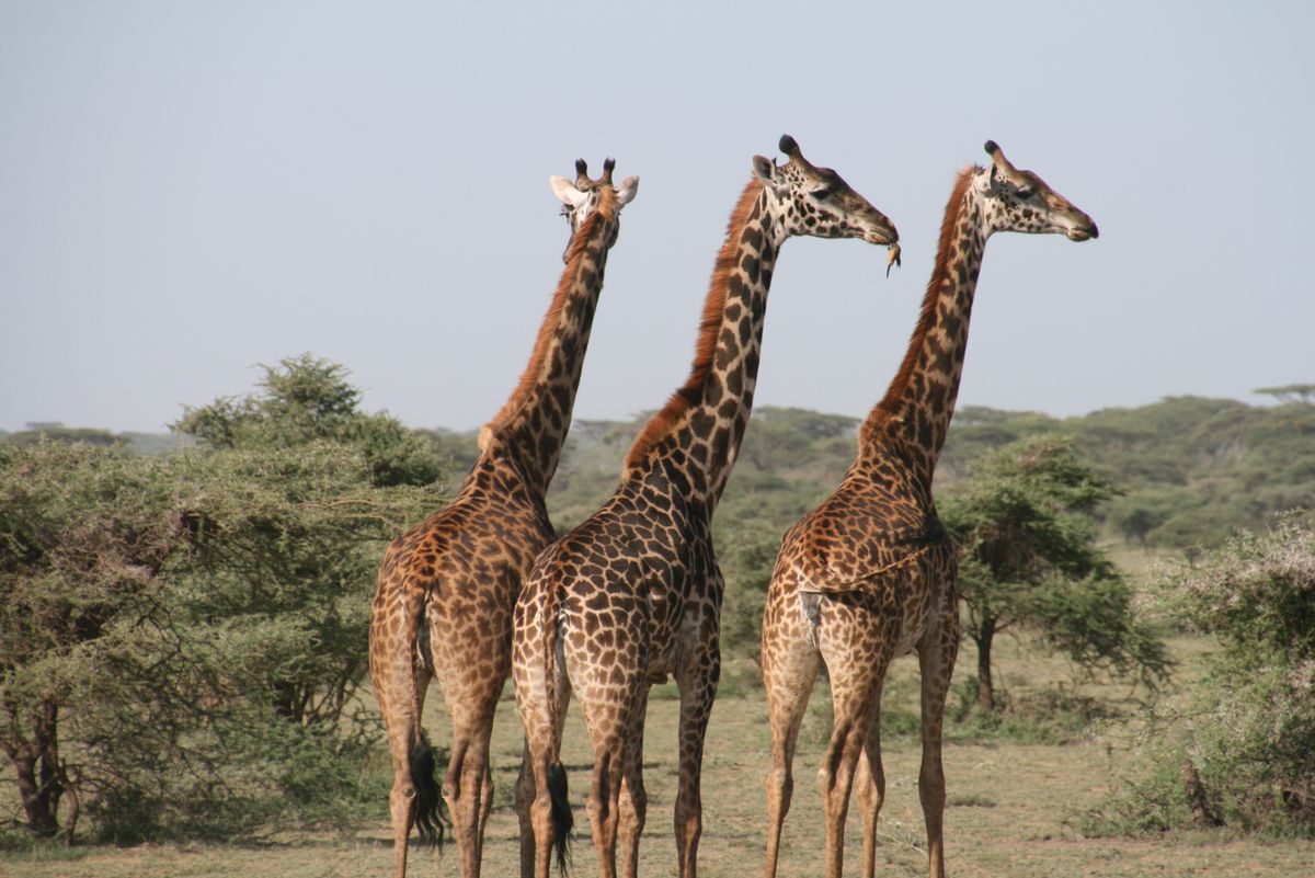
Masai giraffe

Endangered subspecies, and the Mara is a stronghold. Browsers of acacia along drainage lines and hill slopes.

Thomson’s & Grant’s gazelle

Thomson’s gazelle is the cheetah’s staple prey; the larger Grant’s gazelle tolerates drier ground and needs less water.

Common eland

Africa’s largest antelope, shy and far-ranging — most often seen in the conservancies and quieter southern reserve.

Impala & warthog

Edge species of woodland margins; impala harems and bachelor herds are a constant, and warthogs are prime leopard prey.

Waterbuck, bushbuck, oribi & duiker

Riverine and thicket specialists — defassa waterbuck near permanent water, oribi on the short-grass plains.

More than 570 bird species are recorded in the Greater Mara, including some 57 raptor species. Peak birding is November to April, when Palearctic and intra-African migrants arrive and resident species breed.

Common ostrichSecretary birdKori bustard Grey crowned craneLilac-breasted rollerSouthern ground hornbill Martial eagleBateleurAfrican fish eagle Rüppell’s vultureWhite-backed vultureLappet-faced vulture Saddle-billed storkMarabou storkYellow-billed oxpecker Superb starlingLong-crested eagleHartlaub’s bustard Grey-crested helmetshrikeRufous-bellied heronRoss’s turaco
Conservation flag

The Mara’s vultures — especially Rüppell’s and white-backed — have collapsed by more than 60% in a generation, largely through poisoning of carcasses in retaliatory human–wildlife conflict. They are the ecosystem’s sanitation system; losing them changes everything downstream.

Nile crocodile

The Mara River holds exceptionally large individuals, some over 5 m, sustained year-round by drowned migration animals. They are the reason a river crossing looks the way it does.

Hippopotamus

Resident pods throughout the Mara and Talek rivers — Mara Bridge and the hippo pools near Serena are the classic viewing points.

Rock & Nile monitor, python

African rock python, Nile monitor and leopard tortoise are all regular; puff adder and black mamba are present but very rarely seen.

Fish & aquatic life

The Mara River system supports catfish and barbus that process migration carcasses — one of the most striking nutrient-transfer stories in African ecology.

Olive baboon & vervet monkey

Troops along riverine forest; the Mara’s most consistently entertaining — and most camp-raiding — primates.

Banded & dwarf mongoose

Termite-mound colonies on open ground; dwarf mongoose famously partner with hornbills while foraging.

Rock hyrax & klipspringer

Specialists of the Oloololo Escarpment and rocky kopjes.

Aardvark & pangolin

Both present, both almost never seen. Ground pangolin is the most trafficked mammal on Earth and a serious conservation priority here.

Genet, civet & springhare

Nocturnal species best found on conservancy night drives — one of the strongest arguments for spending a night outside the reserve.

Termites — the real engineers

Termite mounds structure the entire savannah: they alter soil chemistry, create nutrient hotspots and give topi their lookout posts.

🐃 The ecosystem’s beating heart

The Great Wildebeest Migration

Around 1.3 million white-bearded wildebeest, 200,000 plains zebra and 300,000 Thomson’s gazelle move in a continuous 800 km loop through the Serengeti–Mara ecosystem. The Masai Mara is the northern end of that loop — the place the herds reach when the Serengeti’s grass fails.

It is not a migration with a timetable. It is a rainfall-driven grazing succession: the herds follow green flush, and the green flush follows storms. When people say “the migration is late”, what actually happened is that it rained somewhere else.

The Mara’s contribution is permanent water. Even in a failed rainy season the Mara River flows, fed by the Mau Forest Complex — which is why the health of a forest 200 km away decides whether the migration has anywhere to go.

The Mara River crossings at Paradise Plain, Cul-de-sac, Lookout and the Serena crossing points are the sequence everyone comes for. They are also genuinely unpredictable: herds may mass on a bank for six hours and simply walk away.

Honest planning advice: book 4–5 nights in the July–October window if crossings matter to you. One night gives you roughly a one-in-four chance. And remember there is a second, separate event — the Loita migration of resident wildebeest moving down from the Loita Plains, which happens on its own schedule.
Wildebeest crossing the Mara River during the Great Migration in the Masai Mara National Reserve

Where the herds are, month by month

Jan – FebCalving on the Ndutu short-grass plains of the southern Serengeti. Mara is quiet, resident game excellent.
Mar – AprHerds move west and north through the Serengeti. Long rains in the Mara — green, dramatic, empty.
May – JunThe Grumeti phase in Tanzania. Advance columns can reach the Sand River in late June.
Jul – AugArrival. First Mara River crossings. Herds spread across Paradise Plain and the Mara Triangle.
Sep – OctPeak concentration and repeated crossings both ways. The most reliable window overall.
Nov – DecShort rains pull the herds south again toward the Serengeti. Superb birding, low rates, few vehicles.

Dates shift by weeks between years. Any operator promising a guaranteed crossing on a given date is selling you something they cannot deliver.

🌿 The Greater Mara

The conservancies — the reserve’s other half

Beyond the reserve boundary lies a ring of community conservancies: Maasai-owned land leased to tourism partners, adding roughly 2,000 km² of protected habitat and paying thousands of landowner families a monthly lease income. They are the single biggest reason the Mara ecosystem still functions.

North

Mara North Conservancy

~74,000 acres of prime habitat including the Leopard Gorge and Lemai country. Strong lion and leopard densities, limited beds per acre.

East

Mara Naboisho Conservancy

~50,000 acres — outstanding lion density, walking safaris and one of the ecosystem’s most successful lease models with over 500 Maasai landowners.

East

Olare Motorogi Conservancy

The lowest guest-to-hectare ratio in the Mara. Exceptional big cats, immediately adjacent to the reserve’s northern boundary.

East

Ol Kinyei Conservancy

Small, pioneering and strictly low-density — the ecosystem’s first conservancy of this model, with excellent walking and night drives.

North-west

Enonkishu Conservancy

The ecosystem’s northern frontier, pioneering holistic livestock management alongside wildlife on the same land.

North

Lemek & Pardamat

Pardamat Conservation Area is the crucial elephant and wildlife corridor allowing settlement and wildlife to coexist rather than separate.

South-east

Siana & Olderkesi

Olderkesi Conservancy links the reserve to the Tanzanian border; Siana buffers the eastern approaches near Oloolaimutia.

Community-led

Nashulai Maasai Conservancy

Community-owned and community-run, sitting inside a wildlife corridor and blending conservation with Maasai cultural continuity.

Umbrella body

MMWCA

The Maasai Mara Wildlife Conservancies Association coordinates the conservancies, standardising lease terms, grazing plans and stocking rates across the Greater Mara.

 Masai Mara National ReserveMara Conservancies
OwnershipCounty trust land, Narok CountyMaasai family-owned land leased to camps
Vehicles at a sightingUncapped — can exceed 30Typically capped at 5
Off-road drivingProhibited (enforced best in the Mara Triangle)Permitted under guide discretion
Night drivesNot permittedPermitted
Walking safarisNot permittedPermitted with armed guide
CostLower — daily park feeHigher — nightly conservancy fee
Migration accessDirect — the crossings are hereMost require a day trip into the reserve
Community benefitVia county revenue & employmentDirect monthly lease payments to landowners

The strongest itinerary is usually both: two or three nights in a conservancy for quiet, off-road and night drives, plus reserve days for the migration and the sheer scale of the plains.

🗓️ When to visit

Best time to visit the Masai Mara — every season delivers

There is no bad month in the Mara, only different trade-offs between wildlife concentration, crowds, price and light. Here is the honest version.

Peak seasonJuly – October
  • Great Migration in the reserve
  • Mara River crossings at their most likely
  • Dry ground, short grass, superb predator viewing
  • Highest park fees and lodge rates
  • Busiest sightings — book early, stay longer
Short dryJanuary – February
  • Clear skies, warm days, dry tracks
  • Outstanding big cat and cheetah activity
  • Resident game concentrated near water
  • Low-season park fees, far fewer vehicles
  • Best value-to-quality window of the year
Long rainsMarch – May
  • Green season — dramatic skies and light
  • Lowest rates; some camps close in April/May
  • Newborn antelope, superb birding
  • Black-cotton soil; 4×4 essential
  • Emptiest the Mara ever gets
Short rainsNovember – December
  • Short afternoon storms, clear mornings
  • Migrant birds arrive in force
  • Tail-end migration herds may linger
  • Low rates until the Christmas peak
  • Excellent photography — dust settles, colour returns
The question behind the question

Most people asking “when should I go?” are really asking “when will I see a crossing?” If that is you, target late August to early October, book at least four nights, and stay near the Mara River in the Mara Triangle or the Musiara/Paradise Plain area.

💵 Fees & budget

Masai Mara park fees and what a safari really costs

Entry fees are set by the County Government of Narok, charged per person per 24 hours, and issued through the Mara digital ticketing system. Conservancy fees are separate and additional.

Reserve entry fees (indicative)

Visitor categoryJan – JunJul – Dec
Non-resident adultUSD 100 / dayUSD 200 / day
Non-resident child (9–17)USD 50 / dayUSD 50 / day
East African resident adultKES 2,500 / dayKES 5,000 / day
Kenyan citizen adultKES 1,500 / dayKES 3,000 / day
Vehicle (under 6 seats)KES 1,000–5,000 / day by capacity
Conservancy feeUSD 80–130 per person per night, additional

Rates are revised periodically by Narok County — always reconfirm before travel. Children under 9 are generally free. Camping and aircraft landing fees are charged separately.

What a Mara safari costs, all-in

Budget$180–280

Per person, per day

Group road safari from Nairobi, budget tented camps outside the reserve near Sekenani or Talek, shared minivan or 4×4, full board, park fees usually included.

Mid-range$350–550

Per person, per day

Comfortable lodges or good tented camps, private 4×4 Land Cruiser with pop-top, better guiding, often a night in a conservancy.

Luxury$700–1,600+

Per person, per day

Fly-in to Ol Kiombo or Mara Serena, low-density conservancy camps, private guide and vehicle, all activities and conservancy fees included.

Additional costs to budget for

Hot air balloon

USD 450–500 per person including bush breakfast — book weeks ahead in peak season.

Domestic flights

USD 200–350 return from Wilson Airport to a Mara airstrip.

Maasai village visit

USD 20–30 per person, paid directly to the community.

Tips & extras

USD 10–20 per guest per day for guides; drinks, laundry and Wi-Fi vary widely by camp.

🚙 Getting there

How to reach the Masai Mara from Nairobi

LegDistanceNotes
Nairobi → Narok~145 km · 2.5 hrsTarmac via the Mai Mahiu escarpment road and the Great Rift Valley viewpoint
Narok → Sekenani Gate~85 km · 2–2.5 hrsSealed most of the way; final stretch rough in the rains
Narok → Oloololo Gate~145 km · 4 hrsVia Lolgorien for the Mara Triangle; 4×4 strongly advised
Nairobi → Talek Gate~265 km · 6 hrsVia Sekenani or the northern Aitong route

A high-clearance 4×4 is essential inside the reserve. Two-wheel-drive minivans manage in the dry season but are a false economy in March–May.

Scheduled daily flights leave Wilson Airport in Nairobi for the Mara’s airstrips, taking 45–50 minutes. Operators include Safarilink, AirKenya and Mombasa Air Safari, with morning and early-afternoon departures.

Flights land at Keekorok, Ol Kiombo, Musiara, Mara Serena, Kichwa Tembo, Angama, Mara North, Naboisho or Siana — your camp meets you airside and the game drive begins immediately. Baggage is limited to roughly 15 kg in soft bags.

Flying costs more but buys back two full days of driving, which on a four-night trip is decisive.

The Sand River Gate and Bologonja border post allow crossings between the Masai Mara and Tanzania’s Serengeti National Park, but the route requires advance arrangement and is not always open to all vehicle types.

The common alternative is flying Mara → Kilimanjaro or Serengeti airstrips, or driving out via Isebania/Namanga. Plan visas, the East Africa Tourist Visa and yellow-fever certificates in advance.

🏕️ Where to stay

Lodges, camps and what your choice actually means

We group accommodation by location rather than star rating, because location — not thread count — determines your access, your crowds and your footprint.

Advantage

You wake up in the game

No gate queue at dawn, immediate access to Paradise Plain, Musiara Marsh and the crossing points.

Trade-off

Busier, and no off-road

Reserve rules mean no night drives, no walking, and shared sightings — sometimes very shared.

Typical

Lodges & tented camps

Established properties in the Mara Triangle, Musiara, Keekorok and central sectors, from mid-range to high-end.

Advantage

Exclusivity, legally

Capped vehicle numbers, off-road driving, night drives and walking safaris — none of which the reserve permits.

Advantage

Direct community benefit

Your conservancy fee becomes a monthly lease payment to named Maasai landowning families.

Trade-off

Distance to crossings

Expect a longer transfer on migration days; some conservancies are 1–2 hours from the Mara River.

Advantage

The affordable Mara

Camps around Sekenani, Talek town and Aitong bring a Mara safari within reach of most budgets.

Trade-off

Daily gate time

You lose the golden first hour to the gate queue, and daily entry fees are charged each time you re-enter.

Watch for

Unmanaged pressure

Dense unplanned development on the boundary is a genuine ecological problem — choose operators with waste, water and staff-welfare policies.

Public campsites

Inside the reserve

Basic sites near the main gates — self-sufficiency, and permits, required.

Mobile camps

Following the herds

Seasonal migration camps that move with the wildebeest and strike camp with almost no trace.

Fly-camping

One night out

Conservancy-only; a bedroll, a bucket shower and the whole plain to yourself.

Maasai morans in traditional shuka near the Masai Mara National Reserve
🔴 The people of the Mara

The Maasai — custodians, not bystanders

The reserve carries the name of the Maasai people, semi-nomadic pastoralists of the Maa-speaking Nilotic group who have grazed these rangelands for roughly four centuries. The Purko, Siria and Loita sections are the communities closest to the reserve.

Their culture is legible everywhere in the Mara: the enkang or manyatta homestead ringed by thorn, the red shuka, the beadwork whose colours encode age-set and status, the adumu jumping dance, and the moran warrior age-grade.

Crucially, the Maasai are not a scenic backdrop. They are the landowners of the conservancies, the rangers in anti-poaching units, and the guides whose tracking knowledge no field guide replaces. Conservation in the Mara works exactly to the degree that it works for them.

Visit responsibly: choose community-run village visits with published fees, ask before photographing people, and buy beadwork directly from the women’s groups that made it.
Language

Maa

An Eastern Nilotic language. Mara = “spotted”; Enkang = homestead; Siringet — the Maa root of “Serengeti” — means “endless plains”.

Livelihood

Pastoralism

Cattle, goats and sheep remain the centre of wealth and identity — and grazing, done well, actively maintains the grassland wildlife needs.

Towns

Narok, Talek & Sekenani

Narok town is the county capital and gateway; Talek and Sekenani are the settlements on the reserve edge.

Pressure

Land subdivision

The conversion of communal group ranches into individual titled plots is the biggest long-term threat to the ecosystem — fences follow titles.

🛡️ Conservation status

A wonder under pressure

The Mara is famous, and famous is not the same as safe. Long-term monitoring across the ecosystem has recorded losses of roughly 70% of resident wildlife since the late 1970s, driven by land-use change outside the reserve rather than by anything happening inside it.

The real pressures

  • Land subdivision & fencing — group ranches converted to private plots, severing the corridors wildlife depends on.
  • Habitat fragmentation — settlement and cultivation creeping into the Loita Plains and northern dispersal areas.
  • Mau Forest Complex degradation — deforestation in the Mara River‘s water tower threatens dry-season flow, and with it the migration itself.
  • Human–wildlife conflict — livestock depredation answered with retaliatory carbofuran poisoning, which kills lions and collapses vulture populations.
  • Snaring and bushmeat poaching — indiscriminate, and heaviest along the western and northern boundaries.
  • Tourism pressure — vehicle crowding at cat sightings, illegal off-road driving, and unregulated bed growth on the reserve edge.
  • Climate variability — more erratic rainfall changing grazing patterns and drought frequency.

What is working

  • The conservancy model — leasing land from Maasai owners has kept ~2,000 km² unfenced and made wildlife pay its own way.
  • The Mara Conservancy — since 2001, transformed anti-poaching, roads and revenue transparency in the Mara Triangle.
  • Digital ticketing & capped beds — Narok County’s e-ticketing has closed long-standing revenue leakage.
  • Collaring & research — the Mara Elephant Project, Mara Predator Conservation Programme and Kenya Wildlife Trust supply the data management decisions need.
  • Community rangers — Maasai-staffed units are the most effective anti-poaching force in the ecosystem.
  • Predator-proof bomas — a simple, cheap intervention that measurably reduces retaliatory lion killing.
What you can do

Stay longer in fewer places. Choose camps that pay conservancy leases. Ask your guide to hold back from crowded sightings. Never ask anyone to drive off-road inside the reserve. Pay the community fee, in full, in the village.

Governance

Narok County Government

Manages the eastern ~two-thirds of the reserve, sets fees and issues entry tickets.

Governance

The Mara Conservancy

Not-for-profit management company running the Mara Triangle on behalf of the Trans Mara community.

National

Kenya Wildlife Service

Provides national wildlife law enforcement, veterinary and translocation support, though it does not manage the reserve directly.

Umbrella

MMWCA

The Maasai Mara Wildlife Conservancies Association, coordinating the conservancies and their landowner members.

⚖️ How it compares

Masai Mara vs. the alternatives

The Mara is not automatically the right answer for every traveller. Here is where it wins, and where it does not.

Compared withChoose the Masai Mara if…Choose the other if…
Serengeti National ParkYou want higher predator density in a smaller area, shorter transfers and lower total costYou want vastness, the calving season, and fewer vehicles per square kilometre
Amboseli National ParkYou want big cats, the migration and open plainsYou want big-tusker elephants framed by Kilimanjaro
Tsavo East & WestYou want reliable, concentrated game viewingYou want wilderness scale, red elephants and far fewer visitors
Lake Nakuru National ParkYou want the full Big Five in open savannahYou want guaranteed rhino and flamingo in a short, easy visit
Samburu National ReserveYou want classic savannah species and the migrationYou want the northern specials — Grevy’s zebra, reticulated giraffe, gerenuk
Laikipia conservanciesYou want the migration and the biggest herdsYou want rhino conservation, walking and horse safaris in low-density country
🎒 Before you go

Practical essentials

What to pack

Neutral khaki, olive and beige layers — mornings on an open vehicle are genuinely cold, afternoons are hot. Avoid blue and black, which attract tsetse flies.

Essentials: binoculars (8×42 is ideal), a wide-brimmed hat, high-SPF sunscreen, a dust-proof camera bag, insect repellent, a headtorch, and a soft duffel if you are flying.

Health & safety

The Mara is a malaria area — take prophylaxis and use repellent at dusk. A yellow fever certificate may be required depending on your route. Drink bottled or filtered water only.

Never leave a vehicle except at designated points, keep tent zips closed at night, and follow your guide’s instructions around elephant, buffalo and hippo without negotiation. Confirm your camp’s flying doctor or AMREF evacuation cover.

Connectivity, power & money

Safaricom coverage is patchy but present across much of the reserve. Most camps run solar power with limited charging hours; bring a power bank and a UK-style Type G adapter.

Carry some Kenyan shillings for village visits and tips. M-Pesa works in Narok and Talek. Gate fees are cashless via the digital ticketing system.

Photography settings that work

Shoot from a beanbag on the window frame, not handheld at full zoom. A 100–400 mm covers most of it; 24–70 mm for landscape context. Golden hour is roughly 06:15–08:00 and 16:30–18:30.

Underexpose slightly to protect highlights in dust-lit backlight, and switch off the engine before shooting — vibration ruins more Mara images than technique ever does.

Safari etiquette & the rules

No off-road driving inside the reserve. Stay 25–30 m from cats, never surround a hunting animal, and never block a crossing point on the Mara River — vehicles at the water’s edge have turned back entire herds.

Maximum five vehicles at a sighting is the ethical standard even where it is not enforced. No drones without a permit. No noise, no feeding, no littering.

Travelling with children

Most camps accept children from age 5; some conservancy camps set a minimum of 8 or 12 for walking and night activities. Family tents and private vehicles make a huge difference on long game drives.

Children under 9 generally enter the reserve free; ages 9–17 pay the child rate.

Accessibility

Several lodges in the Sekenani and Keekorok sectors offer ground-floor or ramped rooms, and some operators run vehicles adapted for wheelchair transfer. Airstrip arrival avoids the roughest road sections entirely — worth the cost for anyone with limited mobility.

Responsible-travel checklist
  • Book camps that pay conservancy leases or publish community contributions
  • Refuse off-road requests, however good the sighting
  • Carry a refillable bottle — single-use plastics are banned in Kenya
  • Pay village fees directly to the community, not to a middleman
  • Tip guides and camp staff fairly and in cash
  • Report snares, poisoned carcasses or rule-breaking vehicles to your camp management
❓ Frequently asked

Masai Mara National Reserve — common questions

Where is the Masai Mara National Reserve?

In Narok County, south-western Kenya, about 230 km from Nairobi in the Great Rift Valley region. It borders Tanzania’s Serengeti National Park to the south and forms the northern sector of the Serengeti–Mara ecosystem.

Is it “Masai Mara” or “Maasai Mara”?

Both are correct and both are in official use. Maasai is the linguistically accurate spelling of the people’s name in Maa; Masai is the older anglicised form still used in the reserve’s formal name and in most travel search. This site uses them interchangeably.

Is the Masai Mara a national park or a national reserve?

A national reserve. It is managed by the County Government of Narok — and, in the Mara Triangle, by the Mara Conservancy — rather than by the Kenya Wildlife Service that runs Kenya’s national parks. It is also largely unfenced, which is essential to the migration.

How big is the reserve?

About 1,510 km² in the core reserve. The surrounding community conservancies add roughly 2,000 km², and the wider Greater Mara ecosystem — including the Loita Plains and dispersal areas — covers several thousand square kilometres more.

What animals will I see?

All of the Big Fivelion, leopard, African bush elephant, Cape buffalo and black rhino — though rhino require luck and the right sector. Add cheetah, spotted hyena, Masai giraffe, topi, zebra, hippo, Nile crocodile and over 570 bird species.

When is the Great Migration?

Herds usually enter the Mara from July, peak August to September, and drift back toward the Serengeti in October and November. Mara River crossings cannot be scheduled — they depend entirely on rainfall and herd behaviour.

Can I self-drive in the Masai Mara?

Yes, self-drive is permitted with a suitable 4×4, but it is demanding: tracks are unsigned, GPS is unreliable, and you will miss most of what a professional guide would find. If you self-drive, hire a freelance Mara guide at the gate — it transforms the experience and supports local employment.

How much are entry fees?

Indicatively, non-resident adults pay about USD 100/day in the January–June low season and USD 200/day in the July–December peak. Kenyan citizens and EAC residents pay reduced KES rates. Tickets cover 24 hours from entry and conservancy fees are charged separately. Always reconfirm current Narok County rates before travel.

What’s the difference between the reserve and a conservancy?

The reserve is county-managed, open to all vehicles, cheaper and can be crowded. The conservancies are Maasai-owned land leased to camps, with capped vehicle numbers, off-road driving, night drives and walking safaris — quieter and more expensive, with money flowing directly to landowning families.

How many days do I need?

Three days is the practical minimum. Four to five lets you reach the Mara Triangle or a conservancy, and substantially improves your odds with leopard, black rhino and migration crossings.

Is the Masai Mara safe?

Yes — it is one of Africa’s most established safari destinations, with professional guiding and camp security. The real risks are ordinary ones: malaria, sun, rough roads, and ignoring your guide around buffalo, elephant and hippo. Check current travel advisories and carry evacuation cover.

Can I visit the Mara on a budget?

Yes. Group road safaris from Nairobi staying in budget tented camps outside Sekenani or Talek start around USD 180–280 per person per day including park fees. Travel in the March–May or November low season and the same trip costs considerably less.

Is a hot air balloon safari worth it?

For most people, once — yes. A dawn launch, an hour over the plains and a bush breakfast runs roughly USD 450–500 per person. Book weeks ahead in the July–October peak; flights are weather-dependent and cancel for wind.

Is the Masai Mara a UNESCO World Heritage Site?

No. The neighbouring Serengeti National Park and Kenya’s Great Rift Valley lake system hold World Heritage status; the Masai Mara National Reserve does not. It is, however, widely recognised as part of the Serengeti–Mara ecosystem, and the Great Migration is routinely listed among the natural wonders of the world.

The plains are waiting

Plan a Masai Mara safari that gives back

Tell us your dates, your budget and what matters most — migration crossings, big cats, photography or quiet. We will build the itinerary around the reserve, not around a spreadsheet.

Plan Your Visit · Getting There

Masai Mara Entry Gates

Seven gazetted road gates, three camp-only access points and five airstrips control every legal way into the Masai Mara National Reserve. Choosing the right one decides how much of your day — and your ticket — you actually spend with the wildlife.

The seven gates · Which to use · Two authorities · The 12-hour clock · What the Management Plan says
7gazetted road gates
2separate authorities
12 hrsticket validity, 06:00–18:00
63%of visitors sleep outside the Reserve
A planning guide

This is a supporting page in our Plan a Masai Mara Safari guide. It answers one question only — where you enter the Reserve and what happens at the barrier. For what you pay, see Masai Mara entry fees; for the journey itself, see getting to the Masai Mara.

The short answer

The Masai Mara National Reserve has seven gazetted public road gatesSekenani, Talek, Musiara, Oloolaimutia, Sand River, Oloololo and the newly approved Enoompuai — plus three camp-specific access points that the public may not use, and five approved airstrips.1 Most visitors arriving by road from Nairobi use Sekenani. The single most consequential choice is not which gate is prettiest, but which gate your bed is behind, because the Reserve is run by two different authorities with two different payment systems, and your 12-hour ticket starts running at 06:00 whatever time you arrive.

A gate in the Masai Mara is not a turnstile at a theme park. It is the point at which a conservation area counts you, prices you, checks your vehicle and decides how much pressure the ecosystem behind it will absorb that day. The Reserve’s own Management Plan is unusually blunt about this: the Mara “is primarily established as a crucial Kenya wildlife conservation area, and only secondarily as a tourism destination.”1

That framing matters, because the gates are where conservation policy stops being abstract. The plan counts queue times at the entrance gates as one of its official carrying-capacity indicators — the same list that includes vehicle numbers at river crossings and rhino displacement.1 If you are sitting in a 40-minute line at Sekenani at 07:00 in August, you are not merely inconvenienced. You are a data point in a monitoring system designed to tell Narok County whether the Mara is over its limit.

Below: every gate, where it actually is, what it opens onto, which one suits your route and your camp, what happens at the barrier, and what the 2023–32 Management Plan has decided about all of it. We finish with the Mara safari packages that use each gate.

The official list

How many gates does the Masai Mara have?

The Masai Mara National Reserve has seven approved public road gates. Almost every travel site on the internet says six. The seventh — Enoompuai — was added when Narok County signed the Maasai Mara National Reserve Management Plan 2023–32 into law on 21 February 2023, and it has simply not filtered through to the guidebooks yet.13

The plan does something no travel article does: it splits access into three legally distinct categories. Getting this straight explains most of the confusion travellers meet at the barrier.

CategoryApproved entry pointsWhat it means for you
Public road accessSekenani · Talek · Musiara · Oloolaimutia · Sand River · Enoompuai (new) · OloololoAnyone with a valid ticket may enter here. These are “the gates”.
Camp-specific accessAngama · Mara Engai · Osero SopiaNot for public use. These serve their own lodge’s guests only. You cannot route yourself through them.
Air accessKeekorok · Ol Kiombo · Musiara (Governors’) · Mara Serena · Kichwa TemboFly-in visitors are ticketed at the airstrip. Landing is not the same as entry — the Reserve fee still applies.

Source: MMNR Management Plan 2023–32, Table 9 (Approved entry points for visitors to the MMNR), gazetted under the Wildlife Conservation and Management Act 2013.5

On the record · The Management Plan

The plan’s Reserve-wide prescription is short and absolute: “All visitors must enter the MMNR through an approved entry point and must possess a valid MMNR ticket.” There is no informal way in. The same table of prescriptions bans night game drives, walking safaris, horseback and bicycle safaris across the entire Reserve — which is precisely why those activities are the selling point of the neighbouring conservancies.1

A guide’s note

There is an eighth crossing that everyone calls a gate and the plan does not: Purungat Bridge, on the Mara River. It is not an entry point from outside — it is the internal border post between two administrations. That distinction is the source of more argument at the barrier than anything else in the Mara. We deal with it in full below.

The decision

Which gate should you use?

Use the gate nearest the camp you have already booked — not the gate nearest the wildlife you want to see. Once you are inside, the Reserve is a single ticketed area and you can drive anywhere the zoning allows. The gate only determines how many hours of your life you spend on a corrugated approach road before your first game drive. Choosing Oloololo because you read that the Mara Triangle is quieter, when your camp is at Talek, buys you a five-hour detour and no extra lion.

The exception is the traveller who has not booked yet. If your camp is still open, the gate question becomes an accommodation question, and it is worth reading the two together.

If you are…UseApproachWhy
Driving from Nairobi, staying east or centralSekenaniA104 → B3 → Narok → C12The tarmac gate. Shortest, most maintained, and the one every budget package uses.
Staying at a Talek River campTalekNarok → C12 → Talek roadPuts you on the central plains within minutes. Ol Kiombo airstrip is close.
Staying in the Mara TriangleOloololo or PurungatVia Bomet/Kilgoris, or transit through SekenaniThe Triangle is a different administration. See the transit rule below — it will save you a second ticket.
Staying at Governors’/Musiara campsMusiaraNarok → C13 via Aitong, or the Ololunga/C14 roadNorthern gate. Direct to Musiara Marsh and the northern Mara River reaches.
Staying at Sopa / south-eastern hill campsOloolaimutiaNarok → C12, then the Oloolaimutia roadHilly south-eastern corner. Quiet gate; rough in the rains.
Flying inNo road gateWilson → Keekorok, Ol Kiombo, Musiara, Serena or Kichwa TemboYou are ticketed at the airstrip. Landing at the wrong strip costs about two hours and a transfer fee.
Coming from the SerengetiNot Sand RiverIsebania borderThe Sand River–Bologonja crossing has been closed since 1977. See below.

Approach roads and driving times vary sharply with season and with the state of the C12/C13. See Nairobi to the Masai Mara by road for the route in detail, and flights to the Mara if you would rather not drive at all.

Gate by gate

Where is each gate and what does it open onto?

Each gate opens onto a different Mara. Sekenani drops you on the eastern plains; Oloololo drops you beneath an escarpment on the far side of a river, in a section run by a different organisation. What follows is each gate in the order you are most likely to use it, with the honest position — not the one copied from site to site.

East · the main gate

Sekenani Gate

Sekenani is the Masai Mara’s principal gate and the one most road visitors from Nairobi use. It sits on the eastern boundary just beyond Sekenani town, at the end of the C12 from Narok — the most maintained approach in the ecosystem and the reason this gate absorbs the heaviest traffic. It is also where Narok County chose to launch the Management Plan in 2023, which tells you something about its status.3

Behind it lie the eastern and central plains, the Talek and Sand River country, and the road west towards Keekorok. It is the natural gate for the whole eastern camp belt — and for our own 3-day budget safari, which runs through it.

Approach
A104 → Mai Mahiu → B3 → Narok → C12. Roughly 5–6 hours from Nairobi.
Nearest airstrip
Keekorok (~30 min); Ol Kiombo (~45 min)
Authority
Narok County — cash or card accepted
Watch for
The dawn queue. In peak season 20+ vehicles can be stacked before the desk opens.
Read next
Full Sekenani Gate guide · The Sekenani sector
East / north-east · at the river

Talek Gate

Talek Gate stands where Talek village meets the Talek River, on the eastern side of the Reserve. It is the busiest gate after Sekenani and the one favoured by budget and independent travellers, because Talek village is packed with camps just outside the boundary and the gate opens directly onto some of the richest predator ground in the Mara.

The Talek River is the working boundary between the eastern and central Mara, and the Management Plan uses it as an actual zone boundary — the river separates the High Use Zone from the Low Use Zone in the north.1 Cross it and the rules on your vehicle change.

Approach
Narok → C12, then the Talek road. Rough after rain; a 4×4 is not optional.
Nearest airstrip
Ol Kiombo (~20 min)
Authority
Narok County
Best for
Central-Mara game drives, Leopard Gorge, big cats along the river
Read next
Full Talek Gate guide · The Talek sector
North · the marsh gate

Musiara Gate

Musiara Gate is the Reserve’s northern entrance, opening onto Musiara Marsh and the northern reaches of the Mara River. It serves the Governors’ camps and the northern camp cluster, and it is the shortest way to the marsh prides and the northern crossing points — which is why photographers pay attention to it.

Musiara is also one of the five approved air access points, listed in the plan as “Musiara (Governors’)”.1 The gate and the airstrip share a name, so confirm which one your itinerary means.

Approach
Narok → C13 via Aitong, or the Ololunga/C14 road. Largely unpaved; allow 7 hours from Nairobi.
Nearest airstrip
Musiara (adjacent)
Authority
Narok County
Best for
Musiara Marsh, northern migration crossings, resident lion prides
Read next
The Musiara sector
North-west · the Mara Triangle

Oloololo Gate

Oloololo Gate is the main road entrance to the Mara Triangle, on the north-western side of the Reserve beneath the Oloololo (Siria) Escarpment. It is run not by Narok County but by the Mara Conservancy, and it is strictly cashless — no US dollars, no shillings, no exceptions.2

Everything about this gate is different: different management, different payment system, different ticket desk. It is also, by the Management Plan’s own numbers, the gate to the less-crowded half of the Reserve — the Triangle runs at roughly the visitor density the plan considers optimal, while the central Mara runs at two to three times that.1

Approach
The long way round via Bomet/Kilgoris — or transit through Sekenani (see the transit rule below). Up to 7 hours by road; most guests fly.
Nearest airstrip
Kichwa Tembo; Mara Serena
Authority
Mara Conservancy — cashless only (M-Pesa, Visa, Mastercard)
Best for
Mara Triangle, black rhino country, the western crossings
Read next
The Mara Triangle
South-east · the hill gate

Oloolaimutia Gate

Oloolaimutia Gate sits in the hilly south-eastern corner of the Reserve, on the edge of Oloolaimutia town. It is the quietest of the mainstream gates and serves the Sopa-side camps and the south-eastern hill lodges. It opens onto the southern plains and the country running down towards the Sand River.

Its weakness is its approach. The last stretch degrades badly in the rains, and this is the gate most likely to cost you an axle in April or November. If you are travelling in the wet, ask your operator directly whether they will commit to it.

Approach
Narok → C12, then the Oloolaimutia road. ~6 hours; poor in the rains.
Nearest airstrip
Keekorok; Siana Springs (outside the Reserve)
Authority
Narok County
Best for
Southern plains, quieter entry, south-eastern camps
Read next
Oloolaimutia & the southern Mara
South · gazetted, but the border is shut

Sand River Gate

Sand River Gate is a legal MMNR entry point on the southern boundary — but the international crossing beside it has been closed to tourists since 1977. The gate stands on the northern bank of the Sand River, metres from the Kenya–Tanzania border and the Serengeti’s Bologonja Gate. It remains gazetted in the Management Plan.1 It is simply almost never used, because the thing it appears to connect to is sealed.

The Sand River is a genuine migration crossing point — this is where herds enter the Mara from the Serengeti — so the gate matters ecologically far more than it does logistically. We treat the border question properly below.

Status
Open as a Kenyan gate; the adjoining border crossing is not
Approach
Internal, via the C12/Keekorok road south
Authority
Narok County
Ecological role
Sand River wildebeest crossings; southern dispersal towards Serengeti
New · approved in the 2023 plan

Enoompuai Gate

Enoompuai is the seventh gate — approved in the 2023–32 Management Plan and listed among the Reserve’s official public road access points. The plan flags it as new and ties it to an action in the Protected Area Operations Programme.1 It addresses a real problem: a major road meets the Reserve boundary there with no official gate, which has meant unauthorised entry and illegal livestock grazing at that point.

Do not plan a route through Enoompuai yet. Gazettement is not the same as an operational ticket desk, and we have seen no confirmation that it is issuing tickets. Treat it as the answer to “how many gates are there” — not as a way in.

Status
Approved, not confirmed operational. Verify before routing.
Purpose
Controlled access at an unmanaged boundary crossing; revenue capture; grazing control
Authority
Narok County
Internal · the border post nobody explains

Purungat Bridge

Purungat is not an entry point from outside the Reserve — it is the bridge across the Mara River where Narok County’s territory ends and the Mara Conservancy’s begins. That is why it does not appear on the Management Plan’s list of public road gates, and why it appears on the Mara Conservancy’s list of places you can buy a ticket.12

If you are staying in the Triangle but driving in from Narok, this is the desk that matters. The rule that follows is the single most useful thing on this page.

Function
Internal crossing + Mara Triangle ticket point
Authority
Mara Conservancy — cashless only
Also sells tickets
Oloololo Gate; Serena Airstrip
Information hygiene

Why do sources disagree about where the gates are?

Because most gate pages have been copied from each other for fifteen years, compass errors and all. This is not a small problem. In the course of writing this page we found published pages — including on large, well-ranked safari sites — that place Talek in the north-west, the north-east, the east and the south-west; and Oloololo, which is unambiguously in the north-west, described repeatedly as being in the “north-eastern region”.

One widely-syndicated paragraph manages to put Talek Gate “on the north-western side” and, two sentences later, “in the southwestern region… closest to Sekenani Gate”. Both cannot be true. They have been reproduced verbatim across dozens of sites.

The reliable way to orient yourself is not by compass point at all. It is by river and road: the Mara River splits the Reserve into the Mara Triangle (west) and Central Mara (east); the Talek River splits the eastern half again; and the C12 from Narok arrives at Sekenani. Every gate can be placed against those three facts. We have used them, and the Management Plan’s zone descriptions, rather than repeating the received compass points.1

A note on data confidence

Even the Reserve’s own size is reported three ways. The Management Plan’s history section gives 1,530 km²; its own comparison table uses 1,560 km²; and most published sources say 1,510 km². We give the range rather than pick the number that sounds most confident. If a gate page quotes any figure to the square metre, be suspicious of the rest of it.

Two kingdoms, one reserve

Narok County gate or Mara Triangle gate?

The Masai Mara is one reserve run by two authorities, and the Mara River is the line between them. Everything east of the river — Sekenani, Talek, Musiara, Oloolaimutia, Sand River — is Narok County. Everything west of it, the Mara Triangle, has been managed since 2001 by the Mara Conservancy, a non-profit protected-area management company contracted by the County.1

They charge the same fee. They do not take the same payment. And the Management Plan is candid that this divergence “leads to confusion amongst the area’s users” — one of the reasons the plan exists at all is to pull the two halves back together.1

 Narok County gatesMara Triangle (Mara Conservancy)
GatesSekenani, Talek, Musiara, Oloolaimutia, Sand RiverOloololo, Purungat Bridge, Serena Airstrip
PaymentCash (USD/KES) or cardCashless only — M-Pesa, Visa, Mastercard
Advance ticketsKAPS portal / KAPS office, NairobiKAPS online with a Visa card, or an authorised KAPS officer at the gate
ID acceptedPassport; National ID for residentsPassport, National ID, or birth certificate for citizen children. Driving licences are not accepted.
Ticket12 hours, 06:00–18:00, whatever time you enter. It does not carry over to the next morning.

Fee levels themselves are the same on both sides. We keep them on one page so they stay current: Masai Mara entry fees 2026.

On the record · The Mara Conservancy

The transit rule, in the Conservancy’s own words: “If you are staying in the Mara Triangle and are driving through Sekenani Gate on the Narok side, do not pay park fees until you enter the Reserve at Purungat Bridge.” Tickets are sold at Purungat Bridge, Oloololo Gate and Serena Airstrip — and the Conservancy does not take cash at any of them.2

The mistake that costs $200

Pay at Sekenani for a Triangle stay and you have bought the wrong ticket. Some operators report a timed transit arrangement across the Reserve; we have not been able to confirm the mechanics of it from an official source, so we will not publish a rule we cannot stand behind. What we can stand behind is the Conservancy’s instruction above: tell the desk you are in transit to the Triangle, and pay at Purungat. Ask your driver whether he has done it before. If he hesitates, that is your answer.

At the barrier

What actually happens at the gate?

Five things, in this order: your category is verified, your ticket is issued, the 12-hour clock starts, your vehicle is looked at, and your details are logged. None of it is quick in August.

1 · Your status is checked against a document

Non-resident, East African resident, Kenyan citizen and Narok resident all pay differently. The document decides. A passport for non-residents; a National ID for citizens. A driving licence will not do, and the Mara Conservancy says so explicitly — arrive without acceptable ID and you pay the non-resident rate regardless of who you are.2

2 · The ticket is issued — and you should be the one buying it

Get out of the vehicle and buy your own ticket. We are a guiding association telling you not to hand your money to a driver-guide, and we mean it: an invalid ticket is your problem at the next inspection, not his. Keep the receipt. There are no printing facilities at the gates, so an advance ticket must arrive as a printed page or a PDF on your phone.

3 · The clock starts — but not when you think

The 12-hour ticket runs 06:00 to 18:00 on the day of purchase, “notwithstanding the time of entry”.2 Enter at 15:00 and you have three hours, not twenty-four. This single sentence is worth more to your budget than any other on this page.

4 · Your vehicle is assessed

Since July 2024 the gates have refused 2WD vehicles. Rangers look at ground clearance and at whether the vehicle is genuinely safari-standard. A pop-roof is, in practice, the thing they look for. See which vehicles get turned away.

5 · You are counted

Your entry is logged — and that log is the raw material for the visitor-density figures the Management Plan uses to decide whether the Mara is over capacity. This is the least visible and most consequential thing that happens at a Mara gate.1

The 12-hour rule

What does the 12-hour ticket mean for your gate?

It means the gate you choose is really a decision about what time you arrive at it. A Masai Mara ticket is not a 24-hour pass. It is valid from 06:00 to 18:00 on the day it is bought, no matter when you present yourself at the barrier — the Mara Conservancy states plainly that the ticket “will not carry overnight for the 12-hour period”.2

Run the arithmetic on a peak-season non-resident adult ticket of USD 200. Enter at 06:00 and you have the full twelve hours: about $17 an hour. Enter at 15:00 — perfectly normal if you left Nairobi at 08:00, stopped for lunch in Narok and met a truck on the escarpment — and you have three hours left, so the same ticket costs you nearly $67 an hour. The gate did not change. Your departure time did.

This is why we tell road guests to leave Nairobi at 06:00 and why we tell everyone to buy the next day’s ticket the evening before where the gate allows it. It is also the reason the season you travel in changes the maths so violently: the fee doubles on 1 July while the clock stays the same length.

One more trap on the way out. A departure-day game drive that runs past 10:00 can trigger a further day’s fee. Plan the last morning around the exit, not around one more lion.

The vehicle check

Which vehicles get turned away?

Two-wheel-drive vehicles, since July 2024. Narok County directed that only safari-standard 4×4s may be used for game drives inside the Reserve, aligning gate practice with the Management Plan’s zoning rules. Rangers at Sekenani and Talek have turned away ordinary SUVs — even 4WD ones — and in practice the pop-up roof is the feature that settles the argument.

What is not true is the widely-repeated claim that self-drive has been banned. It has not. The directive restricts the vehicle, not the driver. Bring a compliant 4×4 and you may drive yourself.

RuleWhere it appliesSource
2WD refused for game drivesReserve-wide at the gates since July 2024; the plan bars 2WD from the Low Use Zone except on main transit routesNarok County directive / Management Plan
Vehicles seating more than 12Not allowed in the Low Use ZoneManagement Plan, LUZ prescriptions1
Tourism Service Vehicles must be painted in earth coloursReserve-wide (dark green, brown or beige)Management Plan, Reserve-wide prescriptions1
Off-road driving prohibitedHigh Use Zone: under all circumstances. Mara River Zone: all off-road prohibited.Management Plan zoning1
Off-road permitted only to approach big catsLow Use Zone only. Max 5 vehicles at a sighting, 15 minutes when others are waiting, 25 m minimum distance.Management Plan, LUZ prescriptions1
No night drives, walking, horseback or bicycle safarisReserve-wideManagement Plan1

Off-road driving in the Mara is not a blanket ban — a claim repeated almost everywhere, including on pages of our own we are now correcting. It is zone-dependent, and in the Low Use Zone it is permitted for big cats within strict limits. More in our game drives guide.

Why the 5-vehicle rule exists · Broekhuis, 2018

The limits above are not arbitrary. Work led by Femke Broekhuis in Ecology and Evolution found that cheetah (Acinonyx jubatus) mothers in the Mara’s high-tourist areas raised around one cub or fewer to independence, against more than two where vehicles were fewer — and that lion and hyena abundance did not explain the difference. The vehicles did. The five-vehicle cap and the minimum-distance rules you meet inside the gate came out of that finding.6 See our cheetah guide.

Coming out

Can you enter one gate and leave by another?

Yes. A valid ticket admits you to the Reserve, not to a particular door. Enter at Sekenani and exit at Musiara, Talek or Oloolaimutia as your route requires — provided you are out before your ticket expires at 18:00.

Two caveats worth more than the freedom. First, the two-authority split still applies: crossing into the Mara Triangle is not simply a different exit, it is a different administration, and it is ticketed at Purungat. Second, gates close for entry at dusk, and being inside the Reserve after dark without authorisation is a serious matter — night driving is prohibited Reserve-wide.1 Entry or exit outside hours is possible only with the warden’s permission, and that is reserved for breakdowns and weather, not for a slow lunch.

Keep your ticket after you leave. There is a checkpoint on the road back towards Nairobi, and the fine for an invalid ticket lands on the passenger, not the driver.

A correction

Can you cross to the Serengeti at Sand River?

No. The Sand River–Bologonja crossing has been closed to tourists since 1977, and it remains closed. You will read the opposite on a great many safari websites — including, until this page replaced it, on one of ours. We would rather correct it than leave it standing.

The border post was shut by Tanzania after the collapse of the East African Community in 1977. Tanzania has declined repeatedly to reopen it, arguing that a flood of Kenyan day-trip vehicles into the northern Serengeti would damage the park; the Tanzania Tourist Board has said as much on the record, even after Kenyan operators announced that agreement had been reached.4 As of early 2026 Bologonja Gate is still listed as closed with no reopening date.

What this means practically: Sand River Gate remains a gazetted Kenyan entry point — it is on the Management Plan’s list1 — but it is not a route to Tanzania. Travellers combining the Mara and the Serengeti cross at Isebania, or fly. Anyone selling you a Mara–Serengeti drive “through Sand River” is selling you something that does not exist.

A guide’s note

The irony is that the wildebeest use the crossing perfectly freely. They enter the Mara across the Sand River every year without a passport, which is the entire argument for treating the Mara and the Serengeti as one ecosystem and the border as a line drawn on top of it.

The conservation core

What does the Management Plan say about the gates?

It treats them as instruments of ecological control, and it says the queue you stand in is a warning light. The Maasai Mara National Reserve Management Plan 2023–32 — approved by the Narok County Assembly and gazetted under the Wildlife Conservation and Management Act 20135 — sets an optimal visitor carrying capacity of about 1–1.2 visitors per km² for the Reserve. The Mara Triangle sits at roughly that level. The Central Mara, behind the gates most people use, has been running at two to three visitors per km², a figure the plan calls out as beyond what the ecosystem and the visitor experience can carry. The conservancies to the north, by comparison, target 0.5–0.6.1

To monitor whether that capacity is being exceeded, the plan lists a set of indicators. Alongside the number of vehicles at carnivore sightings, litter at picnic sites, rhino displacement and wildebeest drownings, it names one that no other gates guide seems to have noticed:

On the record · MMNR carrying-capacity indicators

Among the official measures of whether the Masai Mara is over its ecological limit, the plan lists “Visitor waiting times at MMNR entrance gates” and “Vehicle encounters on the Sekanani–Keekorok main road (C12)”.1 The queue is not an administrative failure. It is a symptom the Reserve has agreed to measure.

The plan then says something that ought to change how budget travellers think about gates. Because 63% of visitors to the Central Mara sleep outside the Reserve and drive in each morning, the plan notes that if softer measures fail, management may have to consider “introducing daily quotas on the number of tickets issued to visitors originating from outside the Reserve”.1

We should be honest about what that would mean for us. Our own partner camp sits outside the boundary, 8 km from Sekenani Gate. Our budget packages are built on exactly the model the plan is describing — sleep outside, enter at dawn, drive in. A daily ticket quota on outside-based visitors would hit our guests before it hit anyone staying in a lodge inside the Reserve. We are telling you about it anyway, because you deserve to know that the gate you are queuing at is the pressure point in the system, and that the pressure is being watched.

The plan also draws a 2 km buffer zone around the entire Reserve — everywhere except the Tanzanian border — precisely because that strip, where the gate-side camps sit, is where most Reserve visitors originate and where the county has least control over development.1 The gate is the seam between those two worlds.

Conservancies (target)0.5–0.6/km²
MMNR optimal carrying capacity1–1.2/km²
Mara Triangle (actual)~1.2/km²
Central Mara, high season (actual)2–3/km²

High-season visitor densities. The gates behind which the Reserve is most crowded are the ones most travellers use. Figures from the MMNR Management Plan 2023–32.1

Where you sleep is the lever

Does the gate you use change anything for the wildlife?

Less than where you sleep does. This is the uncomfortable finding, and it deserves to sit on a gates page rather than be buried.

A 2025 study in Conservation Science and Practice tracked lion (Panthera leo) density across 2,363 km² of the Mara over nine years and found the highest densities where there were no tourist camps at all. Density fell as camp density rose, and new camps were followed by rapid local decline. The authors do not argue for less tourism — they argue for spread, planned tourism.7

Which turns the gate question inside out. The gate is a queue; the camp is a footprint. Choosing a quieter gate mostly saves you time. Choosing where — and how densely — you sleep is the decision that shows up in the lion numbers. If you want your trip to bear less weight, look at the conservancies and at how many beds sit on the ground where you are staying, before you optimise your arrival time at Sekenani.

And use the Reserve’s own logic: it is ecologically cheaper to enter through an under-used gate into the Low Use Zone than to add another vehicle to the crush at a river crossing. The plan’s whole zoning scheme exists to spread the load.1 You can help it do that, for free, by asking your guide for the quiet route on your first morning instead of joining the convoy.

Practicalities

How do you avoid the queue?

Buy tomorrow’s ticket this evening, and be at the barrier before the desk opens. In peak season the dawn line at Sekenani can reach twenty vehicles or more, and every minute of it is deducted from a ticket that expires at 18:00 whether you were in the queue or in the Reserve.

  • Pay in advance. Tickets can be bought through KAPS in Nairobi or online. Generate the ticket where you have signal — not at the gate, where connectivity fails exactly when everyone needs it.
  • Do not use the KWS eCitizen portal. The Mara is a Narok County reserve, not a Kenya Wildlife Service park. A KWS receipt is rejected at the gate and you pay again, in full, non-refundably. This catches people every week.
  • Carry the ticket as paper or PDF. The gates do not print.
  • Pay in USD by card where you have the choice. Gates have been applying an exchange rate well off the market, which quietly adds up over a family and several days. Detail on the entry fees page.
  • Have the right ID out before you reach the desk. Passport for non-residents. Not a driving licence.
  • Arrive before 08:00 or accept the arithmetic. An afternoon entry on a peak-season ticket is the most expensive hour of safari you will ever buy.
  • If you are Triangle-bound via Sekenani, say so at the desk and pay at Purungat.
Before the barrier

What should you have ready at the barrier?

Passport or National ID, your ticket or e-slip, a working card or M-Pesa, and a vehicle that will pass inspection. That is the whole list, and every item on it has turned someone back.

Two things people forget. There is no fuel inside the Reserve — Narok is the serious refuelling stop, with pumps also at Talek, Sekenani and Oloolaimutia. And single-use plastic bottles are banned in Kenya’s protected areas; a rangers’ check at the gate is not the moment to discover your cool box is full of them.

Mobile coverage at the gates is patchy and skewed to one network. If your camp is expecting you, tell them your gate and your ETA before you leave tarmac, not after.

Questions we are asked at the gate

Masai Mara entry gate FAQs

How many entry gates does the Masai Mara have?

The Masai Mara National Reserve has seven approved public road gates: Sekenani, Talek, Musiara, Oloolaimutia, Sand River, Oloololo and the newly approved Enoompuai. The Management Plan 2023–32 also lists three camp-specific access points that are not for public use (Angama, Mara Engai, Osero Sopia) and five air access points (Keekorok, Ol Kiombo, Musiara, Mara Serena, Kichwa Tembo). Most sources still say six gates because they predate the plan.

Which is the best gate to enter the Masai Mara?

Sekenani, for most people arriving by road from Nairobi — it is at the end of the tarmac C12 from Narok and it serves the largest cluster of camps. But “best” is really “nearest to your bed”. If you are staying in the Mara Triangle, Oloololo or Purungat is correct and Sekenani is a costly detour. If you are at a Talek River camp, use Talek.

What time do the Masai Mara gates open and close?

Gates operate 06:00 to 18:00. Your ticket is valid for that 12-hour window on the day of purchase regardless of when you enter, and it does not carry over to the next morning. Entry or exit outside those hours requires the warden’s permission and is granted only for genuine reasons such as a breakdown or bad weather.

Can I enter through one gate and exit through another?

Yes — a valid ticket admits you to the Reserve, not to a single gate. Enter at Sekenani and leave via Musiara or Talek if that suits your route, as long as you are out by 18:00. Crossing into the Mara Triangle is the exception: it is a different management authority and is ticketed separately at Purungat Bridge or Oloololo.

Is the park fee the same at every gate?

Yes — the fee is the same; the payment method is not. Narok County gates (Sekenani, Talek, Musiara, Oloolaimutia, Sand River) accept cash or card. The Mara Triangle (Oloololo, Purungat Bridge, Serena Airstrip) is strictly cashless — M-Pesa, Visa or Mastercard only. Current rates are on our Masai Mara entry fees page.

I am staying in the Mara Triangle but driving through Sekenani. Where do I pay?

At Purungat Bridge, not at Sekenani. The Mara Conservancy is explicit: if you are staying in the Mara Triangle and driving through Sekenani Gate on the Narok side, do not pay park fees until you enter the Reserve at Purungat Bridge. Tell the desk at Sekenani that you are in transit to the Triangle. Paying at the wrong desk means buying the wrong ticket.

Can I cross into the Serengeti at Sand River Gate?

No. The Kenya–Tanzania crossing beside Sand River Gate — Bologonja on the Tanzanian side — has been closed to tourists since 1977 and remains closed. Sand River is still a gazetted Masai Mara entry point, but it is not a route into Tanzania. Travellers combining the Mara and the Serengeti use the Isebania border, or fly.

What vehicle do I need to get through the gate?

A safari-standard 4×4. Since July 2024, Narok County has directed that 2WD vehicles may not be used for game drives in the Reserve, and rangers at Sekenani and Talek have turned away ordinary SUVs. In practice a pop-up roof is what gate staff look for. Self-drive itself is not banned — the restriction is on the vehicle, not the driver. Vehicles seating more than 12 are barred from the Low Use Zone.

Can I pay Masai Mara entry fees through eCitizen or KWS?

No — and this is an expensive mistake. The Masai Mara is a Narok County national reserve, not a Kenya Wildlife Service park. A KWS/eCitizen receipt is not valid at a Mara gate. Visitors who arrive with one are asked to pay again in full, and the original payment is not refunded at the gate. Pay through the county/KAPS system or at the gate itself.

Are night drives or walking safaris allowed once I am through the gate?

No. The Management Plan prohibits night game drives, walking safaris, horseback and bicycle safaris across the entire Reserve. This is deliberate: the plan reserves those activities for the surrounding community areas so that the conservancies can build a viable niche around them. If a night drive or a bush walk matters to you, that decision belongs to your accommodation choice, not your gate choice.

Booked and guided

Which Mara package uses which gate?

Every package we run enters the Reserve through a specific gate, and we would rather tell you which one before you book than after. Road safaris from Nairobi go in through Sekenani — the tarmac gate at the end of the C12. Flying safaris skip the road gates entirely and are ticketed at the airstrip, usually Ol Kiombo or Keekorok.

Our guides are members of the Sekenani Tour Guides Association and have been working this gate for about two decades. If you want the queue handled, the transit rule handled and the vehicle that will not be turned back, that is what a package buys you.

What our prices do and do not include

Park entry fees are a separate line, and we do not hide it. Our packages include the driver-guide’s park fee and the vehicle’s park fee — but your own park entry fee is not included and is paid at the gate. On a peak-season non-resident adult that is a material number, so budget it deliberately: see Masai Mara entry fees 2026. Any operator whose quote seems suspiciously low is usually one who has left the same line out and not told you.

Comparing formats rather than trips? Start with road safaris against flying safaris — the honest short version is that road costs are per vehicle and flights are per person, which is why four adults sharing a Land Cruiser changes the answer completely. Or see every package we run on the Masai Mara safari packages guide.

Travel that protects

Try our tours — explore & learn the Mara firsthand

Guided by the people who work these gates: local guides of the Sekenani Tour Guides Association, with about two decades in the Mara. You get the early entry, the quiet route and the honest fee breakdown — and your visit funds the ecosystem it depends on.

To start planning, use the quick booking form below. ↓

Book your Masai Mara safari

Tell us your dates, your gate and what matters to you, and our team will tailor a conservation-minded safari. Enquiries: Bookings@MasaiMara.ke

[ Booking form goes here ]
In WordPress, add a separate Shortcode block immediately below this Custom HTML block and paste:
[chbs_booking_form booking_form_id="23598"]
Shortcodes do not execute inside a Custom HTML block.
Sources & further reading 1. Approved entry points (Table 9), zonation, carrying capacity and visitor-use prescriptions: Maasai Mara National Reserve Management Plan 2023–32, Narok County Government.   2. Transit rule, cashless payment, 12-hour ticket and accepted identification: Conservation Fees, Mara Conservancy (Mara Triangle).   3. Plan signed into law; seven road entry points and five air entry points confirmed: Kenya News Agency.   4. Closure of the Sand River–Bologonja crossing since 1977 and Tanzania’s refusal to reopen it: The EastAfrican.   5. Gazettement under section 44(3) of the Wildlife Conservation and Management Act 2013: Kenya Gazette, Special Issue Vol. 48, 2 March 2023.   6. Cheetah cub survival and vehicle crowding — the evidence behind the 5-vehicle and minimum-distance rules: Broekhuis, F. (2018), “Natural and anthropogenic drivers of cub recruitment in a large carnivore”, Ecology and Evolution 8(13).   7. Lion density against tourist-camp density across the Mara: Mogensen, N. et al. (2025), Conservation Science and Practice.   Figures and rules change without notice. Where sources conflict we have given the range and said so. Confirm fees and gate procedures with your operator or at the gate before you travel.
Plan & Logistics · The Road Route

Nairobi to the Masai Mara by Road

Two hundred and seventy kilometres, five to seven hours, one escarpment that can turn a morning into a day — and a road surface the entire internet disagrees about.

The short answer

The drive from Nairobi to the Masai Mara is roughly 230–270 km and takes 5–6 hours to the eastern gates (Sekenani, Talek, Oloolaimutia) or 6–6.5 hours to the western ones (Oloololo, Musiara).1 You leave Nairobi on the A104, drop the Mai Mahiu escarpment into the Great Rift Valley, run the B3 to Narok — your last fuel, ATM and supermarket — then take the C12 to the gate.

Leave by 06:00. Not for the scenery: to clear the escarpment before the trucks. And take a 4×4 if there is any chance of rain, or any chance you will drive inside the reserve.

How Long Does It Take to Drive from Nairobi to the Masai Mara?

Five to six hours to Sekenani or Talek; six to six and a half to the western gates. That is the honest planning figure, and it already includes a viewpoint stop and a fuel stop in Narok.1

But the number that matters is not the average. It is the tail.

Drive times by gate, from Nairobi
GateDistanceTypical driveServes
Sekenani~240 km5–6 hrsCentral and eastern reserve. The most-used gate, and the best road.
Talek~250 km5.5–6 hrsTalek River camps
Oloolaimutia~250 km~6 hrsSouthern boundary. Shorter in distance, rougher in surface.
Oloololo · Musiara~270 km+6–6.5 hrsMara Triangle and the north. Turns west after Narok; expect an unpaved stretch.1
Sand River~270 km6 hrs+The far south, near the Tanzanian border
Every gate and the camps it serves is in Masai Mara gates. Choose the gate that matches your camp — then the route.

The six-hour drive that becomes a thirteen-hour drive

The single point of failure on this route is the Mai Mahiu escarpment. It is steep, it is winding, and it carries the heavy commercial traffic of a national trunk road. One stalled lorry on the descent can turn a six-hour journey into a thirteen-hour one.2

There is no diversion, no hard shoulder and no way through. You simply sit there, watching your park ticket — which expires at 18:00 whatever happens — burn.

5–6 hrsNairobi → Sekenani, the standard run
~270 kmGive or take, depending on your gate
06:00Leave by this hour. Not negotiable.
13 hrsWhat one stalled truck on the escarpment costs2

What Is the Route from Nairobi to the Masai Mara?

A104 out of Nairobi, down the Mai Mahiu escarpment, B3 to Narok, then the C12 to Sekenani Gate. That is the spine of it, and almost every vehicle on the road is doing the same thing.

  • 0:00 · Nairobi → the Southern Bypass → A104Out through the western suburbs, climbing past Kikuyu and Limuru. Two-lane tarmac, well used, speed bumps at every small town. Matatus overtake on blind corners; your driver will be entirely unbothered by this.1
  • ~1:00 · The Great Rift Valley viewpoint (Mai Mahiu escarpment)The road reaches the rim and the floor of the Rift opens up below — volcanic cones, flat plains, Mount Longonot to the north. Free, fifteen minutes, and every guide stops. Take it.
  • ~1:15 · The escarpment descentSteep switchbacks, heavy braking, heavy trucks. This is the bottleneck. It is also the reason you left at six.
  • ~2:30 · The Rift Valley floor → B3 → NarokFlat, straight, good tarmac through farmland and small towns. The air changes here — cool, damp highland gives way to warm, dusty savannah. You can smell the Mara coming long before you see it.
  • ~3:00 · Narok townYour last fuel, last ATM, last supermarket, last reliable toilet. Fill the tank completely. See below — this stop matters more than it looks.3
  • ~3:30 · Narok → C12 → SekenaniThe final ~90 km, roughly 1.5 hours. Rolling country, cattle, Maasai settlements, and the first zebra grazing beside the road. Take the C12. Do not take the C11.3
  • ~4:15 · Ewaso Ng’iro bridgeMidway between Narok and the reserve. Guides often stop here for the view down into the Mara ecosystem. Note it: there is a checkpoint here on the way home where you may be asked to produce your park ticket.3
  • ~5:00–5:30 · Sekenani GateTicket window, queue, and — if you timed it right — an afternoon game drive still ahead of you.

The western gates (Oloololo, Musiara, and the Mara Triangle) branch differently: after Narok you turn west on the B3 toward Bomet, and there is an unpaved stretch of roughly 70 km before you reach the reserve.1 There is also a third corridor — Ololunga → Aitong — used for Mara North Conservancy. It is rough, muddy and 4×4 only.

Image slot A — replace with your uploadThe Great Rift Valley from the Mai Mahiu escarpment viewpoint. Download free from Unsplash → “great rift valley” or Pexels → “rift valley kenya”.
The viewpoint at the top of the escarpment. Free, fifteen minutes, and the first moment the trip stops feeling like a commute.

Is the Road to the Masai Mara Tarmac or Dirt?

We cannot give you a clean answer, and anyone who does is guessing. This is the most contradicted fact on the internet about the Masai Mara, and we would rather show you the disagreement than pretend it away.

What the sources actually say — all of them published within weeks of each other

  • Several 2026 guides state the C12 is now fully paved from Narok to Sekenani, about 90 minutes.3
  • Others say it is tarmac “almost” the entire way — which is a different claim wearing the same coat.1
  • Others still say the last hour is unpaved, and that the final 50–60 km needs a 4×4.1
  • One well-known operator’s site says the road is fully paved on one page and that “Narok to Sekenani is where the tarmac ends” on another.1

The reason for the confusion is straightforward: the C12 has been under progressive improvement for years. Sections have been sealed at different times. A guide who drove it in 2023 and a guide who drove it in 2026 are both describing something true — just not the same road.

What we can tell you with confidence:

  • The A104 and B3 to Narok are tarmac and in reasonable condition, with potholed stretches. That part is not in dispute.
  • The C12 to Sekenani is now largely, and possibly entirely, sealed. It is the best road to any Mara gate, and it is why Sekenani is the busiest.
  • The western approach still has ~70 km unpaved. Nobody disputes this either.1
  • Inside the reserve, every road is dirt. Always. No exceptions, ever.
  • Tarmac does not save you in the wet. The black cotton soil either side of the road turns to grease, and the moment you leave the seal — to reach your camp, to reach the gate — you are in it.

So plan for the worse case and be pleased if you get the better one. If your itinerary only works with a perfect road surface, it is not an itinerary, it is a hope.

What Time Should You Leave Nairobi?

06:00. Six in the morning. Every hour later costs you roughly an hour, and for two entirely separate reasons that compound.

What your departure time actually buys
Leave at…What happens
05:30 – 06:00You clear Nairobi before rush hour and descend the escarpment ahead of the heavy trucks. Gate by 11:00–12:00. Lunch, then an afternoon game drive.2
07:00Nairobi’s morning rush is fully built. You lose an hour before you even reach the bypass.3
08:00+Traffic and trucks. You arrive tired, late, and possibly after the gate’s practical cut-off for a useful first drive.
Any time after darkDo not. Livestock on unlit roads, wildlife on the verges, no lighting, no recovery. Reputable operators simply will not do it.

The bypass most guides now use — and almost nobody writes about

Because the Mai Mahiu escarpment is such a reliable bottleneck, professional operators increasingly route via the newly tarmacked Ngong–Suswa bypass, which avoids the escarpment descent entirely and is reported to deliver a consistent 5.5-hour arrival.2

The trade-off is real: you skip the Rift Valley viewpoint, which for a first-time visitor is one of the best free things on the whole journey. Our view: take the escarpment on the way out, when you have the morning and the light; take the bypass on the way home, when all you want is Nairobi.

If you are on a tight schedule with a flight to catch, ask your driver for the bypass in both directions and accept the loss.

Where Should You Stop on the Drive?

Three places are worth the time, and one of them is not on anybody’s list.

The Great Rift Valley viewpoint

At the top of the Mai Mahiu escarpment, about an hour out of Nairobi. The entire Rift floor spreads out below you. It is free, it takes fifteen minutes, and it is where the drive turns into a journey.

A local’s tip about lunch

There is a tourist café at the viewpoint on top. There are samosa vendors at the bottom of the escarpment. The samosas are fresh, hot, and cost about twenty shillings. The café charges roughly ten times as much for something worse.3

Buy your souvenirs at the top if you want them. Eat at the bottom.

The Travellers Chapel, Mai Mahiu

Almost nobody stops, and almost nobody knows it is there. Just off the escarpment road stands a tiny stone chapel built in 1942 by Italian prisoners of war who were constructing the road you are driving on. It is sometimes called the smallest church in Kenya — there is room inside for perhaps four to six people.1

It takes five minutes. It is a strange, quiet, human thing on a road that is otherwise all trucks and hurry, and it is the sort of detail that survives a safari long after the fourth lion has blurred into the fifth. Ask your driver. Many have never been asked.

Narok town

Functional, dusty, and essential. It is the last of everything. See the next section — this is not a stop to rush.

The Ewaso Ng’iro bridge

Midway between Narok and the reserve, with a view down into the Mara ecosystem. Note it now, because on the way home there is a checkpoint here where you may be asked to produce your park entry ticket.3 Do not throw it away at the gate.

One thing to skip

Between Narok and the gates you will be flagged down by roadside touts offering a “Maasai village visit”. Decline. These are not community-run, the money rarely reaches the community, and the experience is a performance staged for a car window. A genuine visit, arranged through your camp with a proper cultural fee that reaches the manyatta, is a different thing entirely — see Maasai village tours, which we write from inside that community rather than about it.

What Should You Do in Narok?

Fuel, cash, water, toilet — in that order — and then leave. Narok is the last real town before the Mara, roughly 90 km from Sekenani Gate, and after it there is essentially nothing.3

  • Fill the tank completely. There is no fuel inside the reserve, and the stations immediately outside it are unreliable. Fill up even if you are three-quarters full.
  • Draw cash. This is your last ATM. But note the trap below.
  • The supermarket is your last one. The Naivas in Narok is the final place to buy water, snacks, batteries, a phone charger, sunscreen — anything you forgot.3
  • Use the toilet. Genuinely. The next reliable one is at the gate or your camp.

The Narok ATM problem — sort this out in Nairobi

Narok’s ATMs dispense KES 1,000 notes only.3 Which is useless for the thing you actually need cash for: tips — for your guide, the camp staff, the ranger, the person who carries your bag.

Nobody in the Mara can break a thousand-shilling note for a two-hundred-shilling tip, and you will end up either over-tipping wildly or not tipping at all, both of which are worse than the alternative.

Get small denominations in Nairobi before you leave. It takes five minutes at a bank and it is the difference between a graceful goodbye and an awkward one.

One more thing: buy a reusable water bottle here if you do not have one. Single-use plastic water bottles are banned in Kenya’s protected areas — that is law, not eco-branding, and the ban is enforced at the gate.

What Vehicle Do You Need for the Drive?

It depends on one question: will this vehicle also be doing your game drives?

If the answer is no — if it is a transfer to a camp on the Sekenani road in the dry season, and the camp’s own vehicle will do the game drives — a comfortable 2WD highway minivan is genuinely fine, and cheaper.

If the answer is yes, you need a 4×4 with a pop-up roof, because since 2024 Narok gates turn away ordinary vehicles for game drives. A 2WD is not permitted inside the reserve for game viewing — a rule people discover at the gate, having paid for the wrong car.

The vehicle decision, priced

We run chauffeur-driven transfers on this corridor, with fuel, tolls, insurance and an English-speaking driver-guide included. Nairobi ⇄ Masai Mara (Sekenani or Talek), roughly 260 km:

VehicleOne wayReturnUse it for
Toyota Noah (2WD, up to 6)$200$400Dry season, paved routes, Sekenani/Talek/Oloolaimutia. Not allowed inside the reserve for game drives.
Toyota Land Cruiser (4×4, up to 7)$270$540All seasons, conservancies, Mara Triangle, Mara North — and in-reserve game drives.

The Rift Valley viewpoint stop and an early wildlife departure are free. JKIA pickup adds $20. Park fees are not included — see entry fees.

See all vehicles, routes & transfer prices →

The full vehicle comparison — Land Cruiser versus Noah, private versus shared, chauffeur versus self-drive, plus transfer pricing from Nakuru, Naivasha and Amboseli — is on our car hire from Nairobi to the Masai Mara page.

Should You Self-Drive, Hire a Car with a Driver, or Take a Shuttle?

Four options, and the right one depends almost entirely on how many of you there are.

Getting down the road: the honest comparison
OptionRough costThe truth about it
Shared shuttleFrom ~KES 1,500 pp one way1By far the cheapest way down. You go when it goes, you stop when it stops, and you arrive when you arrive. Fine if you are young, flexible and staying at a budget camp near the gate.
Chauffeur-driven transfer$200–270 one way, per vehicleFor a group of four, a $540 return Land Cruiser is $135 per person — less than half the cost of flying, with door-to-door service and a driver who knows the road. This is the sweet spot for most families and groups.
Self-drive~$150–180/day + fuel + insurance. A 3-day self-drive for two runs roughly $1,200–1,8503Freedom, and a real sense of achievement. It is not a saving. In high season a guided safari can actually work out cheaper. Choose it because you want to drive, not because you want to economise.
Fly~$150–350 pp each way45 minutes instead of six hours — see flights to the Masai Mara. Buys back a day and a half of game drives on a short trip. For a solo traveller the cost gap narrows sharply; for a family of four it does not.

The arithmetic that decides it

Road costs are per vehicle. Flight costs are per person. That single fact settles most of these arguments.

One person: flying is competitive and saves you eleven hours. Four people: the road is roughly half the price and you keep the vehicle at the other end. Six people: it is not close.

If you are self-driving, one more piece of advice that pays for itself immediately: hire a ranger at the gate. About KES 3,000 for a few hours. They know where the animals were at dawn, they carry a radio, and they will keep you out of a KES 50,000 off-road fine.3

What Goes Wrong on the Road to the Masai Mara?

Five things, reliably, and every one of them is avoidable.

1. Google Maps sends you down the C11

It looks shorter on the map. It is not shorter in life. The C11 is ungraded, corrugated, and after any rain it becomes a mud track — guides who have driven it describe regretting it every time.3 Take the C12. It is the only sane road from Narok to Sekenani, and it is the reason that gate is the busiest in the reserve.

More generally: Google Maps fails inside the reserve entirely. Tracks split without signage and do not appear on the map. Download offline maps before you leave Narok.

2. You pay your park fees through the wrong portal

The Masai Mara is not a KWS park

It is a National Reserve managed by Narok County, not a National Park under the Kenya Wildlife Service. If you pay through the KWS eCitizen portal — as you would for Nakuru or Amboseli — your receipt will be rejected at Sekenani or Talek, and you will pay again.4

In peak season that error costs USD 200 per person, and it is not refundable. Pay through the Narok County system, or at the gate. Full detail — including the exchange-rate trap at the window and why you should buy your own ticket in person — is in Masai Mara entry fees.

3. The black cotton soil takes your day

In April, May and heavy November rains, the soil either side of the road turns to a grey clay that will sink a Land Cruiser to its axles within a few metres. Guides on this road tell the same story again and again: a competent, well-equipped couple in the right vehicle, on the right route, stuck for hours a short distance from the gate — no phone signal, vehicles passing without stopping, and a safari day gone.3

The honest advice: do not self-drive in the long rains unless you have real off-road recovery experience. It is not a challenge to overcome. It is a way to waste the trip you paid for.

4. You drive at night

Never. Livestock on unlit roads, wildlife on the verges, no street lighting, no recovery, no signal. Reputable operators simply do not do it, and neither should you. If you are running late, stop in Narok and go on in the morning.

5. You arrive at the gate at 15:00

Your ticket is a 12-hour ticket that expires at 18:00 whatever time you bought it. Arrive at three and you have paid up to $200 for three hours of daylight. This is the real cost of a late departure, and it is why the six o’clock start is worth more than the lie-in.
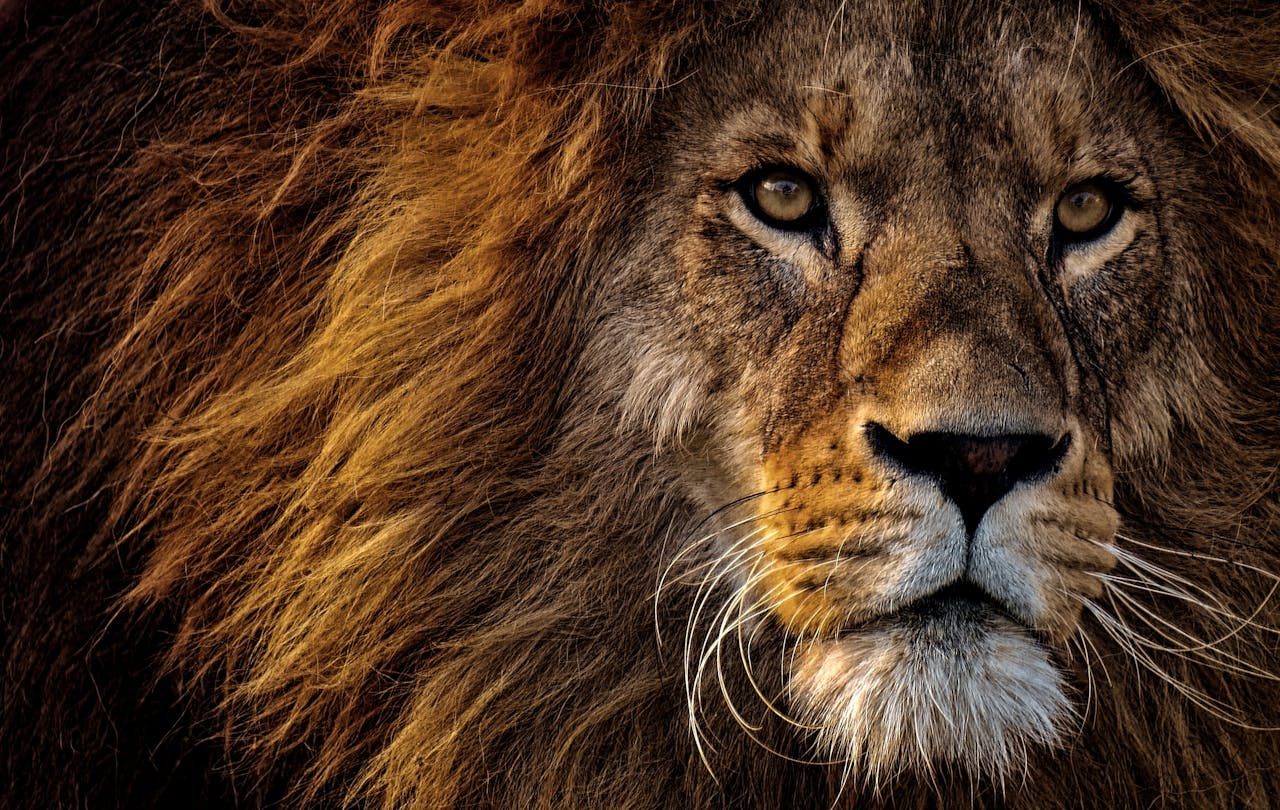
Lions on the plains of the Masai Mara, the reward at the end of the five to six hour road journey from Nairobi
Six hours of road, and then this. Leave at six and you will still have an afternoon drive.

What Does the Road Cost the Masai Mara?

Not what you think — and considerably more than your car.

The instinct is to feel guilty about the fuel, and the fuel is real. But the honest picture is that your vehicle on the C12 is a rounding error next to what the C12 itself has done to the land it runs through.

Now read that list again with a road in mind. Settlement expansion. Fencing. Land subdivision. These are the things a good road brings. The dispersal areas — the unfenced land outside the reserve that the wildlife actually needs — sit either side of the corridor you have just driven down. Every kilometre of tarmac makes that land more valuable, more accessible, more worth fencing and more worth selling.

The tarmac that makes your journey pleasant is the same tarmac that closes the corridors. That is not an argument against roads — Maasai families need to reach hospitals and markets and schools, and it would be grotesque for a tourist to argue otherwise from the back of a Land Cruiser. It is an argument for understanding what you are looking at through the window.
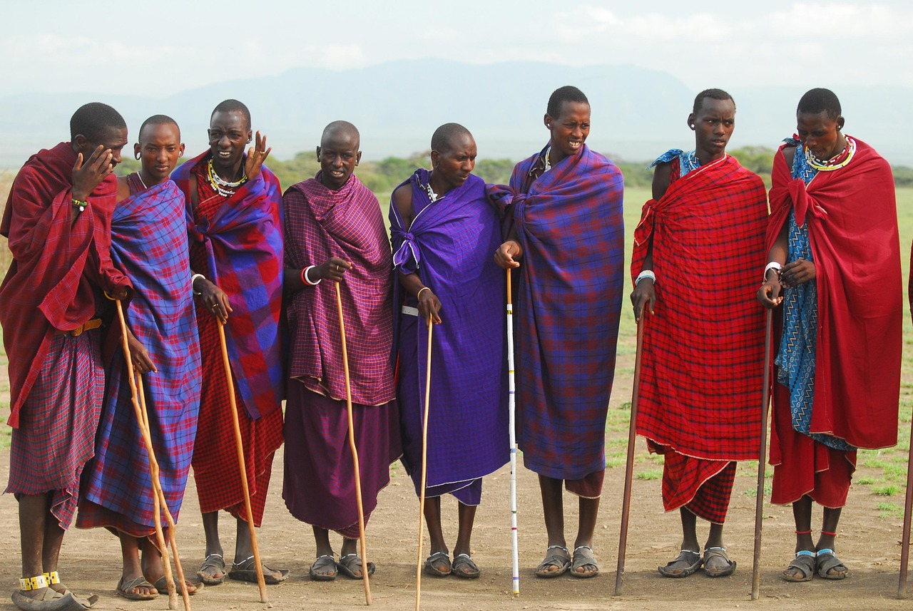
Maasai community members in the dispersal areas along the Narok corridor, where land-use change rather than tourist traffic drives wildlife decline
The land either side of the road you just drove is the dispersal area. What happens to it decides the Mara’s future — not what you drove down it in.
  • Your car is not the lever. Your camp is. Where you sleep at the end of the road is the decision with measurable consequences — see lodges & camps.
  • Go off-peak. Half the gate fee, half the vehicles, and the resident wildlife does not leave.
  • Consider a conservancy. Conservancy leases pay Maasai landowners directly to keep the dispersal land unfenced — which is precisely the mechanism the Ogutu data says is failing. See the Mara conservancies.
  • Buy in Narok. Fuel, food, water, a guide, a ranger. Money that stops in Narok County stays in the ecosystem that needs it.

What Else Do People Ask About Driving to the Masai Mara?

How long does it take to drive from Nairobi to the Masai Mara?

5–6 hours to the eastern gates (Sekenani, Talek, Oloolaimutia) and 6–6.5 hours to the western ones (Oloololo, Musiara), covering roughly 230–270 km. But a single stalled truck on the Mai Mahiu escarpment can stretch that to thirteen hours, which is why the departure time matters more than the distance.

What time should I leave Nairobi for the Masai Mara?

06:00. Leaving by six clears Nairobi before the morning rush and gets you down the Mai Mahiu escarpment ahead of the heavy commercial trucks. Leave at seven and you lose an hour to city traffic alone. You should be at the gate by late morning, with an afternoon game drive still ahead of you.

Is the road from Nairobi to the Masai Mara tarmac?

Mostly — but this is genuinely disputed. The A104 and B3 to Narok are tarmac. The C12 from Narok to Sekenani has been progressively sealed over several years, and 2026 sources contradict each other on whether the final stretch is now fully paved. The western approach still has about 70 km unpaved. And every road inside the reserve is dirt. Plan for the rougher case.

Do I need a 4×4 to drive to the Masai Mara?

For the drive itself, in the dry, to Sekenani — not necessarily. A 2WD minivan handles the tarmac corridor fine. But you need a 4×4 with a pop-up roof if the same vehicle will do your game drives, because 2WD vehicles are not permitted inside the reserve for game viewing. You also need a true 4×4 in the rains, and for the western and conservancy routes.

How much does it cost to travel from Nairobi to the Masai Mara by road?

A shared shuttle starts from around KES 1,500 per person. A private chauffeur-driven transfer is roughly $200 one way in a 2WD Noah or $270 in a 4×4 Land Cruiser — priced per vehicle, so for four people a return Land Cruiser works out at about $135 per person. Self-drive rental runs $150–180 a day plus fuel and insurance.

Can I take a bus or matatu to the Masai Mara?

You can reach Narok by public transport easily and cheaply. Getting from Narok to a gate and then into the reserve is the hard part — there is no public transport inside the Mara, and you cannot enter the reserve on foot. A shared shuttle transfer from Nairobi, from around KES 1,500 per person, is the practical budget option.

Where do I stop between Nairobi and the Masai Mara?

The Great Rift Valley viewpoint at the top of the Mai Mahiu escarpment (free, fifteen minutes, and every guide stops), the Travellers Chapel built by Italian prisoners of war in 1942 — sometimes called the smallest church in Kenya, and almost nobody stops — and Narok town, which is your last fuel, ATM and supermarket. Eat the samosas at the bottom of the escarpment, not at the café on top.

Can I pay my Masai Mara park fees through the KWS portal?

No — and this is an expensive mistake. The Masai Mara is a National Reserve managed by Narok County, not a KWS national park. A KWS receipt will be rejected at the gate and you will pay again — up to $200 per person in high season, non-refundable. Pay through the Narok County system or at the gate.

Is it safe to drive to the Masai Mara?

Yes, in daylight, with a competent driver. The road is a public highway used by thousands of vehicles daily. The real risks are night driving (livestock, wildlife, no lighting — never do it), black cotton mud in April, May and November, and the Mai Mahiu escarpment, where heavy truck traffic and steep switchbacks make a slow, cautious descent the only sensible one.

Should I drive or fly to the Masai Mara?

Road costs are per vehicle; flight costs are per person — and that settles most of it. Solo or as a couple on a short trip, flying is competitive and saves you eleven hours of road. As a family or group of four or more, the road is roughly half the price and you keep the vehicle at the other end. On a two-night trip, flying buys back a day and a half of game drives.

We drive this road every week — let us drive it for you

We are local guides of the Sekenani Tour Guides Association. We will pick you up anywhere in Nairobi, leave at six, stop at the viewpoint, get you through Narok efficiently, and have you at your camp with an afternoon game drive still in front of you. Fuel, tolls, insurance and an English-speaking driver-guide included.

See vehicles and transfer prices → · or use the quick booking form below. ↓

Book your Nairobi to Masai Mara transfer or safari

Send your dates, pickup point, group size and your camp. We will confirm the vehicle, the route, the departure time — and tell you honestly if flying would serve you better.

Booking form goes here. Note: WordPress shortcodes do not run inside a Custom HTML block — place [chbs_booking_form booking_form_id="23598"] in a separate Shortcode block immediately below this one.

Prefer email? Write to Bookings@MasaiMara.ke.

Sources & further reading

  1. Nairobi–Masai Mara route, distances and drive times by gate; the A104/B3/C12 routing; the ~70 km unpaved western approach toward Bomet; the Travellers Chapel at Mai Mahiu; shared shuttle pricing; and the contested road-surface question — sources published weeks apart variously describe the C12 as fully paved, “almost” paved, or unpaved for the final hour. Getting to the Masai Mara by road; Nairobi to Masai Mara road trip 2026. Road surface changes. Confirm with your camp before travelling.
  2. The Mai Mahiu escarpment as the route’s single point of failure — a stalled heavy commercial vehicle turning a six-hour journey into a thirteen-hour one; the recommended 06:00 departure to clear the escarpment ahead of truck traffic; and the newly tarmacked Ngong–Suswa bypass now favoured by professional operators for a consistent 5.5-hour arrival. Nairobi to Masai Mara drive time 2026.
  3. Self-drive road practicalities — the C12 versus the C11 (the Google Maps trap), the 90-minute Narok–Sekenani leg, Narok as the last fuel/ATM/supermarket and the KES 1,000-note ATM problem, the samosa vendors at the foot of the escarpment, black cotton soil in the long rains, the Sekenani gate queue, offline navigation, ranger hire at ~KES 3,000, self-drive cost ranges, and the Ewaso Ng’iro checkpoint. Self-drive Masai Mara: routes and 2026 rules.
  4. The payment-portal trap — the Masai Mara is a National Reserve managed by Narok County, not a national park under the Kenya Wildlife Service. KWS receipts are rejected at Sekenani and Talek and are non-refundable, forcing a second payment. Nairobi to Masai Mara: the KWS portal error. See also Masai Mara entry fees.
  5. Ogutu, J.O. et al. (2011). Continuing wildlife population declines in the Masai Mara region, Journal of Zoology — long-term ungulate losses attributed to land-use change, settlement expansion, fencing and livestock pressure in the dispersal areas outside the reserve. Figures vary by species and baseline period.
  6. Mogensen, N., Packer, C., Svenning, J-C., Amoke, I. & Buitenwerf, R. (2025). “Balancing benefits and burdens: Tourist camps and lion conservation in the Maasai Mara.” Conservation Science and Practice. doi.org/10.1111/csp2.70210.
MasaiMara.ke logo

MasaiMara.ke is a conservation-led guide to the Masai Mara National Reserve and the Greater Mara ecosystem, written by local guides of the Sekenani Tour Guides Association.

© 2026 MasaiMara.ke · Bookings: Bookings@MasaiMara.ke

Things to Do · Ballooning

Hot-Air Balloon Safari in the Masai Mara

An hour of silence at four hundred metres, a champagne breakfast on the grass — and a park fee nobody warns you about, even if you are staying in a conservancy.

The short answer

A hot-air balloon safari over the Masai Mara lifts off at first light, drifts for about an hour across the plains, and ends with a champagne bush breakfast where you land. Expect to pay roughly USD 450–570 per person for a shared basket of up to sixteen. The two long-established operators are Governors’ Balloon Safaris and Balloon Safaris Ltd, both licensed by the Kenya Civil Aviation Authority.1 The one thing to check before you pay: whether the Masai Mara reserve entry fee is included — because balloons land inside the reserve, and that fee can apply even if you are staying in a conservancy.2

What Is a Masai Mara Balloon Safari?

A dawn flight in a hot-air balloon over the Masai Mara National Reserve — the single most requested add-on in East African safari travel, and the only way to see the Mara without an engine underneath you.

You are collected from your camp in the dark, driven to a launch site, and watch the envelope inflate by burner-light. At sunrise the balloon lifts, and for the next hour you drift wherever the wind takes you: high enough to read the whole landscape — the Mara River winding, the Oloololo Escarpment standing over the Triangle — and low enough, at the pilot’s discretion, to float over a herd without a single animal looking up.

Then you land somewhere unplanned, because a balloon lands where the wind puts it, and there is a table laid on the grass.

~$450–570Per person, shared basket1
~1 hourAirborne, from first light
Up to 16Passengers per basket
+ park feeOften not included — check2
Image slot A — replace with your uploadA hot-air balloon over open savannah at sunrise. Download free from Unsplash → “hot air balloon safari” or Pexels → “hot air balloon savannah sunrise”.
The balloon rises with the sun. The burner is the only sound, and it fires perhaps once a minute.

How Much Does a Masai Mara Balloon Safari Cost?

Roughly USD 450–570 per person for a seat in a shared basket, with $450–500 the most commonly quoted 2026 figure. A private balloon — the whole basket, for a couple or a family — runs from about USD 1,800 to 2,500.1

Unusually for the Mara, this is a fairly stable price. Both main operators charge similarly, and there is little advantage in shopping around on price alone — the difference between operators is where they launch from, which decides what you fly over.

What the price normally covers — and what it normally doesn’t
ItemUsually included?
Pre-dawn transfer from your camp to the launch siteYes
The flight (~1 hour), with a licensed pilotYes
Champagne bush breakfast at the landing siteUsually — but some budget operators now strip it out to cut the headline price2
Transfer back to camp, often via a short game driveYes
Flight certificateUsually
Masai Mara reserve entry feeOften NOT included. This is the one that catches people — see below.
Tips for the pilot and ground crewNo

Does the Price Include the Masai Mara Park Fee?

Often not — and this is the single most expensive assumption in Mara ballooning. Balloons take off and land inside the national reserve. That means a balloon flight is an entry into the reserve, and reserve entry is charged per day of entry.

The conservancy trap

Here is the part that catches even experienced travellers. If you are staying in a private conservancy — Mara North, Naboisho, Olare Motorogi — you have been paying a conservancy fee, usually bundled into your camp rate, and you may never have paid a reserve fee at all.

On balloon morning, that changes. Because the balloon lands inside the reserve, the reserve entry fee can apply to you even though you are sleeping outside it.2 At USD 100 per adult from January to June and USD 200 from July to December,3 a couple can meet a $400 surprise on the morning of a flight they thought was paid for.

Now the honest complication: practice varies between operators, and the published sources contradict each other. Some operators state plainly that the reserve fee is excluded and payable separately. Others say that permits and reserve access fees are built into the base price. Both claims are made in public, in 2026, about the same activity.2

A note on data confidence — and what to actually do

We are not going to resolve this for you with a confident sentence, because the truth is that it depends on your operator and your camp, and anyone who tells you otherwise is guessing. What we can tell you is the exact question to ask, in writing, before you pay:

“Does my balloon price include the Masai Mara National Reserve entry fee for the day of the flight — yes or no? And if I am staying in a conservancy, does that change?”

Get the answer in an email. It is worth up to $200 per adult, and it takes one line. The fee table itself is at Masai Mara entry fees.

What Happens on the Morning of the Flight?

It starts brutally early and ends with sparkling wine before ten. The exact times shift with how far your camp sits from the launch site — which is why your camp’s location, not your preference, sets your alarm.

  • 04:30 – 05:00 · The alarmA knock on the tent, a flask of coffee, and no time to think about it.
  • 05:00 – 05:30 · PickupBe at reception. Transfers leave on time and will not wait — the balloon flies at first light or not at all.1
  • ~05:15 – 05:45 · The launch siteSafety briefing from the pilot, and the inflation. Watching a balloon fill by burner-light in the dark is genuinely part of the experience — don’t sit in the vehicle.
  • ~06:00 – 06:15 · Lift-offAt sunrise. The ascent is so gentle that people routinely miss the moment the basket leaves the ground.
  • ~07:00 – 07:15 · LandingWherever the wind decided. You brace; the basket may tip. This is normal and nobody minds.
  • 07:30 – 09:00 · The bush breakfastA table, linen, a hot cooked breakfast and a glass of something cold, on open grass. See bush breakfasts.
  • ~09:30 – 10:00 · Back at campUsually via a short game drive. You have been awake five hours and the day has not started.

A guide’s note

The chase crew has been up since three. The pilot checked the wind at four. By the time you are handed a glass at the landing site, roughly sixteen people have worked to put you in that basket for an hour — a pilot, a ground crew of about six, and a breakfast team behind them.1 Tip accordingly; it is not included.

What Is the Flight Actually Like?

Silent, and much less like a fairground ride than you expect. There is no sensation of speed, because you are travelling with the wind — so there is no wind in the basket at all. The balloon does not sway. It simply hangs there while the Mara moves underneath.

The only sound is the burner, and it fires intermittently — perhaps once a minute. Between firings the silence is total, and that silence is the thing people remember, not the height.

What you see, and from where
AltitudeWhat it gives you
High (a few hundred metres)The whole system: the Mara River winding through, the Oloololo Escarpment, the plains running to the Serengeti. In migration season, herds reading as dark rivers across the grass.
Low (treetop, at the pilot’s discretion)Drifting over animals with no engine noise — the reason experienced pilots burn hard early to gain height, then descend in silence.2

A photographer’s note: the burner vibrates the basket. If you are shooting with a long lens, ask for a position toward the centre of the basket, which is steadier than the corners.2 And shoot between burns.

Is a Balloon Safari Worth It?

Yes — but not for the reason most people book it, and we would rather say so now than take your $500 and let you find out at 400 metres.

A balloon safari is not a game drive. You are high, you are moving, you cannot stop, and you cannot ask the pilot to go back. Most of the time you are too far up for a close view of anything, and you will not get the frame-filling lion portrait you would get from a vehicle at thirty metres.

What you get instead is the thing a vehicle can never give you: the animals in the context of the landscape. The Mara as a system rather than a series of sightings. You understand, in a way no game drive teaches you, how the river cuts the plain, where the woodland gives way to grass, and why the herds move the way they do.

Who should book it — and who should spend the money elsewhere
Book it if…Skip it if…
You are here in July–October and want to see the migration herds at scaleYou are on a tight budget — $500 is roughly two extra nights in a decent camp
You want the landscape, not another sightingYour priority is close-up wildlife photography
It is a honeymoon, a milestone, a once-in-a-lifetime tripYou have only two nights — the balloon eats a whole morning
You have three or more nights so a weather cancellation can be rescheduledYou are visiting in April or May, when cancellation risk is highest2

Outside migration season it remains a beautiful flight — but be clear that the defining image, the one that sells the ticket, is massed herds seen from above, and from November to June they are not there.

What Are You Actually Looking Down At?

Fewer wildebeest than the brochure says, possibly by half — and this is the most interesting thing anyone can tell you before a migration-season flight.

You will still look down on a spectacle that will silence a basket of sixteen people. But you will be looking at it with better information than most of the people who sold you the ticket — and that, we think, makes it more remarkable rather than less. The full picture is in the Great Migration.

When Is the Best Time to Take a Balloon Safari?

July to October, without much argument, because that is when the migration herds are on the plains below you and a river crossing might unfold underneath the basket.2

Ballooning by season
MonthsFlying conditionsWhat you’ll see
Jul – OctExcellent — dry, clear, stableThe migration at scale. Peak demand: book 2–3 months ahead.
Jan – FebGood — dry and clearStrong resident game and active predators. Quieter skies.
Jun, Nov, DecGenerally goodShoulder conditions; fewer balloons aloft.
Apr – MayHighest cancellation risk — the long rains2Green and beautiful, but do not build a trip around a flight that may not go.

Balloons fly year-round. But if a balloon is the reason you are coming, do not come in April.

Who Can Fly — and Who Can’t?

Ballooning is more physically demanding than it looks. You stand for an hour, you climb into a chest-high basket, and you land in a braced position that may end up horizontal.

Restrictions to check before booking
ConsiderationTypical operator position
Minimum ageUsually 7 years, and the child must be able to see over the basket edge unaided4
WeightPassengers over roughly 120 kg may be asked to purchase a second seat, for weight-and-balance reasons4
MobilityYou must be able to climb into and out of the basket unassisted, and adopt a braced landing position
Standing for an hourThere are no seats. If that is a problem, it is a problem.
Motion sicknessRarely an issue — there is no swaying — but raise it with your camp manager if you are prone to it4
PregnancyAsk the operator directly. Policies vary and we will not guess on your behalf.

On the weight point: this is a genuine aviation constraint, not a judgement. Balloons fly to strict weight limits, and the crew would far rather sort it discreetly when you book than at a launch site in the dark. Raise it early and it is a non-event.

Is It Safe — and What If It’s Cancelled?

Yes, and the credential to look for is real: balloon operators in the Mara must be licensed by the Kenya Civil Aviation Authority (KCAA), and pilots hold KCAA licences with substantial logged hours.4 Balloons are inspected before every flight, and the two established operators have flown here for decades.

Flights are weather-dependent and will be cancelled for strong wind, heavy rain or poor visibility. That is the system working. If it happens, operators typically try to reschedule you to the next morning at no cost, or refund you.1

The single best planning decision you can make

Book the balloon for your second morning, not your last.

If the flight is cancelled on your final morning, there is no next morning — you are on a plane, and all you can do is take the refund and the disappointment. Book it early in the stay and a cancellation costs you nothing but a lie-in, because tomorrow still exists. This is the whole trick, and almost nobody does it.

Seats also sell out. In August and September, flights go months ahead. Book the balloon when you book the camp, not when you arrive.

Does Ballooning Disturb the Wildlife?

Nobody has properly measured it — and every operator will tell you it doesn’t.

Search for a balloon safari and you will find the same eco-note repeated everywhere: balloons operate with minimal disturbance to animals, making them one of the most eco-conscious ways to view wildlife. It is a plausible claim. It is also, as far as we can establish, a claim made almost exclusively by the people selling the flights. We looked for a peer-reviewed study measuring balloon disturbance to Mara wildlife and did not find one.

What we can say honestly

The physics genuinely favours the balloon. There is no engine, no wheels, no tyre tracks, and the burner fires intermittently rather than continuously. Animals below routinely do not look up. Compared with a vehicle idling at thirty metres from a cheetah, an hour of drifting is very probably the gentler thing.

But “very probably” is not “measured”, and we would rather tell you that than repeat marketing copy back to you as science.

And there is a part of the operation that the eco-notes never mention.

The bit nobody photographs: the chase vehicles

A balloon lands where the wind puts it. Which means that every single morning, recovery vehicles and a breakfast crew drive to that spot — across the plains, off the tracks, to a location nobody knew the night before. The balloon leaves no tyre marks. The convoy that retrieves it does.

That is off-road driving inside the reserve, performed daily, at scale, by every operator flying. It is not a scandal and it is not hidden — it is simply never counted when the flight is described as low-impact. And it means that the vehicles the Mara’s viewing rules were written for are very much part of a balloon safari.

Lions on the open plains of the Masai Mara, the landscape a balloon safari passes over at first light
From the basket, the Mara reads as a system rather than a series of sightings. That is the thing worth $500.

None of this is an argument against ballooning. We sell it, and we would fly it ourselves. It is an argument for honesty about what the activity actually is — an hour of near-zero impact in the air, wrapped in a ground operation that is much like any other morning’s game driving.

The genuinely good news is on the money side. Balloon operators pay concession and landing fees to Narok County, and the reserve entry fee on your flight morning is real revenue for the reserve that protects the animals you just drifted over. At $450–570 a seat, ballooning is exactly the “high-value” tourism the county says it wants — which is a debate we take up honestly in overtourism in the Masai Mara.

  • Ask your operator where the recovery vehicles drive. A good one will have a sensible answer. A bad one will look at you strangely.
  • Don’t ask the pilot to go lower over a predator. He may oblige. That does not make it right.
  • Remember the airspace. Balloons and light aircraft share the Mara’s low airspace, which is a large part of why drones are banned outright.
  • Tip the ground crew. Sixteen people got you into that basket.
Maasai community members in the Greater Mara ecosystem, who benefit from the concession and entry fees that balloon tourism generates
Concession fees, landing fees and reserve entry on flight morning are real money reaching the reserve and the communities around it.

What Else Do People Ask About Balloon Safaris?

How much is a hot-air balloon safari in the Masai Mara?

Roughly USD 450–570 per person for a shared basket of up to sixteen, with $450–500 the most commonly quoted 2026 figure. A private balloon costs from about $1,800–2,500. The price normally includes the transfer, the flight and a champagne bush breakfast — but often excludes the reserve entry fee, which is the cost that catches people out.

Do I have to pay Masai Mara park fees for a balloon flight?

Possibly — and this catches conservancy guests especially. Balloons take off and land inside the national reserve, so a flight is an entry into the reserve, and entry is charged per day ($100/adult Jan–Jun, $200 Jul–Dec). Even if you are staying in a private conservancy and have never paid a reserve fee, it can apply on balloon morning. Operators differ on whether it is bundled into the price, so get a written yes or no before you pay.

How long is a Masai Mara balloon flight?

About an hour in the air, though published figures range from 45 minutes to 90 minutes and the actual duration depends on wind. The morning, though, is a five-hour commitment: a 4:30–5:00 wake-up, pickup by 5:30, lift-off around 6:00 at sunrise, landing about an hour later, then the bush breakfast, and back at camp by 9:30–10:00.

What time does the balloon safari start?

Pickup is typically 05:00–05:30, with lift-off at first light, around 06:00–06:15. Your exact time depends on how far your camp sits from the launch site — so your camp’s location, not your preference, sets your alarm. Transfers leave on time and will not wait.

Is a balloon safari worth it?

Yes — but understand what you are buying. It is not a game drive. You are high, you are moving, you cannot stop, and you will not get frame-filling wildlife photographs. What you get is the Mara as a system: the river, the escarpment, the plains, and — in July to October — the migration herds at a scale no vehicle can show you. Outside migration season it is a beautiful flight, but the defining image is absent.

When should I book my balloon flight during my stay?

The second morning — never the last. Flights are cancelled for wind and rain, and if that happens on your final morning there is no next morning: you take the refund and the disappointment. Booked early in the stay, a cancellation costs you nothing but a lie-in. It is the single best planning decision available, and almost nobody makes it.

Is a Masai Mara balloon safari safe?

Yes. Operators must be licensed by the Kenya Civil Aviation Authority, pilots hold KCAA licences with substantial logged hours, and balloons are inspected before each flight. The two established operators — Governors’ Balloon Safaris and Balloon Safaris Ltd — have flown here for decades. Flights are cancelled in poor weather, which is the safety system working rather than failing.

Can children go on a balloon safari?

Usually from age 7, and the child must be able to see over the basket edge without help. Younger children need specific operator approval. Bear in mind there are no seats — everyone stands for the whole hour — and the landing requires a braced position. Confirm with your operator before booking.

Do hot-air balloons disturb the animals?

Probably far less than a vehicle does — but honestly, nobody has measured it. The universal “minimal disturbance” claim comes almost entirely from operators, and we could not find a peer-reviewed study of balloon disturbance in the Mara. The physics favours the balloon: no engine, no wheels, no tracks. But the recovery vehicles and breakfast crew drive off-road to wherever the balloon lands, every morning — and that part is never counted when ballooning is described as low-impact.

We’ll book the balloon — and tell you the park fee before you pay it

We are local guides of the Sekenani Tour Guides Association. We will match you to the right launch site for your camp, put the flight on the right morning of your stay, and get you a written yes or no on the reserve entry fee.

To start planning, use the quick booking form below. ↓

Add a balloon safari to your Masai Mara trip

Tell us your dates and your camp. We will confirm the operator, the launch site, the total including fees, and the best morning to fly.

Booking form goes here. Note: WordPress shortcodes do not run inside a Custom HTML block — place your booking shortcode in a separate Shortcode block immediately below this one.

Prefer email? Write to Bookings@MasaiMara.ke.

Sources & further reading

  1. Masai Mara balloon safari operating detail — pricing, the 5:00–5:30 pickup, dawn lift-off, one-hour flight, champagne bush breakfast, basket capacity (up to 16), Cameron-built envelopes, crew numbers, and weather-cancellation and refund practice. Hot-air balloon safaris in Kenya. Prices and inclusions change — confirm at booking.
  2. Masai Mara balloon safari 2026 — the reserve entry fee being excluded from the flight price and applying even to conservancy guests because balloons land within the reserve boundary; launch-site variation; the April–May cancellation risk; basket-position advice for photographers; and the practice of some budget operators excluding the bush breakfast. Masai Mara balloon safari: operator guide. Note: other operators state that reserve access fees are included in their base price — sources conflict, so confirm in writing.
  3. Narok County 2026 Masai Mara entry fees — USD 100 per non-resident adult per day (January–June) and USD 200 (July–December). Masai Mara reserve entry fees.
  4. Balloon operator safety and passenger restrictions — Kenya Civil Aviation Authority (KCAA) licensing of operators and pilots, the typical minimum age of 7 with the requirement to see over the basket edge unaided, the ~120 kg additional-seat threshold, and motion-sickness guidance. Masai Mara hot-air balloon: safety and restrictions. Policies vary by operator.
  5. Duporge, I. et al. (2025). “Deep learning-based detection of wildebeest and zebra in the Serengeti–Mara ecosystem from satellite imagery.” PNAS Nexus 4(9). doi.org/10.1093/pnasnexus/pgaf264. The authors do not claim a population crash; the finding concerns counting method as much as population.
  6. Broekhuis, F. (2018). “Natural and anthropogenic drivers of cub recruitment in a large carnivore.” Ecology and Evolution 8(13): 6748–6755. doi.org/10.1002/ece3.4180.
MasaiMara.ke logo

MasaiMara.ke is a conservation-led guide to the Masai Mara National Reserve and the Greater Mara ecosystem, written by local guides of the Sekenani Tour Guides Association.

© 2026 MasaiMara.ke · Bookings: Bookings@MasaiMara.ke

The Masai Mara · Conservation

Conservation in the Masai Mara

Most of the Mara’s wildlife was lost before anyone argued about off-road driving — and it was lost outside the gate, to people making sensible decisions about their own land. This is the page that explains why, and what has actually worked.

The collapse · The fence · The lease · What doesn’t add up · What helps
−97%Resident wildebeest, since the early 1980s
33→64%Land under conservation, since 2013
~15,000Maasai landowners in the model
+14%Lion density in conservancies vs the Reserve
The short answer

Conservation in the Masai Mara is a land-tenure problem wearing a wildlife costume. The Reserve is only about 4–6% of the ecosystem; almost everything that decides the Mara’s future happens on the privately owned Maasai land outside it. That land lost up to 97% of its resident wildlife since the early 1980s — not to poachers and not to tourists, but to fencing, settlement, ploughing and livestock.2 And the only intervention that has ever reversed it is the one that pays landowners rent: the conservancy model, which now covers about 450,000 acres and pays roughly 15,000 landowners a guaranteed lease.1

This page is the argument that holds the rest of this website together. It is not a list of charities. It is an attempt to say plainly what the problem actually is, what has genuinely worked, and which parts of the story do not add up — including a figure we nearly published before we checked it.

Before you read on

Six things worth knowing

The collapse is already historyMost of the Mara’s resident wildlife was gone before the current tourism debate began. You are arguing about the last few per cent.
It happened outside the gateOn private Maasai land. The Reserve boundary held. What it was holding back was mostly nothing — the loss was on the other side.
A fence is not vandalismIt is a rational answer to a badly set problem. Wildlife ate the grass and killed the calves and paid nothing.
Rent is the only thing that workedPay a landowner a guaranteed monthly fee to keep land open, and they keep it open. Land under conservation went from a third to nearly two-thirds.
Nobody can tell you what they earnPublished figures for the average landowner’s lease differ by more than five times — from the same organisation. We show you both.
And more tourism is not the fixLion densities are highest where there are no camps at all. The land needs tourism money; the wildlife needs less tourism. Nobody has solved that.
The number that reframes everything

What has actually been lost from the Masai Mara?

Most of it. Between roughly 70% and 97% of the Mara’s resident wildlife, depending on which species you count, measured against the early 1980s.2

Not the migration — that still arrives every year and fills the plains and makes the place look overwhelmingly alive. The residents. The animals that are supposed to be here in February when the wildebeest are in Tanzania.

Resident wildebeest−97%
Zebra−75%
Giraffe>70%
Topi>70%
Impala>70%
Warthog & hartebeest>70%

Now the part that matters more than the numbers. Ogutu and his colleagues did not attribute this to poaching, and they did not attribute it to tourism. They attributed it to land-use change — settlement, cultivation, fencing and an enormous increase in livestock — concentrated in the pastoral ranches outside the Reserve boundary.2 Livestock now makes up around a quarter of the large-herbivore biomass inside the Reserve itself, against a fraction of that historically.

Read the rest of this website in the light of that number

We have published thousands of words on cheetah cub recruitment and crowded sightings and off-road driving. Every word of it is true and we stand behind all of it.

None of it caused this. By the time anyone in a Land Cruiser was arguing about how close is too close, the Mara had already lost the overwhelming majority of its resident wildlife — quietly, legally, and on the other side of the gate.

A conservation page that opens with plastic bottles and vehicle etiquette is not lying to you. It is just answering a much smaller question than the one you came with.

— Masai Mara Kenya (MasaiMara.ke)
The boundary problem

Why doesn’t the Reserve protect the Masai Mara?

Because the Reserve is only about 4–6% of the ecosystem, and almost every force that decides the Mara’s future acts from outside it.

The Masai Mara National Reserve covers roughly 1,510 km². The Serengeti–Mara ecosystem it belongs to is somewhere around 25,000 km². The Reserve is a room in a house it does not own — and the plumbing, the foundations and the front door are all somebody else’s.

What the Mara depends onWhere it actually isProtected?
Its water — the Mara RiverRises in the Mau Forest, 100+ km upstreamNo. Outside every protected area, and roughly a quarter already cleared
Its migrationThe Serengeti, across an international borderYes — but by Tanzania, not Kenya
Its resident wildlifeThe dispersal areas and conservancies outside the boundaryOnly where a lease pays for it
Its corridorsPrivate Maasai landOnly where a lease pays for it
Its climateNot in Narok County

This is not our observation. It is the settled view of the people who assess these things. When Kenya nominated the Mara for World Heritage status in 1997, the verdict came back that the site, considered on its own, did not meet the natural criteria — but that it could be considered as an extension of the Serengeti.11 The Masai Mara does not work alone, and the assessors said so nearly thirty years ago.

We have set that record out in full on the Masai Mara National Reserve overview, and traced the river to its source on the landmarks pillar. What matters here is the consequence: a conservation strategy confined to the Reserve is a strategy that cannot work.

The uncomfortable centre of this page

Why do Maasai landowners fence their land?

Because it is the correct thing to do with land that has to feed a family, when the animals living on it eat your grass, kill your calves, and pay you nothing.

Almost every conservation article written about the Mara treats fencing as a problem to be solved, a behaviour to be discouraged, a failure of understanding. We are a Maasai guides’ association. We are not going to write that article.

How the land came to be owned this way

The Mara’s rangelands were held as group ranches — communal land, collectively managed. That system failed. And the account of how it failed does not come from us; it comes from the conservancies’ own umbrella body, in its own published case study: three or four decades of rapid and unequal development, a history of land grabbing, poor governance and corruption, and then subdivision, in which “a few powerful individuals amassing extensive benefits, while the majority of landowners remained disempowered”.3

So by the 2000s the Greater Mara consisted of thousands of Maasai families holding individual title to individual plots — and carrying a hard-won lesson about what happens when you trust a collective arrangement with your land.

Now put a lion on that plot

It kills a calf worth several months of household income. The wildebeest eat the grass your cattle need in the dry season. An elephant flattens the maize. Nobody compensates you. Nobody pays you. The tourists driving past pay US$200 a day at a gate eight kilometres away, and not one shilling of it arrives at your door.9

  • Fence and graze — income, and your calves survive.
  • Plough it for wheat — income, and no lions.
  • Subdivide and sell — income, immediately.
  • Keep it open for wildlife — income of zero, unless somebody actually pays you to.

Population growth in the Mara region is among the highest anywhere on the planet.3 The pressure on that decision is increasing every single year.

The sentence this whole website exists to make

A fence is not vandalism. It is a correctly-solved economic problem. The people who put it up did the arithmetic properly. The arithmetic was set wrong.

Our neighbours are not the threat to the Masai Mara. They were handed an impossible problem — own this land, feed your children, and also please subsidise the world’s wildlife out of your own pocket — and they solved it the only way it could be solved. If you want a different answer, you have to change the sum. Everything below is about changing the sum.

— Masai Mara Kenya (MasaiMara.ke)
The thing that worked

What actually works in Masai Mara conservation?

Paying the landowner rent. Guaranteed, monthly, whether or not the tourists come. That is the whole innovation, it is almost embarrassingly simple, and it is the most important thing that has happened to conservation in East Africa in fifty years.

Individual Maasai landowners pool their plots. The pooled block is leased to tourism partners — the camps. And each landowner receives a lease fee tied to the agreement they personally signed. The conservancies’ own umbrella body describes the distinctive feature of what it calls the “Mara Model” as “the direct guaranteed benefit in the form of lease fees”.1

The word doing the work in that sentence is “guaranteed.” Not a share of profits. Not a cut of the gate. A fixed payment, arriving whether or not a single guest books. That is what converts wildlife from a liability into rent — and it is why a landowner can now borrow against it.1

The modelWhere it stands
Conservancies24, at different stages of development1
LandAbout 450,000 acres of the Greater Mara1
LandownersOver 15,0001
Lease fees paidApproximately US$7.5 million a year1
Also includedBursaries, regulated grass access, consolation schemes for livestock losses, credit against guaranteed income1
Founded2013, under Kenya’s Wildlife Conservation and Management Act

And it demonstrably works

On the record · What the conservancies have achieved

Since the conservancies’ association was formed, land under conservation in the Mara landscape has risen from 33% to 64% — from a third to nearly two-thirds. Two major wildlife corridors have been secured. Around 3,500 elephants now move freely through the ecosystem. And the measure that should end the argument: lion density in the conservancies is 14% higher than inside the National Reserve.3

Read that last figure again. Community-owned land, grazed by cattle, lived on by people, is holding more lions per square kilometre than the protected area next door. The conservancies are not a buffer around the good bit. They are the good bit.

The same principle explains every other success on this website

  • The black rhino. Eighteen animals in 1984; about fifty-seven today. No fence, no reintroduction, no breeding programme. Rangers were paid to patrol. That was the entire method. → Rhinos of the Masai Mara
  • The Mara Triangle. Handed to a non-profit management company in 2001 and given the revenue to spend on rangers. Result: tens of thousands of snares lifted and thousands of poachers arrested.10anti-poaching
  • Pardamat. A dual-use conservation area where people, livestock and wildlife share the same ground — landowners are paid to take fences down, cap herd sizes and accept predator-proof bomas.3
Our position

Conservation in the Masai Mara is not a moral argument. It is an accounting one. Every acre of the Greater Mara that still holds wildlife holds it because, this month, wildlife out-earned wheat.

That sounds cynical. It is the opposite. It means the problem is solvable — not by persuading fifteen thousand families to love lions more, but by making the sum come out differently. And it means the question you should be asking about any camp, any operator, any conservation charity, is the least romantic one available: who, exactly, gets paid?

— Masai Mara Kenya (MasaiMara.ke)
The most useful thing on this page

Where does your money actually go?

Into one of two completely separate pipes — and most visitors have no idea which one they are paying into. This is, in our experience, the single most misunderstood thing about visiting the Masai Mara, and it takes thirty seconds to fix.

Where your money actually goes Two pipes. Most visitors think there is one. THE PARK FEE You, at the gate US$100–200 per adult, per day Narok County Government The Reserve — rangers, gates, roads Funds the Reserve. It does not reach a Maasai landowner. THE BED-NIGHT IN A CONSERVANCY You, at a camp Nightly rate + conservancy fee Tourism partner (the camp) GUARANTEED lease — ~15,000 landowners Paid monthly, whether or not you turn up. LAND STAYS OPEN — unfenced, unploughed, unsold Both are legitimate. They are not the same money, and they do not do the same job.
Reserve entry fees are set by Narok County and paid to the county.9 Conservancy lease payments are contractual obligations of the tourism partners, paid monthly to the individual landowners whose plots make up the conservancy.1 The diagram is ours.

Neither pipe is the “good” one. Your park fee pays the rangers who kept the black rhino alive; that is not nothing. But if you want your money to touch the mechanism that actually decides whether there is any wildlife outside the Reserve — the mechanism this entire page is about — it has to be the second pipe.

And note what the second pipe does not depend on: you. The lease is paid in February when nobody comes. It is paid in the rain. That predictability is precisely what makes a landowner willing to take a fence down — and it is why the model is worth defending even in the years when it is inconvenient for the camps.

The part most conservation pages leave out

What doesn’t add up about Masai Mara conservation?

Four things — and we are going to set all four out, because a conservation page that only carries the good news is not a conservation page. It is a brochure.

1. Nobody can tell you what a landowner actually earns

This is the one we nearly got wrong ourselves, and we would rather show you the working than quietly fix it.

MMWCA’s own website states that its member conservancies bring together over 15,000 landowners who annually receive approximately US$7.5 million in lease fees.1 Divide one by the other and you get about US$500 per landowner per year — less than a single non-resident visitor pays in park fees for three days in peak season.9 It is a devastating comparison. We had written it.

Then we checked it against a second source, and it fell apart.

MMWCA’s own chief executive, co-authoring a commentary in Mongabay, states that each landowner is paid a monthly lease fee of around US$235 — roughly US$2,820 a year — from a total landowner income across the conservancies of about US$4 million.4

Those two figures are more than five times apart, and they come from the same organisation.

A note on data confidence — and why we will not publish an average

Both figures can be true, and the reason is that leases are paid per acre, not per person. Enonkishu’s published rate is about US$25 per acre per year; Olare Motorogi’s was around US$41 per hectare per year in 2011 — roughly $17 an acre.7 A landowner with 150 acres and a landowner with 20 acres are in the same scheme and in different worlds. And MMWCA is explicit that its 24 conservancies are at differing stages of development — which means not all of them are paying leases yet.1

So the honest answer is that we do not know what an average Maasai landowner earns from conservation — and neither, on the published evidence, does anybody else. We are not going to invent a number to make a point, and you should be sceptical of anyone who hands you one without showing their arithmetic.

2. The people carrying the cost are subsidising it with patience

On the record · A 2025 study of households next to the Reserve

Research published in 2025 on residents living adjacent to the Masai Mara National Reserve found high levels of human–wildlife conflict and limited household financial security — and, at the same time, high satisfaction with the conservancy model and strong support for conservation.5

Sit with that for a moment. The people whose calves are being eaten support this arrangement more than their own bank balances justify. That is not a happy finding. That is a warning.

Part of the Mara’s conservation is currently being financed by Maasai goodwill. Nobody has put that on a balance sheet, no donor reports it as revenue, and goodwill is not a renewable resource.

3. The whole thing rests on tourists turning up

When COVID stopped travel, some conservancies came close to collapse. Landowners who had given up farming had no lease income and no crop. Some camps kept paying anyway — Mara North’s operators maintained payments to their 783 landowners through the worst of it — and some did not.8

Understand what the model does: it converts a subsistence asset — land you can eat off — into a tourism-dependent income stream. Which means it transfers the risk of a global travel shock from a European tour operator onto a family in Narok County.

Resilience is now the explicit strategic problem, and the conservancies know it: MMWCA’s own stated aim is to move its members towards resilient and diversified revenue models — livestock programmes, carbon, and longer leases — precisely so that the whole edifice does not rest on a single industry.1 The Nature Conservancy has since helped negotiate 25-year leases paying over 50% more than previous deals.8 That is genuine progress, and it gives families real stability. It also binds them to tourism for a generation. Whether that is a good trade is a question nobody can currently answer.

4. And more tourism is not the answer either

On the record · Mogensen et al. (2025)

Nine years of data across 2,363 km² of the Mara found the highest lion densities in areas with no tourist camps at all. Density fell as camp density rose, and the establishment of new camps was followed by rapid local decline. The authors’ conclusion is not that there should be fewer tourists — it is that tourism must be spread and planned rather than concentrated.6

So the obvious fix — build more camps in the conservancies, raise the lease pool, pay the landowners more — degrades the very thing the land is being protected for.

The tension nobody resolves

The land needs tourism revenue. The wildlife needs less tourism.

That is the central contradiction of conservation in the Masai Mara, and we are not going to pretend to have solved it, because we have not, and neither has anybody else. The best available answer is more money per bed rather than more beds — which means higher prices, which means fewer people can come, which is its own kind of problem, and which is a very awkward thing for a tour operator to write on its own website.

We have written it anyway. If you take one thing from this page, take this: anyone who tells you Mara conservation is simple is selling you something.

— Masai Mara Kenya (MasaiMara.ke)
Ranked honestly

What are the real threats to the Masai Mara?

Ranked by measured impact rather than by how upsetting they are to read about. Most conservation pages list threats in the order that produces the strongest feeling. We have listed them in the order that produced the actual losses — which means the one you have heard most about comes last.

RankThreatWhy it sits hereCovered in full
1Land conversion & fencingCaused the 70–97% collapse in resident wildlife. Everything else on this list is smaller.2The conservancies
2Human–wildlife conflictThe engine of threat 1. A lion that kills a calf is why a fence goes up.Human–wildlife conflict
3Water — the Mau ForestThe Mara River rises outside every protected area. A single point of failure for the whole ecosystem.Landmarks
4Climate changeCompounds all of the above — drought pushes wildlife onto community land and pushes herders to fence.3Climate & the Mara
5PoachingSevere for specific species — it took the rhino from 120 to 18 — but not the driver of the ecosystem-wide collapse.Poaching · the response
6Over-tourismReal, measured, and second-order. It is costing cheetahs cubs and suppressing lion density around camps — on a population already reduced by everything above.6Over-tourism
Why we put our own biggest campaign last

We have written more words about over-tourism than about anything else on this website. We believe every one of them. And it belongs at number six.

Putting it at number one would be easier — it is the threat visitors can see, feel guilty about, and act on before lunch. It would also be false, and it would let the much larger and much more boring problem — who owns the land, and what it pays them — carry on unexamined. Do not confuse feeling responsible with being useful.

— Masai Mara Kenya (MasaiMara.ke)
The people doing it

Who is actually doing the conservation work?

A small number of organisations, most of them underfunded, several of them run by Maasai. Each has its own page on this site; this is the map, not the territory.

OrganisationWhat it actually doesRead more
MMWCACoordinates the 24 conservancies, negotiates and protects the lease model, secures corridors, supports governance.1 The single most important body in Mara conservation.MMWCA
The Mara ConservancyHas run the Mara Triangle since 2001 as a non-profit: anti-poaching patrols, tracker dogs, ivory-detection dogs, and the rhino surveillance unit.10The Mara Triangle
Mara Elephant ProjectSatellite collars, EarthRanger, an elephant re-identification database, chilli fences and rapid-response rangers.Mara Elephant Project
Mara Predator Conservation ProgrammeCounts lions, cheetahs, leopards and hyenas as individuals, not estimates. Publishes the numbers that make our species pages possible.MPCP
The Mara Cheetah ProjectProduced the cub-recruitment research that gave the Mara its 5-vehicle and 30-metre cheetah rules.12Cheetahs of the Mara
Sheldrick, KWS, WRTI & Narok CountyThe black rhino ear-notching and GPS programme — over three-quarters of the Mara’s rhino are now individually identifiable.Rhinos of the Mara
Narok County GovernmentManages the National Reserve, sets the entry fees, and wrote the Management Plan (2023–2032) that governs zoning, off-road rules and vehicle limits.13The Management Plan

This is not an exhaustive list, and inclusion here is not an endorsement of every decision an organisation has made. It is a map of who holds which lever.

Your part

What can a visitor actually do for the Masai Mara?

Four things, ranked by how much they matter — and the first one is not the one you are expecting.

  • 1. Sleep in a conservancy for at least part of the trip. By a very wide margin the biggest lever you hold. A conservancy bed-night flows into the lease that keeps a landowner from fencing. A Reserve-only trip, however well behaved, never touches that mechanism at all. → the conservancies · where to stay
  • 2. Ask who gets paid. Say it plainly to any camp: how much of my nightly rate reaches a landowner, and how do you know? A camp with a real answer will give you a number and a name. A camp that changes the subject to its solar panels has also answered you.
  • 3. Come in the green season. Half the vehicles, half the park fee — US$100 rather than US$2009 — and the lease is paid whether you come in February or August. The animals are still here. February beats August. → best time to visit
  • 4. Behave properly at a sighting. Thirty metres from a cheetah, five vehicles maximum, never off-road for a rhino, never publish a rhino’s location. This matters. It matters less than the three above, and anybody who tells you otherwise is letting you off lightly.

And what does not help very much

Refusing a plastic bottle. Do it — single-use plastics have been banned in Kenya’s protected areas since 2020 anyway — but do not count it as your contribution. Feeling bad about your vehicle. Guilt is not a conservation instrument. Donating to a charity you found in an airport lounge without first asking whether any of it reaches a landowner.

There is one more thing, and it is uncomfortable. The most useful visitor is a more expensive one. The evidence says the wildlife does better where there are fewer camps6 and the landowners do better where the leases are higher.8 Both point the same way: fewer beds, paid more. That is a very awkward sentence for a guiding association to publish on its own booking page, and it is still what the evidence says.

The whole website, in three sentences

The Masai Mara will not be saved by people who love it. There has never been any shortage of those.

It will be saved, or lost, by about fifteen thousand people deciding — every year, one plot at a time — whether wildlife is worth more to them than wheat.

Every page on this site is, in the end, an argument about that decision. This is the one that says so out loud.

— Masai Mara Kenya (MasaiMara.ke)
Quick answers

Masai Mara conservation — FAQs

What is the biggest threat to the Masai Mara?

Land conversion outside the Reserve — fencing, settlement, ploughing and livestock on the privately owned Maasai land that surrounds it. That is what drove the loss of up to 97% of resident wildebeest and more than 70% of impala, warthog, giraffe, topi and hartebeest since the early 1980s. Poaching is severe for specific species, and over-tourism is real and measurable, but neither caused the ecosystem-wide collapse. The Reserve itself is only about 4–6% of the ecosystem.

Has the Masai Mara lost its wildlife?

Its resident wildlife, largely yes. Long-term analysis found resident wildebeest down around 97%, zebra around 75%, and impala, warthog, giraffe, hartebeest and topi all down more than 70% against early-1980s baselines. Even the migratory wildebeest were down around 64%. The migration still arrives every year and makes the Mara look overwhelmingly full — which is precisely why the collapse of the residents went largely unnoticed. Come in February and you are looking at the truth.

What are the Masai Mara conservancies and how do they work?

They are privately owned Maasai land, pooled voluntarily and leased to tourism partners. Individual landowners commit their plots; the camps pay a guaranteed monthly lease fee — guaranteed whether or not tourists come — and in return the land stays open, unfenced and unploughed. There are 24 conservancies at various stages of development, covering roughly 450,000 acres, involving over 15,000 landowners, with about US$7.5 million paid annually in lease fees. They are not government land, and they are not part of the National Reserve.

How much do Maasai landowners actually earn from conservation?

Nobody can tell you honestly, and we are not going to pretend we can. MMWCA’s own site reports about US$7.5 million a year paid to over 15,000 landowners — roughly $500 each per year. But MMWCA’s own chief executive has written that each landowner receives around US$235 per month, which is about $2,820 a year. Those figures are more than five times apart. The reason is that leases are paid per acre, not per person (roughly $25 per acre per year at Enonkishu), so payments are wildly unequal — and not all 24 conservancies are yet paying leases at all. Be sceptical of any single average, including one from us.

Does my Masai Mara park fee go to conservation?

It goes to Narok County Government, and it funds the National Reserve — rangers, gates, roads, management. That is genuine conservation work: it is the money that kept the black rhino alive. But it is a completely separate pipe from the conservancy lease payments, and none of it reaches a Maasai landowner. If you want your money to touch the mechanism that decides whether wildlife survives outside the Reserve, that has to come from a conservancy bed-night, not a gate ticket.

Is tourism good or bad for the Masai Mara?

Both, and the tension is not resolved. Tourism revenue is the only thing that has ever made it worth a Maasai landowner’s while to keep land open — without it, the conservancy model collapses and the fences go back up. But the research also finds the highest lion densities in areas with no tourist camps at all, and measures fewer cheetah cubs raised where vehicle density is high. The land needs tourism revenue; the wildlife needs less tourism. The least-bad answer appears to be fewer beds, paid more — which is an awkward thing for anyone in this industry to say.

What is the “Mara Model”?

The Mara conservancies’ distinctive innovation: a direct, guaranteed lease fee paid to each individual landowner, tied to the lease agreement they personally sign — not a share of profits, not a cut of the gate, and not conditional on tourists arriving. That guarantee is what turns wildlife from a liability into rent, and it is why a landowner can borrow against it. Alongside it sit bursary schemes, regulated grazing access and consolation payments for livestock losses.

Are the Masai Mara conservancies actually working?

On the evidence, yes — strikingly. Since the conservancies’ association was formed in 2013, land under conservation in the landscape has risen from 33% to 64%, two major wildlife corridors have been secured, and around 3,500 elephants now move freely through the ecosystem. Most tellingly, lion density in the conservancies is about 14% higher than inside the National Reserve — community-owned land, grazed by cattle and lived on by people, is outperforming the protected area next door. The fragility is financial, not ecological: COVID nearly collapsed the model when tourism stopped.

Is poaching still a problem in the Masai Mara?

Yes — and it takes two different forms. Commercial poaching for horn and ivory is what took the Mara’s black rhino from about 120 animals in 1971 to 18 by 1984; a young rhino was still killed for its horn here in 2016. Bushmeat snaring is the quieter and more constant problem: the Mara Conservancy has lifted tens of thousands of snares from the Mara Triangle alone. But poaching did not cause the ecosystem-wide collapse of the Mara’s resident wildlife. Land conversion did.

What is the single most useful thing a visitor can do?

Sleep in a conservancy for at least part of your trip. A conservancy bed-night flows directly into the guaranteed lease that keeps a Maasai landowner from fencing, ploughing or selling their land — which is the actual mechanism that decides whether there is any wildlife outside the Reserve. Then ask the camp how much of your rate reaches a landowner, and expect a number. Behaving well at a sighting matters too, genuinely — but it is the fourth most useful thing you can do, not the first.

Travel that pays the rent

Plan a Mara safari that reaches a landowner

Our guides live at Sekenani. We will tell you which nights go to the county and which go to a landowner, we will put you in a conservancy for part of the trip, and we will tell you February is better than August even though August is what you wanted to book.

Tell us your dates below and we’ll build something honest around them. ↓

Booking form goes here Insert a WordPress Shortcode block directly below this Custom HTML block and paste:
[chbs_booking_form booking_form_id="23598"]

Sources & further reading

  1. Maasai Mara Wildlife Conservancies Association (MMWCA) — membership of 24 conservancies at different stages of development, covering about 450,000 acres, bringing together over 15,000 landowners who annually receive approximately US$7.5 million in lease fees; the distinctive feature of the “Mara Model” described as “the direct guaranteed benefit in the form of lease fees” tied to each landowner’s lease agreement, alongside bursary schemes, regulated grass access, consolation schemes and credit access against guaranteed income; and MMWCA’s stated goal of supporting conservancies towards resilient and diversified revenue models. MMWCA
  2. Ogutu, J.O., Owen-Smith, N., Piepho, H.-P. & Said, M.Y. (2011). Continuing wildlife population declines and range contraction in the Mara region of Kenya during 1977–2009. Journal of Zoology 285(2): 99–109 — resident wildebeest down about 97%, zebra about 75%, and impala, warthog, giraffe, hartebeest and topi all down more than 70%; migratory wildebeest down around 64%; declines attributed to expanding human settlement, cultivation and livestock in the surrounding pastoral ranches rather than to hunting pressure inside the Reserve. doi:10.1111/j.1469-7998.2011.00818.x
  3. MMWCA case study, Equator Initiative (UNDP) — land under conservation in the Mara landscape rising from 33% to 64% since MMWCA’s formation; lion density in the conservancies 14% higher than in the National Reserve; approximately 3,500 elephants moving freely through the ecosystem; two major wildlife corridors secured; the Pardamat dual-use conservation area, where landowners are paid to remove fences and cap herd sizes; human population growth in the Mara among the highest on the planet; drought pushing wildlife onto community land and herders towards fencing; and the account of the group-ranch failure, after which land was subdivided in a way that concentrated the benefits among a few powerful individuals and left most landowners disempowered. Equator Initiative
  4. Sopia, D. & Nelson, F. (2018). Local conservancies create new hope for wildlife in Kenya’s Maasai Mara (commentary), Mongabay — each landowner paid a monthly lease fee of around US$235; Naboisho comprising over 600 individual plots and generating over US$900,000 of landowner income annually; approximately US$4 million received annually by landowners across all the Mara conservancies. Daniel Sopia is the chief executive of MMWCA, which is why this figure and note 1 sitting five times apart is worth your attention. Mongabay
  5. Research published in 2025 on communities adjacent to the Masai Mara National Reserve — finding high levels of human–wildlife conflict and limited household financial security alongside high satisfaction with the conservancy model and strong support for conservation. MDPI
  6. Mogensen, N.L. et al. (2025). Tourist camp density is associated with lower lion density in the Masai Mara. Conservation Science and Practice — nine years of monitoring across 2,363 km² finding the highest lion densities in areas with no tourist camps, density falling as camp density rises, and rapid local decline following the establishment of new camps; the authors recommend spreading and planning tourism rather than reducing visitor numbers. doi:10.1111/csp2.70210
  7. Conservancy lease rates — Enonkishu land leases reported at approximately US$25 per acre per year on 15-year terms, with provision for members to receive above the base rate in strong tourism years; Olare Motorogi leases reported at around US$41 per hectare per year in 2011 (roughly US$17 per acre). Lease payments are made per acre committed, not per landowner, which is why an “average payment” is not a meaningful figure. See our conservancy guides.
  8. Reporting on the fragility and evolution of the lease model — conservancies coming close to collapse during COVID when tourism stopped and landowners who had given up farming lost their lease income; Mara North’s eleven member camps guaranteeing fixed monthly payments to 783 Maasai landowners and maintaining them through the worst of the pandemic while other camps did not; and The Nature Conservancy subsequently helping to negotiate 25-year leases paying over 50% more than previous agreements — greater stability, at the cost of binding families to tourism for a generation. Breaking Travel News
  9. Masai Mara National Reserve entry fees, set by Narok County Government — non-resident adults US$100 per day in the low season (January–June) and US$200 per day in the high season (July–December), payable to the county. These fees fund the Reserve and do not form part of any conservancy lease payment. See Masai Mara entry fees.
  10. The Mara Conservancy — the non-profit management company that has run the Mara Triangle since 2001, operating anti-poaching and de-snaring patrols, a tracker dog unit, an ivory-detection dog unit and a rhino surveillance unit, and lifting tens of thousands of snares and arresting thousands of poachers over that period. See the Mara Triangle.
  11. UNESCO World Heritage documentation — the 1997 Bureau finding that the Masai Mara, considered on its own, did not meet the natural World Heritage criteria, but that it could be considered as an extension of the Serengeti. See our Reserve overview.
  12. Broekhuis, F. (2018). Natural and anthropogenic drivers of cub recruitment in a large carnivore. Ecology and Evolution 8(13): 6748–6755 — cheetah mothers in areas of high tourist density raising approximately one cub or fewer to independence, against more than two where vehicles are fewer, with lion and hyena abundance ruled out as an explanation. The research behind the Mara’s five-vehicle and 30-metre cheetah rules. doi:10.1002/ece3.4180
  13. Maasai Mara National Reserve Management Plan (2023–2032), Narok County Government — the zoning scheme, vehicle limits and off-road rules that govern the Reserve. See our summary: the MMNR Management Plan.

Where published figures conflict — as they do, badly, on landowner earnings — we have printed the conflict rather than an average, and shown our arithmetic so you can check it. Where we do not know something, we have said so. Population and financial figures in Mara conservation are frequently repeated without sourcing; treat any number you meet elsewhere, including a rounder and more comfortable one than ours, with the scepticism it deserves.

Masai Mara · Sectors · Talek

The Talek Sector

The Masai Mara’s leopard country — and the most tightly restricted ground in the Reserve. Almost all of it is High Use Zone, where off-road driving is prohibited under all circumstances and there is no big-cat exception. This is why, and this is what the Management Plan says about it.

The zoning · The riverine forest · The predators · The hard edge · The honest verdict
High UseThe zone almost all of it sits in
0Circumstances in which off-road is legal here
Riverine forestThe habitat the camps are built in
“Hard edge”The Plan’s own phrase for what this is becoming
The short answer

The Talek sector is the central-eastern quarter of the Masai Mara National Reserve, gathered around the Talek River and reached through Talek Gate. It holds the Reserve’s best leopard habitat, its densest big-cat driving and — according to the Reserve’s own gazetted management plan — it is almost entirely High Use Zone, where off-road driving is “prohibited under all circumstances.”1 No exception for a leopard. No exception for a kill. None.

That is not an arbitrary restriction. It is a management response to the fact that this is the most heavily used country in the Masai Mara, ringed by the densest cluster of camps on the entire Reserve boundary — camps that, as the Plan puts it without naming them, “occupy important wildlife habitats (such as riverine forest).”1

Riverine forest is the leopard’s habitat. That sentence is the whole story of this sector, and everything below is an elaboration of it.

Part of the sectors cluster

This is the Talek entry in our sector-by-sector series. The parent — Masai Mara Sectors & Zones — explains the three different ways the Reserve is divided and why they don’t line up. The barrier and the town are covered separately at Talek Gate & Talek Town.

Key takeaways — what a Mara guide would actually tell you

01

You are in the strictest zone in the Reserve. High Use Zone means off-road is banned outright — not “discouraged,” not “for big cats only.” Banned.

02

The rule does not flip at the gate. It flips further west, past the Ntiakitiak River. At Talek Gate, both banks of the Talek are High Use.

03

Leopards live in the riverine forest — and so do the camps. The Management Plan says tourism facilities here “occupy important wildlife habitats (such as riverine forest).” That is not a coincidence. It’s the same trees.

04

Topi Plains and Ol Kiombo are the country you actually drive. Open plains, hyena dens, cheetah, and the highest vehicle density in the Mara.

05

The Plan warns of a “hard edge” of back-to-back camps blocking wildlife movement. Stand at the Talek and look north-east along the boundary. That is what it is describing.

06

If you want off-road, night drives or walking — go 20 minutes north. The conservancies allow all three. The Reserve allows none of them, anywhere.

Definition

What is the Talek sector?

The Talek sector is the country gathered around the Talek River in the central-eastern Masai Mara — the ground you reach through Talek Gate, running west from the Reserve boundary toward the Mara River. Like every “sector” in the Mara it has no legal existence: the word does not appear in the Reserve’s management plan, and the boundaries you will see drawn for it vary from map to map.

What is definite is the geography. The sector is organised by four rivers, and three of them are also legal lines:

  • The Talek River — runs west from the gate through the middle of the sector. Riverine forest. Leopards. And, west of the Ntiakitiak, the boundary between two management zones
  • The Ntiakitiak River — flows south into the Talek. It is the eastern edge of the Low Use Zone
  • The Olare Orok River — the Ntiakitiak’s neighbour, and named alongside it in the Plan’s zone boundary
  • The Mara River — far to the west, and its own protected zone entirely

Which means the Talek sector is not a place so much as a set of intersecting lines with lions in it. And the lines matter, because they determine what your driver is allowed to do.

The Management Plan · the core of this page

What does the Management Plan say about the Talek sector’s zoning?

It places almost all of the Talek sector in the High Use Zone — the Reserve’s most restricted category — and it draws the boundary of that zone along the Talek and Ntiakitiak rivers. Here is the Plan’s own language, and it is worth reading slowly because most people who drive this sector have never seen it:1

From the gazetted plan · High Use Zone, Central Mara

“In the north, the zone covers the area east of the Ntiakitiak and Olare Orok Rivers to their confluence with the Talek River. From here the zone boundary follows the Talek River west until it reaches the Mara River Ecological Zone.”

And on the Low Use Zone

“The Talek River then forms the LUZ’s southern boundary, while the Ntiakitiak River separates it from the High Use Zone to the east.”

Read those two sentences together and the map falls out of them. We have drawn it below — schematically, from the Plan’s text and its Figure 4.

OUTSIDE THE RESERVE Community land · conservancies 2 km BUFFER ZONE (outside) TALEK GATE Talek town · outside the boundary Talek River Ntiakitiak Olare Orok Mara River LOW USE ZONE Off-road: big cats only Max 5 vehicles · 15 min · 25 m HIGH USE ZONE Off-road PROHIBITED under all circumstances Most of the Talek sector sits here HIGH USE — both banks, east of the Ntiakitiak Topi Plains Ol Kiombo toward Rhino Ridge & Musiara 1.5 km strip · all off-road banned
High Use Zone Low Use Zone Mara River Ecological Zone Buffer Zone (outside) Reserve boundary
Schematic — not to scale, and not a navigational map. Drawn by MasaiMara.ke from the zone boundary descriptions and Figure 4 of the Maasai Mara National Reserve Management Plan 2023–32.1 For the authoritative map, see Figure 4 of the Plan itself.
A correction to our own guide

Our Talek Gate page states that the driving rules change as you cross the Talek River. That is true — but it is not true at the gate, and we are correcting it here. Because the High Use Zone extends east of the Ntiakitiak, the country on both banks of the Talek at Talek Gate is High Use Zone. The zone boundary only starts running along the river some way west of the gate, past the Ntiakitiak confluence. So if you enter at Talek and immediately cross north of the river, you have not entered the Low Use Zone — you are still somewhere off-road driving is banned outright. We had it nearly right, and nearly right is how people get fined.

The MasaiMara.ke take

Nobody hands you this map. Not the gate, not the camp, not the brochure. You are expected to enter a legal regime you have never been shown, in a vehicle driven by someone whose incentive is to give you a good sighting.

So carry one fact: in the Talek sector, “we can just pop off the track for a second” is not a grey area. It is prohibited under all circumstances. The KES 50,000 fine is the least of it.

The Sekenani Tour Guides Association

The full three-map framework — sections, zones and sectors, and why they don’t line up — is on the parent pillar, Masai Mara sectors & zones.

The rule, and the reason

Why is off-road driving banned outright in the Talek sector?

Because the High Use Zone is defined as the country “presently used by the majority of Reserve visitors” — and the management response to that is not to relax the rules but to tighten them.1

This is worth sitting with, because it is the opposite of what most visitors assume. People arrive believing the busy sectors will be the permissive ones and the remote sectors the strict ones. The Plan does exactly the reverse. In the Low Use Zone — the quieter country north of the Talek and west of the Ntiakitiak — off-road driving is permitted, but only to approach big cats, and only under hard limits. In the High Use Zone, where you are, it is “prohibited under all circumstances.”1

The logic is straightforward once you see it. Where there are five vehicles, off-road damage is containable. Where there are fifty, it is not. So the crowded country gets the absolute rule and the empty country gets the conditional one.

Where you areOff-roadConditions
Talek sector — south of the Talek, and east of the NtiakitiakProhibited under all circumstancesNone. There is no big-cat exception here
North of the Talek, west of the Ntiakitiak (Low Use)Permitted — big cats onlyMax 5 vehicles · max 15 min · min 25 m · no 2WD off transit routes · no vehicles seating >12
Within 1.5 km of the Mara RiverAll off-road prohibitedNo bush dinners either
Anywhere in the ReserveNo night drives. No walking. No horseback. Earth-coloured vehicles only

Illegal off-road driving carries a fine of around KES 50,000. The Plan also provides for Ticket Inspection Units patrolling inside the Reserve.1

The MasaiMara.ke take

Here is the uncomfortable part, and it is about us, not you. Most off-road driving in the Talek sector is done by drivers — our colleagues — on behalf of guests who asked nicely, or who simply did not object.

You have more power in that vehicle than you think. “Please stay on the track” ends the conversation instantly; no driver overrules a paying client on a rule he was already breaking. Saying nothing is, in practice, saying yes.

And if you want the sighting where the vehicle can leave the track legally — that exists. It is twenty minutes north, in the conservancies. Book a night there.

The Sekenani Tour Guides Association · policing our own trade
The ground

What is the country actually like?

Two habitats, pressed against each other, and the contrast between them is the whole reason this sector produces the sightings it does.

The riverine forest

A continuous green corridor of tall trees along the Talek’s banks — sycamore fig (Ficus sycomorus), African ebony (Diospyros mespiliformis), Croton dichogamus, wild date palm, leleshwa. The figs fruit on staggered cycles all year, feeding baboon troops, vervet monkeys and green pigeons; the canopy and root tangles give a leopard both a daytime bed and an ambush position; the deep pools hold hippo (Hippopotamus amphibius) and crocodile through the dry.

This strip is why the Talek sector is leopard country. It is also — and this is the sector’s tragedy in one sentence — exactly where the camps are built.

The open plains

South and east of the river the country opens into short-grass plains: Topi Plains, the Ol Kiombo country. Long sightlines, red oat grass, scattered Balanites and acacia. This is cheetah ground, because a cheetah (Acinonyx jubatus) needs to see and to run. It is also lion ground, hyena ground, and the ground where every vehicle in the sector goes at dawn.

Wildebeest and zebra on the plains of the Masai Mara during the Great Migration
The Talek River is a migration crossing point in its own right — smaller, shallower and far less photographed than the Mara River, and for that reason often far more watchable.
Why the two habitats matter together:
Plains → prey·Forest → cover·Edge → predators

Predator density peaks where open hunting ground meets dense cover. The Talek sector is a long ribbon of exactly that edge. It is not lucky. It is structural.

The animals

What lives in the Talek sector?

The Mara’s most reliable leopards, resident lion prides that patrol the river, cheetah on the plains, and the densest hyena activity in the eastern Reserve. Here is what the sector is actually good for — and what it is not.

SpeciesWhere, in this sectorHow good is it, honestly
Leopard (Panthera pardus)The Talek riverine forest; the Ol Kiombo treesThe sector’s signature. Canopy, root cover, baboon prey and permanent water in one strip. As good as the Mara gets
Lion (Panthera leo)Topi Plains; prides patrolling the river lineVery good. Resident prides work the riverine prey routes. Expect company at a sighting
Cheetah (Acinonyx jubatus)Topi Plains, the Ol Kiombo open groundGood — and the most vehicle-sensitive animal here. See the research below
Spotted hyena (Crocuta crocuta)Dens on Topi Plains; the town edge at nightExcellent, and worth more of your attention than it gets. Watch them return to dens at dawn
Elephant (Loxodonta africana)The Double Crossing area; the river woodlandReliable. Large herds move along the river corridor
Hippo & Nile crocodileTalek pools, Fig Tree Bridge, Talek BridgeGuaranteed. The Talek holds both year-round
Black rhino (Diceros bicornis)Not here. The Mara Triangle is your realistic chance. We are not going to pretend otherwise
Mara River crossingsNot here. Those are the Mara River, west. The Talek has its own smaller crossings — different thing

Species-by-species detail lives in our wildlife guides. This table is about where in this sector, not about the animals themselves.

The MasaiMara.ke take

If you have one morning in the Talek sector, do not spend it chasing a lion. Lions you will get. Spend it slowly, along the river, looking up.

Leopard is the animal this country is built for, and it is the one that rewards patience over kilometres. Most vehicles blast west to Topi Plains at first light and drive past three leopards to reach a lion pride that has already eaten.

The Sekenani Tour Guides Association
The ground you cover

Where do you actually drive in the Talek sector?

Four named pieces of country, all reachable from Talek Gate within an hour — and all of them, note, in the High Use Zone. Each has its own guide; these are the summaries.

A note on the “Talek full-day game drive”

The full-day itinerary most operators sell out of Talek Gate — Topi Plains, then Paradise Plains, then Lookout Hill — takes you out of the Talek sector entirely. Paradise Plains is Musiara country; Lookout Hill is south. That is not a criticism: it is a good drive. But you should know that you are paying for a lot of driving, and that the zone rules change under you while you do it. If your priority is leopard, the honest advice is to stay in the Talek riverine belt and go slowly.

Conservation · the crisis in this sector

What is the “hard edge”, and why is the Talek sector it?

The Management Plan warns that in places, back-to-back tourism camps along the Reserve’s border have formed a “hard edge” that physically blocks wildlife movement — and that elsewhere those camps sit inside important wildlife habitats, “such as riverine forest.” It does not name the Talek sector. It does not have to.

From the gazetted plan · the threats chapter

“Very high levels of visitor use, especially the harassing/crowding of wildlife and off-road driving in unsuitable conditions and locations, as well as rapidly expanding tourism accommodation developments in the greater ecosystem, are all having a severe impact… In some places back-to-back tourism facilities have created a ‘hard edge’ along the Reserve’s border, preventing wildlife movements, while in others they occupy important wildlife habitats (such as riverine forest) or potentially reduce wildlife migratory and dispersal areas.”1

Put the two halves of that sentence side by side and look at where you are standing.

Half one — the hard edge. The Talek River camp strip is the densest continuous run of tourism accommodation on the whole Reserve boundary. Wildlife that has moved between the Reserve and the northern rangelands for millennia now meets a wall of fences, staff quarters, kitchens and generators.

Half two — the riverine forest. The camps are on the river because guests want to hear hippos from bed. The leopards are on the river because it is the only cover in a grassland. They are competing for the same trees, and only one of them signed a lease.

Maasai community members on the rangelands bordering the Masai Mara National Reserve in Narok County
The land immediately north of the Talek sector is Maasai land, not Reserve. The “hard edge” is the line between the two — and it is being built on from the outside in.
The pressureWhat the evidence shows
Camp density on the boundaryA nine-year Mara study found the highest lion densities where there were no tourist camps at all, with density falling as camp density rose3
Vehicle crowding at sightingsCheetah mothers in high-tourist areas raised roughly one cub or fewer to independence, against more than two where vehicles were fewer2
Waste from tourist facilitiesAn audit found 58% of Mara tourist facilities with improper waste management and 55% without an EIA licence. Solid waste draws hyenas, baboons and marabou storks in to feed — changing behaviour and driving conflict4
The river itselfThe Talek’s pollution has reached Tanzania. In 2022 a foul-smelling, blackened Mara River — traced upstream to the Talek — triggered a government investigation and a temporary ban on water use in four villages5
The wider collapseResident wildebeest down ~97%, zebra ~75%, and impala, warthog, giraffe, hartebeest and topi all down more than 70% against early-1980s baselines — driven by land-use change outside the Reserve6
The MasaiMara.ke take · the one question that matters here

We are a local guides’ association and our own guests sleep in this sector. So take this as a confession as much as an argument.

The zoning is the Reserve doing what it can with the land it controls. But the Reserve does not control the boundary strip, and the boundary strip is where the damage is being done. No zonation rule reaches a camp built in a leopard’s forest.

What does reach it is you. Before you book any camp on the Talek — ours, theirs, anyone’s — send one email: “Please send me your EIA licence and your waste-disposal arrangement.” The majority of audited facilities could not produce one. A camp that answers in a day is doing the work. A camp that goes quiet has told you everything you need to know.

It costs you nothing, it takes ninety seconds, and it is worth more than any amount of choosing a lodge from photographs.

The Sekenani Tour Guides Association · ask us the same question. We expect it.

The town’s waste and water crisis is covered in full on Talek Gate & Talek Town. The wider conservation picture is on our conservation hub.

The evidence

What does the science say about driving this sector?

That the rules you are asked to follow here were written from body counts, not from bureaucratic caution. Two studies matter most, and both were done in this ecosystem.

On the record · Broekhuis (2018), Ecology and Evolution

Femke Broekhuis’s Mara study found that cheetah (Acinonyx jubatus) mothers in high-tourist areas raised roughly one cub or fewer to independence — against more than two where vehicles were fewer. Crucially, lion and hyena abundance did not explain the difference. The vehicles did. Read the study.2

Why it matters here: Topi Plains and the Ol Kiombo open ground are cheetah country and the highest-vehicle country in the eastern Mara. Those two facts are pointed straight at each other. The five-vehicle and twenty-five-metre limits came from this.

On the record · Mogensen et al. (2025), Conservation Science and Practice

A nine-year study across 2,363 km² of the Mara found the highest lion (Panthera leo) densities in areas with no tourist camps at all, with density falling as camp density rose — and new camps followed by rapid local decline. The authors’ conclusion is not “fewer tourists.” It is spread, planned tourism: the harm lies in the concentration. Read the study.3

Why it matters here: the Talek River strip is the most concentrated camp cluster on the Reserve boundary. This is the study’s argument made physical.

The MasaiMara.ke take

Notice what neither study concludes. Neither says stop coming. Broekhuis’s finding is about vehicles at a sighting; Mogensen’s is about camps in a cluster. Both are arguments about how, not whether.

Which is the only good news on this page: the fix is not fewer visitors, it is better-behaved ones. Fewer vehicles per cat. Camps spread instead of stacked. Rubbish carried out. Drivers on the track.

The Mara does not need you to stay home. It needs you to be a nuisance about the right things.

The Sekenani Tour Guides Association
The decision

Where should you stay in the Talek sector?

You have three real options here, and they are not just price tiers — they are three different relationships with the land.

Inside the Reserve, near Ol Kiombo. You wake up already in the country, skip the gate queue, and pay for the privilege. The Plan permits no new accommodation and no expansion of existing bed capacity inside the Reserve for the life of this plan1 — so what exists is what there will be.

On the Talek River, outside the boundary. The classic Talek camp: hippos from bed, minutes from the gate, and — as this page has argued at length — built in the riverine forest that the leopards need. Cheaper. Louder. This is the “hard edge.”

In a conservancy, twenty minutes north. Naboisho, Ol Kinyei, Olare Motorogi. Roughly 0.5–0.6 visitors per km² against Central Mara’s high-season two to three.1 Night drives, walking safaris and legal off-road access — all three of which the Reserve prohibits everywhere. More expensive per bed, and the money goes to Maasai landowners as lease payments.

In-ReserveTalek River stripConservancy
Gate queueNoneDailyNone (own land)
Night drivesNoNoYes
Walking safariNoNoYes
Legal off-roadNo (High Use)No (High Use)Generally yes
Vehicles at sightingsManyMostFewest
Bed costHighLowestHigh
Where the money goesReserve leaseMixedMaasai landowners
Remember

A conservancy stay does not include Reserve entry, and a Reserve ticket does not admit you to a conservancy. They are separate places with separate fees. Many good Talek itineraries do both.

Tiers, camps and honest pricing are in our accommodation guide. The conservancies have their own pillar at Mara conservancies.

Timing

When should you visit the Talek sector?

June to October for predators and the migration; January to March for space, price and cubs; April, May and November only with a plan for water. The Talek sector’s timing is not the Mara’s generic timing, because this sector’s access road and its river both fail in heavy rain.

SeasonThe sectorWhat a guide would say
Jul–Oct — dry, peakMigration herds in the eastern Mara; game concentrates on the riverBest predator action, worst crowding, USD 200/day park fee. The Talek’s own crossings happen here — smaller and far less mobbed than the Mara River’s
Jan–Mar — dry, lowResident game, big-cat cubs, wide open countryOur pick. Half the park fee, a fraction of the vehicles, and the leopards are exactly where they always are. The migration is not the Mara
Jun — shoulderHerds arriving from the southExcellent value. Still USD 100/day until 30 June — the single best-value week in the calendar is the last one in June
Apr–May, Nov — wetGreen, empty, beautiful — and the road and the bridge are at riskThe Talek road failed outright in the May 2024 floods. Come, but ask your camp what its plan is if the river rises4
The MasaiMara.ke take

The Talek sector in February is one of the great underrated experiences in East Africa, and we will lose money telling you so.

No migration, no queue, half the fee, and a riverine forest full of leopards that never left. You will sit at a sighting with two other vehicles instead of eleven — which, if you have read the rest of this page, you now know is not just pleasanter. It is measurably better for the animal.

The Sekenani Tour Guides Association

Month-by-month detail is on best time to visit, and the herds’ movements on the Great Migration.

The sibling question

Talek, Sekenani or Musiara?

TalekSekenaniMusiara
The countryRiverine forest + plainsOpen plains, widest sightlinesPermanent marsh
Signature animalLeopardCheetahLion — the Marsh Pride
ZoneHigh Use — off-road bannedHigh Use — off-road bannedMixed; Low Use in places
Access22 km of dirt past SekenaniTarmac to the barrierMusiara Gate; often flown
AirstripOl KiomboKeekorokMusiara
CrowdingHighHighestModerate
Wet seasonRoad and bridge at riskLower risk — sealed roadSwampy going; Land Cruiser
The MasaiMara.ke take

Choose Talek if you want leopard and you are willing to trade solitude for it. Choose Sekenani if it is your first Mara and the sealed road matters. Choose Musiara if you are here for lions and you have a Land Cruiser under you.

And choose a conservancy night whichever you pick. It is the only way to see this ecosystem under rules that let a vehicle behave properly.

The Sekenani Tour Guides Association

Each sector has its own guide: Sekenani, Musiara, the Mara Triangle, Oloolaimutia & the south. The framework that holds them together is the sectors & zones pillar.

Questions we get asked

Talek sector FAQs

Can you drive off-road in the Talek sector?

No — not under any circumstances. Almost all of the Talek sector sits in the Reserve’s High Use Zone, where the gazetted management plan states off-road driving is “prohibited under all circumstances.” There is no big-cat exception here — that exception exists only in the Low Use Zone, north of the Talek River and west of the Ntiakitiak. The fine is around KES 50,000.

Do the driving rules change when you cross the Talek River?

Yes — but not at the gate. This is a subtlety we got wrong ourselves and are correcting. The High Use Zone extends east of the Ntiakitiak River, which means the country on both banks of the Talek at Talek Gate is High Use. The zone boundary only begins running along the river some way west of the gate, past the Ntiakitiak confluence. Cross the river near the gate and you have not changed zone.

What is the Talek sector best for?

Leopard (Panthera pardus), unambiguously. The Talek’s riverine forest — sycamore fig, African ebony, dense root cover, permanent water and resident baboon troops — is the best leopard habitat in the eastern Reserve. It is also strong for resident lion prides, cheetah on Topi Plains, hyena, elephant, hippo and crocodile. It is not where you will see black rhino, and it is not where the Mara River crossings happen.

Where is the Talek sector in the Masai Mara?

The central-eastern Reserve, gathered around the Talek River and entered through Talek Gate. It runs west from the Reserve boundary toward the Mara River, and is bounded by the Talek, Ntiakitiak and Olare Orok rivers. The conservancies — Naboisho, Ol Kinyei, Olare Motorogi — lie immediately north of it, outside the Reserve.

Which airstrip serves the Talek sector?

Ol Kiombo, inside the Reserve, roughly 20–30 minutes from Talek Gate. It is the closest airstrip to the eastern camps and about 45 minutes’ flight from Wilson Airport in Nairobi. If you are sleeping outside the Reserve and flying out from Ol Kiombo, ask at the gate for the two-hour transit ticket — it lets you cross without buying a full day’s entry, and it is not offered unless you ask.

Are there Mara River crossings in the Talek sector?

No. The famous crossings are on the Mara River, well to the west — mostly in the Mara Triangle and the Musiara sector. The Talek River has its own crossings, which are real but smaller, shallower and far less photographed. Many guides consider them more watchable for exactly that reason: fewer vehicles, closer views.

Can you self-drive in the Talek sector?

You need a safari-standard 4×4 with a pop-up roof, and vehicles are physically inspected at Talek Gate — 2WD cars are turned away. Beyond that, the position is genuinely contested: some sources state that private vehicles have been banned from self-driving in the Talek and Sekenani sectors since 2024 and that a licensed guide or ranger escort is now required; others say no such requirement exists. Do not plan a self-drive around a rule you read on a blog. Phone the gate or your camp in the week you travel.

Why are there so many camps on the Talek River?

Because guests want to hear hippos from bed — and because, until recently, nothing stopped it. The Management Plan is blunt about the consequence: back-to-back tourism facilities have created a “hard edge” along the Reserve’s border that prevents wildlife movement, and in places they “occupy important wildlife habitats (such as riverine forest)”. Riverine forest is the leopard’s habitat. The camps and the cats are competing for the same trees.

Are night drives or walking safaris allowed in the Talek sector?

No — and not anywhere else in the National Reserve either. Night drives, walking safaris and horseback safaris are prohibited Reserve-wide. This is deliberate: the Management Plan says the ban exists so surrounding community conservancies can capitalise on those niche markets. If you want a night drive or a walking safari, the conservancies begin twenty minutes north of Talek Gate.

Is the Talek sector worth it in the green season?

The country is at its best and emptiest — but the access road and the Talek Bridge are the sector’s weak point. In the floods of 1 May 2024, the Talek River burst its banks, camps were submerged, Narok County deployed two helicopters to evacuate tourists, and the Talek road became impassable. Come in April, May or November by all means — but ask your camp, before you pay a deposit, what its plan is if the road goes.

Travel that protects

Try our tours — explore & learn the Mara firsthand

We guide this sector. We will keep the vehicle on the track, tell you which zone you are in, take you slowly along the river where the leopards actually are — and show you our EIA before you ask.

To start planning, use the quick booking form below. ↓

Book your Masai Mara safari

Tell us your dates and what matters to you, and our team will tailor a conservation-minded safari — and tell you exactly which sector, gate and zone you will be in.

[ Booking form goes here ]
In WordPress, add a separate Shortcode block directly below this Custom HTML block and paste:
[chbs_booking_form booking_form_id="23598"]
Shortcodes do not execute inside a Custom HTML block.
Sources & further reading 1. Maasai Mara National Reserve Management Plan 2023–32 — High Use / Low Use Zone boundary descriptions and Figure 4 (the zone map), off-road prescriptions, Reserve-wide rules, the “hard edge” and riverine-forest passages, the accommodation moratorium, and conservancy visitor densities: Narok County (PDF).   2. Broekhuis, F. (2018). Natural and anthropogenic drivers of cub recruitment in a large carnivore. Ecology and Evolution 8(13): 6748–6755: doi:10.1002/ece3.4180.   3. Mogensen, N. et al. (2025). Tourism camp density and lion density in the Maasai Mara. Conservation Science and Practice: doi:10.1111/csp2.70210.   4. The May 2024 Talek floods and the environmental audit finding 58% of tourist facilities with improper waste management and 55% without an EIA licence: The Star.   5. Tanzania’s temporary ban on Mara River water use and the pollution investigation traced upstream to the Talek: The Water Diplomat.   6. Ogutu, J.O. et al. (2011). Continuing wildlife population declines and range contraction in the Mara region of Kenya. Journal of Zoology: doi:10.1111/j.1469-7998.2011.00818.x.   The zone schematic on this page is our own drawing from the Plan’s boundary text and Figure 4; it is not to scale and is not a navigational map. Where sources conflict, we have said so on the page rather than picking a side.
Masai Mara National Reserve · Sectors & Zones

The Sectors & Zones of the Masai Mara

The Masai Mara is not one place. It is divided three different ways at once — administratively, legally and commercially — and the three divisions do not line up. Which one you are standing in decides what you pay, where you may drive, and what you are allowed to do.

Three maps · Two sections · Four zones · Five sectors · One reserve
2Administrative sections
4Legal management zones
5Tourism sectors (unofficial)
37%Of the Reserve where off-road is ever legal
The short answer

The Masai Mara National Reserve is usually described as having five sectors — the Mara Triangle, Musiara, Talek, Sekenani and Oloolaimutia — but “sector” is a tourism convention, not a legal fact. The Reserve’s own gazetted management plan never uses the word. What it defines instead are two administrative sections and four management zones. Those are the divisions that actually govern your safari, and almost nobody explains them.

This is the map page for the Masai Mara. Everything else on this site — the gates, the fees, the driving rules, the camps, the wildlife — sits somewhere on one of the three grids below. Get the grids straight once and the rest of the Mara stops being confusing.

Ask five safari operators how many sectors the Mara has and you will get three, four or five. They are not being careless. There genuinely is no official answer, because the divisions people call “sectors” were invented by the tourism industry to describe where its camps are, and they were never gazetted. Meanwhile the divisions that were gazetted — the ones that decide whether your driver may leave the track — go almost entirely unmentioned in safari marketing.

We are going to give you all three maps, tell you which one matters for which decision, and then route you down to the sector you are actually going to.

Key takeaways — what a Mara guide would actually tell you

01

“Sector” is marketing. “Zone” is law. Your camp is sold to you by sector. Your driver is bound by zone. Only one of those two words appears in the Management Plan.

02

The Mara River splits the Reserve into two countries. West of it is the Mara Triangle, run by the Mara Conservancy, cashless. East is Central Mara, run by Narok County. Different management, different payment, one ticket price.

03

Off-road driving is legal in 37% of the Reserve and illegal in 63% — and where it is legal, it is legal only to approach big cats. There is no sector where you may simply drive wherever you like.

04

The Mara Triangle feels emptier because it is. 42% of it is Low Use Zone. Central Mara is 59% High Use. That is not a vibe — it is a land-use decision written into a gazetted plan.

05

A conservancy is not a sector. Conservancies are Maasai community land outside the Reserve, with their own rules — night drives, walking safaris — that the Reserve forbids everywhere.

06

Pick your sector by your bed and your gate, not by the wildlife. The animals do not know the lines exist. Your drive time to a sighting very much does.

Definitions

What are the Masai Mara’s sectors?

The sectors of the Masai Mara are informal regions of the National Reserve, named after the gates, rivers and landmarks that define them — and there is no agreed list of them. Most operators name five: the Mara Triangle, Musiara, Talek, Sekenani and Oloolaimutia. Others insist there are only three, dividing the Reserve by its two rivers. Some merge Talek and Musiara. Some count Keekorok separately.

They are all, in a sense, right — because none of them is describing anything official. The word “sector” does not appear once in the Maasai Mara National Reserve Management Plan 2023–32, the gazetted document that actually governs the Reserve.1 It is a convention the safari industry built to answer a practical question: where is your camp, and what can you drive to from it?

That is a useful question. It is just not the only one, and it is not the one the rangers are working from.

Who is dividing the MaraInto how many partsOn what basis
Most safari operatorsFive sectorsGates and camp clusters: Mara Triangle, Musiara, Talek, Sekenani, Oloolaimutia
A large body of guides and sitesThree sectorsThe two rivers: everything west of the Mara River, everything between the Mara and the Talek, everything east/south of them3
Narok County (administration)Two sectionsThe Mara River. Mara Triangle vs Central Mara (Narok)1
The gazetted Management Plan (law)Four zonesWhat you are permitted to do there — not where you sleep1

Four different answers, all current, all defensible. This is not a failing of the sources; it is a genuine feature of the place.

The MasaiMara.ke take

Most sites pick one of these four and present it as fact. We think that is the mistake, because a traveller who learns only the sector map arrives believing they understand a reserve whose actual rules they have never been shown.

Learn the sector map to choose a camp. Learn the zone map to understand what your driver may legally do once you are in it. They are not the same map and confusing them is how people end up in a vehicle that has just committed an offence.

The Sekenani Tour Guides Association
The core of it

How is the Masai Mara actually divided?

Three ways at once — and each grid answers a different question. Here is the whole thing in one view. Everything else on this page is detail.

Map 1 · Administration
2

Sections

Split by the Mara River. The Mara Triangle in the west, run by the Mara Conservancy. Central Mara (Narok) in the east, run directly by Narok County.

→ Decides WHERE YOU PAY
Map 2 · Law
4

Management zones

High Use, Low Use, Mara River Ecological, and the Buffer Zone. Drawn along rivers and roads so they can be read on the ground.

→ Decides WHAT YOU MAY DO
Map 3 · Tourism
5

Sectors

Mara Triangle, Musiara, Talek, Sekenani, Oloolaimutia. Unofficial, informal, and the only one you will see in a brochure.

→ Decides WHERE YOU STAY & DRIVE
One question, three answers:
“Which part of the Mara am I in?”·Section → who takes your money·Zone → what your driver may legally do·Sector → how far you are from breakfast
Map 1 · Administration

What are the Masai Mara’s two sections?

The Mara River splits the Reserve into two administrative halves that are run by two different organisations under two different sets of habits. This is the division with the most immediate consequences for your wallet, and it is the one visitors discover at a barrier, in the wrong queue.

West of the Mara River lies the Mara Triangle — about 488 km². Since 2001 it has been managed on Narok County’s behalf by the Mara Conservancy, an independent non-profit protected-area management company.12 It is cashless: Visa, Mastercard or M-Pesa only.

East of the Mara River lies Central Mara (Narok) — about 1,072 km², roughly twice the size, managed directly by Narok County and taking cash as well as card.

The Management Plan is candid that this split has been a problem: management of the two sides “gradually diverged,” producing “significant differences on both sides of the Reserve, which leads to confusion amongst the area’s users.”1 Bringing them back together is one of the plan’s stated aims.

The practical upshot: where you sleep decides who takes your money, and the internal border post is Purungat Bridge, not any external gate. Staying in the Triangle but driving in via Sekenani? You transit — and pay at Purungat. The mechanics are on the entry gates hub.

Wildebeest crossing a river during the Great Migration in the Masai Mara
The Mara River is not scenery. It is the administrative border of the Reserve, the axis of its zonation, and the reason the Mara exists at all.
Mara TriangleCentral Mara
Area~488 km²~1,072 km²
Managed byMara Conservancy (since 2001)Narok County
PaymentCashless onlyCash or card
GatesOloololo · Purungat · Serena airstripSekenani · Talek · Musiara · Oloolaimutia · Sand River
Visitor density (high season)1.22 /km²2–3 /km²
Map 2 · The one that actually binds you

What are the Masai Mara’s four management zones?

The Management Plan divides the Reserve into four zones — High Use, Low Use, Mara River Ecological and Buffer — and it is the zone you are standing in, not the sector, that decides what your driver may legally do. The zone boundaries were deliberately drawn along rivers and roads so they can be read on the ground. That only works if somebody tells you where they are.

Here is the whole zonation scheme, with the areas from the Plan’s own text. As far as we can tell, nobody has published this table before.

ZoneCentral MaraMara TriangleTotalWhat you may do
High Use Zone~638 km²~198 km²~836 km²Game viewing on maintained tracks. Off-road prohibited under all circumstances. Bush dinners at approved sites
Low Use Zone~374 km²~203 km²~577 km²Off-road permitted only to approach big cats — max 5 vehicles, max 15 min, min 25 m. No 2WD except on transit routes. No vehicles seating >12
Mara River Ecological Zone~62 km²~77 km²~139 km²A 1.5 km strip either side of the Mara River. All off-road prohibited. No bush dinners. Riverine forest, rhino breeding areas, crossing points
Buffer ZoneA 2 km strip outside the Reserve boundary~250 km²Not part of the Reserve. Where 63% of Central Mara’s visitors sleep — and the least regulated land of all

Areas as stated in the Management Plan 2023–32.1 The Plan hedges its own figures (“just over 638”, “approximately 198”, “just under 77”), so these sum to ~1,552 km² against its stated 1,560 km² — a rounding gap, not a contradiction. We have not smoothed it over.

Reserve-wide, everywhere, no exceptions

Four rules apply across the entire Masai Mara National Reserve regardless of section, zone or sector:1

  • No night game drives. Anywhere
  • No walking safaris, horseback or bicycle safaris. Anywhere
  • All tourism vehicles must be earth-coloured — dark green, brown or beige
  • Every visitor must enter through an approved entry point with a valid ticket

That first pair is not an oversight. The Plan says the ban exists deliberately, “to enable the surrounding community areas of the Greater Mara Ecosystem to capitalise on these niche markets, giving the community areas a potential tourism boost.”1 The Reserve is choosing not to compete with Maasai landowners. If you want a night drive, that is by design a conservancy product.

Where off-road driving is ever legal

Legal — big cats only (Low Use)37%
Illegal — always (High Use + Mara River)63%

Off-road driving is permitted in 37% of the Masai Mara — and even there, only to approach big cats, and even then under a five-vehicle, fifteen-minute, twenty-five-metre limit. There is no part of the Reserve where you may simply drive where you like. The fine is KES 50,000.

On the record · Broekhuis (2018), Ecology and Evolution

The five-vehicle and twenty-five-metre limits came from counting cubs. Femke Broekhuis’s Mara study found cheetah (Acinonyx jubatus) mothers in high-tourist areas raised roughly one cub or fewer to independence, against more than two where vehicles were fewer — and that lion and hyena abundance did not explain the gap. The vehicles did. Read the study.4

The MasaiMara.ke take

This is the single most useful thing on this page and it is almost never said out loud: your driver’s legal freedom changes depending on which side of a river he is on, and he is unlikely to explain that to you.

Most off-road driving in the Mara is not done by tourists. It is done by drivers, on behalf of tourists who asked nicely. A guest who says “please stay on the track” ends that conversation instantly. A guest who says nothing has, in practice, said yes.

You do not need to memorise the zone boundaries. You need to know that they exist, that 63% of the Reserve is off-limits to off-road driving under all circumstances, and that a great sighting is not a legal defence.

The Sekenani Tour Guides Association · yes, we are telling you to police your guide

How this plays out on a single morning’s drive is covered in Masai Mara game drives. Who wrote these rules, and how they are enforced, is on Reserve management.

Map 3 · The one in the brochure

What are the five sectors of the Masai Mara?

Five informal regions, each named for the gate, river or marsh at its heart, each with a distinct character and its own guide. This is the map that decides which camp you book and how far you drive before breakfast. Each one gets a full page — these are the summaries.

West of the Mara River

The Mara Triangle

The quiet half. Separately managed since 2001, better roads, fewer vehicles, and the Reserve’s most reliable migration crossing points beneath the Oloololo Escarpment.

Gates: Oloololo, Purungat · Cashless · 42% Low Use Zone
The Mara Triangle →
North, between the rivers

The Musiara Sector

Permanent water in a dry country. Musiara Marsh holds predators year-round — this is the Marsh Pride’s ground, and the country the BBC filmed for Big Cat Diary.

Gate: Musiara · Best for: lions, leopard, birds
The Musiara sector →
Central, on the Talek River

The Talek Sector

Riverine forest and the corridor that leopards work. The Talek River runs through it — and is also the line where the Reserve’s off-road law changes bank to bank.

Gate: Talek · Best for: leopard, elephant, hippo
The Talek sector → Central-east

The Sekenani Sector

The busiest ground in the Reserve and the one most visitors actually see. Open plains, widest sightlines, most camps, most vehicles. Good for cheetah; crowded at a kill.

Gate: Sekenani · Almost entirely High Use Zone
The Sekenani sector → South & south-east

Oloolaimutia & the Southern Mara

The empty end. Sand River, the Tanzanian border, and where the migration usually enters the ecosystem first — late June, ahead of the crowds that follow it north.

Gates: Oloolaimutia, Sand River · Best for: solitude, early migration
Oloolaimutia & the south →
Inside every sector

The named places

Paradise Plains, Rhino Ridge, Topi Plains, Musiara Marsh, Lookout Hill, the Oloololo Escarpment, the Mara and Talek rivers — the landmarks the sectors are built around.

The features, not the areas
Masai Mara landmarks →
A note on data confidence · how many sectors?

We have used five because that is the most common division and the one that maps cleanly onto the gates. But a substantial body of guides — including well-regarded ones — say there are three, dividing the Reserve purely by its two rivers: the Triangle in the west, Musiara between the Mara and Talek, and everything east and south of them lumped together as “Sekenani.”3 Neither count is wrong, because neither is official. If a site tells you confidently that the Mara has exactly N sectors and does not mention that others disagree, it has not checked.

The decision

Which Masai Mara sector should you choose?

Choose by your gate, your budget and your tolerance for other vehicles — not by the wildlife. The animals move across every one of these lines daily and do not recognise any of them. What the sectors actually determine is how far you drive before you see something, and how many other people are looking at it with you.

SectorGateCharacterVehiclesChoose it if…
Mara TriangleOloololo, PurungatOpen west bank under the escarpment; best crossingsFewestYou want the migration crossings and the least crowded driving in the Reserve — and you can reach the west side
MusiaraMusiaraPermanent marsh; predators year-roundModerateYou are here for lions and leopard, you have a Land Cruiser, and you do not mind swampy going
TalekTalekRiverine forest corridorModerate–highYou want leopard and elephant on the river, on a budget, and you are travelling in the dry
SekenaniSekenaniOpen plains, widest sightlinesMostIt is your first Mara, you are driving from Nairobi, and reliability matters more to you than solitude
Oloolaimutia / SouthOloolaimutia, Sand RiverEmpty southern plainsFewestYou want space, or you want the migration as it arrives — before it reaches the crossings

Vehicle density is our own field judgement, not a published figure. The one hard number is the Plan’s: Central Mara runs at 2–3 visitors per km² in high season against the Mara Triangle’s 1.22, and against the Reserve’s own optimal capacity of 1–1.2.1

The MasaiMara.ke take

Almost every “best sector” article is really an accommodation ad. So here is ours, plainly: we sell most of our safaris into Sekenani, and Sekenani is the most crowded sector in the Reserve. Both of those are true and we are not going to hide the second to protect the first.

Sekenani is where the tarmac ends, which makes it the cheapest, fastest, most reliable way into the Mara from Nairobi. That is a real advantage and it is why it is busy. If what you want is space, the honest answer is the Mara Triangle or the southern plains — and we will book you there instead, at a higher price, and tell you why.

The Sekenani Tour Guides Association · arguing against our own busiest product
The payoff

Why don’t the three maps line up?

Because they were drawn by different people, at different times, to answer different questions — and nobody has ever had a reason to reconcile them. The sections are administrative history. The zones are ecological law. The sectors are commercial shorthand. They overlap, cut across each other, and produce results that surprise people who assume one map explains everything.

Here is a worked example. It is not hypothetical; it happens most weeks.

You book a camp “in the Talek sector”

Map 3. Your camp is on the Talek River, your gate is Talek Gate, and everything the brochure told you is true.

You pay at a Narok County window

Map 1. You are east of the Mara River, so you are in the Central Mara section. Cash or card. Had your camp been in the Mara Triangle, you would have paid the Mara Conservancy at Purungat instead — even though you entered by the same road.

Your driving rules change during the drive — twice

Map 2. Cross the Talek River northward and you move from the High Use Zone, where off-road is banned outright, into the Low Use Zone, where it is permitted for big cats under strict limits. Drive west toward the Mara River and you enter the Mara River Ecological Zone, where it is banned again. One morning, one sector, three legal regimes.

And you probably sleep outside the Reserve entirely

Map 2 again — the Buffer Zone. Most Talek and Sekenani camps sit in the 2 km strip outside the boundary, which is not part of the Reserve, is the least regulated land in the ecosystem, and is where 63% of Central Mara’s visitors originate.1 You have been “in the Masai Mara” all week without sleeping in it once.

The MasaiMara.ke take

None of this is a scandal. It is what happens when a working landscape accumulates three centuries’ worth of decisions in seventy-five years.

But it does mean one thing worth carrying with you: “which sector am I in?” is not actually the question. The useful questions are “who takes my money here,” “what may my driver legally do here,” and “am I even inside the Reserve right now.” Ask those three and you will understand more about the Mara than most people who have been ten times.

The Sekenani Tour Guides Association
The distinction everyone gets wrong

Are the Mara conservancies sectors of the Reserve?

No. The conservancies are not sectors, not zones, and not part of the Masai Mara National Reserve at all. They are Maasai community land outside the Reserve boundary, leased from thousands of individual landowners, and governed under an entirely separate regime.

This confusion is everywhere, and it costs people money and disappointment. Naboisho, Olare Motorogi, Mara North, Ol Kinyei, Siana and the rest are not parts of the Mara you can drive into on a Reserve ticket, and a Reserve ticket does not admit you. Equally, a conservancy stay does not include Reserve entry — you pay again at the gate.

The trade is a real one, and it runs both ways. Conservancies run at roughly 0.5–0.6 visitors per km² against Central Mara’s high-season two to three.1 And they permit the three things the Reserve forbids everywhere: night drives, walking safaris and off-road access — not by accident, but because the Reserve deliberately declines to compete for that market.

The full picture is on the Masai Mara conservancies pillar.

The ReserveThe conservancies
LandGazetted county reserveMaasai community land, leased
EntryReserve ticket at a gateUsually only as a guest of a partner camp
Night drivesNeverYes
Walking safarisNeverYes
Off-road37% of the Reserve, big cats onlyGenerally permitted
Visitor density2–3 /km² (Central Mara)0.5–0.6 /km²
Your Reserve ticketValidDoes not admit you
The mistake that costs the most

“We’re staying in the Mara” can mean three completely different things: inside the Reserve, in the 2 km Buffer Zone just outside it, or in a conservancy twenty kilometres away. All three are sold as “the Masai Mara.” Ask which one, in writing, before you pay.

Honesty

How big is the Masai Mara, really?

Somewhere between 1,510 and 1,560 km² — and the Reserve’s own gazetted management plan gives two different answers within the same document. We are flagging this because a page about how the Mara is divided ought to be honest about the fact that its total is not settled.

FigureWhere it comes fromStatus
1,510 km²The most widely quoted figure, repeated across most safari sites and much of the pressUbiquitous. Origin unclear
1,530 km²The Management Plan’s history section: the size after the 1984 excisions1Primary source
1,560 km²The same Management Plan, in its visitor-density comparison — and the sum of its own two section areas (1,072 + 488)1Primary source, same document
520 km²The original 1948 gazettement — the Mara Triangle alone1Historical
1,831 km²The 1961 extension eastward, before the 1984 excisions1Historical
A note on data confidence

We use ~1,510 km² where a single round number is needed, because that is the figure in common use and the one you will meet everywhere else. But the gazetted plan says 1,530 in one chapter and 1,560 in another, and its own zone areas sum closer to 1,552. We have not picked a winner, because we do not have grounds to. If a site gives you one figure to the square kilometre with no caveat, it has copied it from another site that did the same.

The MasaiMara.ke take

This looks like pedantry and it is not. The reason it matters is that every “visitors per square kilometre” figure — including the carrying-capacity limit the Reserve is measured against — has one of these numbers as its denominator.

You cannot manage what you have not agreed to measure. A 50 km² disagreement is 3% of the Reserve, and 3% is the difference between “at capacity” and “over it.”

The Sekenani Tour Guides Association
Conservation · the closing argument

Why is the real story happening outside these lines?

Because the Masai Mara’s wildlife has collapsed — and the cause is almost entirely outside the Reserve boundary, in land the sector map does not even show. Every division on this page describes the 1,510-odd square kilometres inside the fence line. The animals do not live only there, and the threat does not come from there.

Long-term monitoring found resident wildebeest down by around 97%, zebra by 75%, and impala, warthog, giraffe, hartebeest and topi all by more than 70% against early-1980s baselines.6 The drivers were not tourist vehicles. They were land-use change, settlement expansion, fencing and livestock pressure in the dispersal areas beyond the Reserve — the corridors that the Mara’s wildlife needs and that no zonation scheme governs.

Which is why the most important line on all three of our maps is the one nobody markets: the 2 km Buffer Zone. It is not part of the Reserve. It is the least regulated land in the ecosystem. And it is where most visitors sleep.

Maasai community members in the Greater Mara ecosystem of Narok County — a general photograph
The land outside the Reserve is Maasai land. Whether the Mara survives is a question about that land, not about the lines drawn inside it.
On the record · Mogensen et al. (2025), Conservation Science and Practice

Where visitors sleep is a conservation lever, not a comfort preference. A nine-year study across 2,363 km² of the Mara found the highest lion (Panthera leo) densities where there were no tourist camps at all, with density falling as camp density rose — and new camps followed by rapid local decline. The authors’ conclusion is not “fewer tourists.” It is spread, planned tourism: the damage is in the concentration. Read the study.5

The MasaiMara.ke take · the last word

You came to this page to find out which sector to book. Here is what we would rather you took away.

The Reserve’s boundaries, sections and zones are a serious attempt to manage a place under enormous pressure, and they are worth understanding. But the Masai Mara is not the 1,510 km² inside the line. It is the whole ecosystem — the conservancies, the dispersal areas, the Loita plains, the Mau catchment that fills the Mara River — and the wildlife inside the Reserve is only as safe as the land outside it.

Choose your sector. Then choose a camp that pays a lease to Maasai landowners, ask it for its environmental impact assessment, and keep your driver on the track. Those three things do more for the Mara than any line on any map.

The Sekenani Tour Guides Association · guiding the Mara for two decades
Questions we get asked

Masai Mara sectors & zones FAQs

How many sectors does the Masai Mara have?

There is no official answer. Most operators name five — Mara Triangle, Musiara, Talek, Sekenani and Oloolaimutia. A substantial number say three, dividing the Reserve purely by its two rivers. The word “sector” does not appear in the Reserve’s gazetted management plan at all. What is official: two administrative sections and four management zones.

What is the difference between a sector and a zone in the Masai Mara?

A sector is an informal tourism region — it tells you where your camp is and what you can drive to. A zone is a legal designation in the Management Plan — it tells you what you and your driver are permitted to do. Sectors are marketing; zones are law. Your camp is sold to you by sector, but your driver is bound by zone, and the two do not line up.

Can you drive off-road in the Masai Mara?

Only in about 37% of it, and only to approach big cats. Off-road driving is prohibited under all circumstances in the High Use Zone (~836 km²) and along the Mara River (~139 km²). In the Low Use Zone (~577 km²) it is permitted solely to approach big cats, with a maximum of 5 vehicles, a maximum of 15 minutes, and a minimum distance of 25 metres. The fine for illegal off-road driving is KES 50,000.

Which sector of the Masai Mara is best?

It depends on what you are optimising for. The Mara Triangle has the fewest vehicles and the best migration crossings. Musiara has permanent marsh and year-round predators. Talek has the leopard-rich river corridor. Sekenani is the easiest to reach and the most crowded. Oloolaimutia and the south are the emptiest. The animals cross all of these lines daily — what the sector really decides is your drive time and how many other vehicles share your sighting.

Are the Mara conservancies part of the Masai Mara National Reserve?

No. The conservancies are Maasai community land outside the Reserve boundary — leased from thousands of landowners and governed separately. Your Reserve ticket does not admit you to a conservancy, and a conservancy stay does not include Reserve entry. In exchange, conservancies permit night drives, walking safaris and off-road driving, which the Reserve prohibits everywhere, and run at roughly 0.5–0.6 visitors per km² against Central Mara’s two to three.

Why is the Mara Triangle managed differently?

Because since 2001 the day-to-day management of the Mara Triangle — the section west of the Mara River — has been contracted by Narok County to the Mara Conservancy, an independent non-profit. Practical consequences: the Triangle is cashless (Visa, Mastercard or M-Pesa only), and 42% of it is Low Use Zone against Central Mara’s 59% High Use. That is why it feels emptier. It is emptier by design.

Are night drives or walking safaris allowed in the Masai Mara?

Not anywhere in the National Reserve — no night game drives, no walking safaris, no horseback or bicycle safaris, in any sector or zone. This is deliberate: the Management Plan says the ban exists so that surrounding community areas can capitalise on these niche markets. If you want a night drive or a walking safari, that is by design a conservancy product, not a Reserve one.

How big is the Masai Mara National Reserve?

Between 1,510 and 1,560 km², and the sources genuinely conflict — including the gazetted Management Plan, which gives 1,530 km² in one chapter and 1,560 km² in another. The most commonly quoted figure is 1,510 km². It began in 1948 as the 520 km² Mara Triangle, was extended east to 1,831 km² in 1961, and was cut back in 1984.

Which river divides the Masai Mara?

Two do. The Mara River is the administrative divide — the Mara Triangle lies west of it, Central Mara east. The Talek River is the internal zonation divide in the north: south of it is High Use Zone, where off-road driving is banned outright; north of it is Low Use Zone, where it is permitted for big cats only. Both rivers were chosen as boundaries precisely because they can be read on the ground.

Is my camp inside the Masai Mara National Reserve?

Probably not — and you should check. The Management Plan records that 63% of Central Mara’s visitors sleep outside the Reserve, mostly in the 2 km Buffer Zone along the boundary, which is not part of the Reserve and is the least regulated land in the ecosystem. “In the Masai Mara” is used to mean inside the Reserve, in the buffer strip, or in a conservancy twenty kilometres away. Ask which one, in writing, before you pay.

Travel that protects

Try our tours — explore & learn the Mara firsthand

We will tell you which sector you are booking, which section takes your money, which zone your driver is bound by, and whether your camp is actually inside the Reserve. It should never be a surprise.

To start planning, use the quick booking form below. ↓

Book your Masai Mara safari

Tell us your dates and what matters to you, and our team will tailor a conservation-minded safari in the right part of the Mara for it.

[ Booking form goes here ]
In WordPress, add a separate Shortcode block directly below this Custom HTML block and paste:
[chbs_booking_form booking_form_id="23598"]
Shortcodes do not execute inside a Custom HTML block.
Sources & further reading 1. Maasai Mara National Reserve Management Plan 2023–32 — zonation scheme and zone areas, the two Reserve sections, approved entry points, Reserve-wide prescriptions, visitor densities and carrying capacity, the 63% figure, and the Reserve’s own conflicting size figures: Narok County (PDF).   2. The Mara Conservancy’s management of the Mara Triangle since 2001, and its cashless payment rule: Mara Conservancy.   3. The competing three-sector definition, cited so you can weigh it against the five-sector one: Masai Mara National Reserve — the three sectors.   4. Broekhuis, F. (2018). Natural and anthropogenic drivers of cub recruitment in a large carnivore. Ecology and Evolution 8(13): 6748–6755: doi:10.1002/ece3.4180.   5. Mogensen, N. et al. (2025). Tourism camp density and lion density in the Maasai Mara. Conservation Science and Practice: doi:10.1111/csp2.70210.   6. Ogutu, J.O. et al. (2011). Continuing wildlife population declines and range contraction in the Mara region of Kenya. Journal of Zoology: doi:10.1111/j.1469-7998.2011.00818.x.   Zone areas are as stated in the Management Plan, which hedges its own figures; they sum to ~1,552 km² against the Plan’s stated 1,560 km². We have shown the gap rather than smoothing it. Where sources conflict, we have said so on the page rather than picking a side.
Plan Your Visit · Getting There

Masai Mara Entry Gates

Seven gazetted road gates, three camp-only access points and five airstrips control every legal way into the Masai Mara National Reserve. Choosing the right one decides how much of your day — and your ticket — you actually spend with the wildlife.

The seven gates · Which to use · Two authorities · The 12-hour clock · What the Management Plan says
7gazetted road gates
2separate authorities
12 hrsticket validity, 06:00–18:00
63%of visitors sleep outside the Reserve
A planning guide

This is a supporting page in our Plan a Masai Mara Safari hub. It answers one question only — where you enter the Reserve and what happens at the barrier. For what you pay, see Masai Mara entry fees; for the journey itself, see getting to the Masai Mara.

The short answer

The Masai Mara National Reserve has seven gazetted public road gatesSekenani, Talek, Musiara, Oloolaimutia, Sand River, Oloololo and the newly approved Enoompuai — plus three camp-specific access points that the public may not use, and five approved airstrips.1 Most visitors arriving by road from Nairobi use Sekenani. The single most consequential choice is not which gate is prettiest, but which gate your bed is behind, because the Reserve is run by two different authorities with two different payment systems, and your 12-hour ticket starts running at 06:00 whatever time you arrive.

A gate in the Masai Mara is not a turnstile at a theme park. It is the point at which a conservation area counts you, prices you, checks your vehicle and decides how much pressure the ecosystem behind it will absorb that day. The Reserve’s own Management Plan is unusually blunt about this: the Mara “is primarily established as a crucial Kenya wildlife conservation area, and only secondarily as a tourism destination.”1

That framing matters, because the gates are where conservation policy stops being abstract. The plan counts queue times at the entrance gates as one of its official carrying-capacity indicators — the same list that includes vehicle numbers at river crossings and rhino displacement.1 If you are sitting in a 40-minute line at Sekenani at 07:00 in August, you are not merely inconvenienced. You are a data point in a monitoring system designed to tell Narok County whether the Mara is over its limit.

Below: every gate, where it actually is, what it opens onto, which one suits your route and your camp, what happens at the barrier, and what the 2023–32 Management Plan has decided about all of it. We finish with the Mara safari packages that use each gate.

The official list

How many gates does the Masai Mara have?

The Masai Mara National Reserve has seven approved public road gates. Almost every travel site on the internet says six. The seventh — Enoompuai — was added when Narok County signed the Maasai Mara National Reserve Management Plan 2023–32 into law on 21 February 2023, and it has simply not filtered through to the guidebooks yet.13

The plan does something no travel article does: it splits access into three legally distinct categories. Getting this straight explains most of the confusion travellers meet at the barrier.

CategoryApproved entry pointsWhat it means for you
Public road accessSekenani · Talek · Musiara · Oloolaimutia · Sand River · Enoompuai (new) · OloololoAnyone with a valid ticket may enter here. These are “the gates”.
Camp-specific accessAngama · Mara Engai · Osero SopiaNot for public use. These serve their own lodge’s guests only. You cannot route yourself through them.
Air accessKeekorok · Ol Kiombo · Musiara (Governors’) · Mara Serena · Kichwa TemboFly-in visitors are ticketed at the airstrip. Landing is not the same as entry — the Reserve fee still applies.

Source: MMNR Management Plan 2023–32, Table 9 (Approved entry points for visitors to the MMNR), gazetted under the Wildlife Conservation and Management Act 2013.5

On the record · The Management Plan

The plan’s Reserve-wide prescription is short and absolute: “All visitors must enter the MMNR through an approved entry point and must possess a valid MMNR ticket.” There is no informal way in. The same table of prescriptions bans night game drives, walking safaris, horseback and bicycle safaris across the entire Reserve — which is precisely why those activities are the selling point of the neighbouring conservancies.1

A guide’s note

There is an eighth crossing that everyone calls a gate and the plan does not: Purungat Bridge, on the Mara River. It is not an entry point from outside — it is the internal border post between two administrations. That distinction is the source of more argument at the barrier than anything else in the Mara. We deal with it in full below.

The decision

Which gate should you use?

Use the gate nearest the camp you have already booked — not the gate nearest the wildlife you want to see. Once you are inside, the Reserve is a single ticketed area and you can drive anywhere the zoning allows. The gate only determines how many hours of your life you spend on a corrugated approach road before your first game drive. Choosing Oloololo because you read that the Mara Triangle is quieter, when your camp is at Talek, buys you a five-hour detour and no extra lion.

The exception is the traveller who has not booked yet. If your camp is still open, the gate question becomes an accommodation question, and it is worth reading the two together.

If you are…UseApproachWhy
Driving from Nairobi, staying east or centralSekenaniA104 → B3 → Narok → C12The tarmac gate. Shortest, most maintained, and the one every budget package uses.
Staying at a Talek River campTalekNarok → C12 → Talek roadPuts you on the central plains within minutes. Ol Kiombo airstrip is close.
Staying in the Mara TriangleOloololo or PurungatVia Bomet/Kilgoris, or transit through SekenaniThe Triangle is a different administration. See the transit rule below — it will save you a second ticket.
Staying at Governors’/Musiara campsMusiaraNarok → C13 via Aitong, or the Ololunga/C14 roadNorthern gate. Direct to Musiara Marsh and the northern Mara River reaches.
Staying at Sopa / south-eastern hill campsOloolaimutiaNarok → C12, then the Oloolaimutia roadHilly south-eastern corner. Quiet gate; rough in the rains.
Flying inNo road gateWilson → Keekorok, Ol Kiombo, Musiara, Serena or Kichwa TemboYou are ticketed at the airstrip. Landing at the wrong strip costs about two hours and a transfer fee.
Coming from the SerengetiNot Sand RiverIsebania borderThe Sand River–Bologonja crossing has been closed since 1977. See below.

Approach roads and driving times vary sharply with season and with the state of the C12/C13. See Nairobi to the Masai Mara by road for the route in detail, and flights to the Mara if you would rather not drive at all.

Gate by gate

Where is each gate and what does it open onto?

Each gate opens onto a different Mara. Sekenani drops you on the eastern plains; Oloololo drops you beneath an escarpment on the far side of a river, in a section run by a different organisation. What follows is each gate in the order you are most likely to use it, with the honest position — not the one copied from site to site.

East · the main gate

Sekenani Gate

Sekenani is the Masai Mara’s principal gate and the one most road visitors from Nairobi use. It sits on the eastern boundary just beyond Sekenani town, at the end of the C12 from Narok — the most maintained approach in the ecosystem and the reason this gate absorbs the heaviest traffic. It is also where Narok County chose to launch the Management Plan in 2023, which tells you something about its status.3

Behind it lie the eastern and central plains, the Talek and Sand River country, and the road west towards Keekorok. It is the natural gate for the whole eastern camp belt — and for our own 3-day budget safari, which runs through it.

Approach
A104 → Mai Mahiu → B3 → Narok → C12. Roughly 5–6 hours from Nairobi.
Nearest airstrip
Keekorok (~30 min); Ol Kiombo (~45 min)
Authority
Narok County — cash or card accepted
Watch for
The dawn queue. In peak season 20+ vehicles can be stacked before the desk opens.
Read next
Full Sekenani Gate guide · The Sekenani sector
East / north-east · at the river

Talek Gate

Talek Gate stands where Talek village meets the Talek River, on the eastern side of the Reserve. It is the busiest gate after Sekenani and the one favoured by budget and independent travellers, because Talek village is packed with camps just outside the boundary and the gate opens directly onto some of the richest predator ground in the Mara.

The Talek River is the working boundary between the eastern and central Mara, and the Management Plan uses it as an actual zone boundary — the river separates the High Use Zone from the Low Use Zone in the north.1 Cross it and the rules on your vehicle change.

Approach
Narok → C12, then the Talek road. Rough after rain; a 4×4 is not optional.
Nearest airstrip
Ol Kiombo (~20 min)
Authority
Narok County
Best for
Central-Mara game drives, Leopard Gorge, big cats along the river
Read next
Full Talek Gate guide · The Talek sector
North · the marsh gate

Musiara Gate

Musiara Gate is the Reserve’s northern entrance, opening onto Musiara Marsh and the northern reaches of the Mara River. It serves the Governors’ camps and the northern camp cluster, and it is the shortest way to the marsh prides and the northern crossing points — which is why photographers pay attention to it.

Musiara is also one of the five approved air access points, listed in the plan as “Musiara (Governors’)”.1 The gate and the airstrip share a name, so confirm which one your itinerary means.

Approach
Narok → C13 via Aitong, or the Ololunga/C14 road. Largely unpaved; allow 7 hours from Nairobi.
Nearest airstrip
Musiara (adjacent)
Authority
Narok County
Best for
Musiara Marsh, northern migration crossings, resident lion prides
Read next
The Musiara sector
North-west · the Mara Triangle

Oloololo Gate

Oloololo Gate is the main road entrance to the Mara Triangle, on the north-western side of the Reserve beneath the Oloololo (Siria) Escarpment. It is run not by Narok County but by the Mara Conservancy, and it is strictly cashless — no US dollars, no shillings, no exceptions.2

Everything about this gate is different: different management, different payment system, different ticket desk. It is also, by the Management Plan’s own numbers, the gate to the less-crowded half of the Reserve — the Triangle runs at roughly the visitor density the plan considers optimal, while the central Mara runs at two to three times that.1

Approach
The long way round via Bomet/Kilgoris — or transit through Sekenani (see the transit rule below). Up to 7 hours by road; most guests fly.
Nearest airstrip
Kichwa Tembo; Mara Serena
Authority
Mara Conservancy — cashless only (M-Pesa, Visa, Mastercard)
Best for
Mara Triangle, black rhino country, the western crossings
Read next
The Mara Triangle
South-east · the hill gate

Oloolaimutia Gate

Oloolaimutia Gate sits in the hilly south-eastern corner of the Reserve, on the edge of Oloolaimutia town. It is the quietest of the mainstream gates and serves the Sopa-side camps and the south-eastern hill lodges. It opens onto the southern plains and the country running down towards the Sand River.

Its weakness is its approach. The last stretch degrades badly in the rains, and this is the gate most likely to cost you an axle in April or November. If you are travelling in the wet, ask your operator directly whether they will commit to it.

Approach
Narok → C12, then the Oloolaimutia road. ~6 hours; poor in the rains.
Nearest airstrip
Keekorok; Siana Springs (outside the Reserve)
Authority
Narok County
Best for
Southern plains, quieter entry, south-eastern camps
Read next
Oloolaimutia & the southern Mara
South · gazetted, but the border is shut

Sand River Gate

Sand River Gate is a legal MMNR entry point on the southern boundary — but the international crossing beside it has been closed to tourists since 1977. The gate stands on the northern bank of the Sand River, metres from the Kenya–Tanzania border and the Serengeti’s Bologonja Gate. It remains gazetted in the Management Plan.1 It is simply almost never used, because the thing it appears to connect to is sealed.

The Sand River is a genuine migration crossing point — this is where herds enter the Mara from the Serengeti — so the gate matters ecologically far more than it does logistically. We treat the border question properly below.

Status
Open as a Kenyan gate; the adjoining border crossing is not
Approach
Internal, via the C12/Keekorok road south
Authority
Narok County
Ecological role
Sand River wildebeest crossings; southern dispersal towards Serengeti
New · approved in the 2023 plan

Enoompuai Gate

Enoompuai is the seventh gate — approved in the 2023–32 Management Plan and listed among the Reserve’s official public road access points. The plan flags it as new and ties it to an action in the Protected Area Operations Programme.1 It addresses a real problem: a major road meets the Reserve boundary there with no official gate, which has meant unauthorised entry and illegal livestock grazing at that point.

Do not plan a route through Enoompuai yet. Gazettement is not the same as an operational ticket desk, and we have seen no confirmation that it is issuing tickets. Treat it as the answer to “how many gates are there” — not as a way in.

Status
Approved, not confirmed operational. Verify before routing.
Purpose
Controlled access at an unmanaged boundary crossing; revenue capture; grazing control
Authority
Narok County
Internal · the border post nobody explains

Purungat Bridge

Purungat is not an entry point from outside the Reserve — it is the bridge across the Mara River where Narok County’s territory ends and the Mara Conservancy’s begins. That is why it does not appear on the Management Plan’s list of public road gates, and why it appears on the Mara Conservancy’s list of places you can buy a ticket.12

If you are staying in the Triangle but driving in from Narok, this is the desk that matters. The rule that follows is the single most useful thing on this page.

Function
Internal crossing + Mara Triangle ticket point
Authority
Mara Conservancy — cashless only
Also sells tickets
Oloololo Gate; Serena Airstrip
Information hygiene

Why do sources disagree about where the gates are?

Because most gate pages have been copied from each other for fifteen years, compass errors and all. This is not a small problem. In the course of writing this page we found published pages — including on large, well-ranked safari sites — that place Talek in the north-west, the north-east, the east and the south-west; and Oloololo, which is unambiguously in the north-west, described repeatedly as being in the “north-eastern region”.

One widely-syndicated paragraph manages to put Talek Gate “on the north-western side” and, two sentences later, “in the southwestern region… closest to Sekenani Gate”. Both cannot be true. They have been reproduced verbatim across dozens of sites.

The reliable way to orient yourself is not by compass point at all. It is by river and road: the Mara River splits the Reserve into the Mara Triangle (west) and Central Mara (east); the Talek River splits the eastern half again; and the C12 from Narok arrives at Sekenani. Every gate can be placed against those three facts. We have used them, and the Management Plan’s zone descriptions, rather than repeating the received compass points.1

A note on data confidence

Even the Reserve’s own size is reported three ways. The Management Plan’s history section gives 1,530 km²; its own comparison table uses 1,560 km²; and most published sources say 1,510 km². We give the range rather than pick the number that sounds most confident. If a gate page quotes any figure to the square metre, be suspicious of the rest of it.

Two kingdoms, one reserve

Narok County gate or Mara Triangle gate?

The Masai Mara is one reserve run by two authorities, and the Mara River is the line between them. Everything east of the river — Sekenani, Talek, Musiara, Oloolaimutia, Sand River — is Narok County. Everything west of it, the Mara Triangle, has been managed since 2001 by the Mara Conservancy, a non-profit protected-area management company contracted by the County.1

They charge the same fee. They do not take the same payment. And the Management Plan is candid that this divergence “leads to confusion amongst the area’s users” — one of the reasons the plan exists at all is to pull the two halves back together.1

 Narok County gatesMara Triangle (Mara Conservancy)
GatesSekenani, Talek, Musiara, Oloolaimutia, Sand RiverOloololo, Purungat Bridge, Serena Airstrip
PaymentCash (USD/KES) or cardCashless only — M-Pesa, Visa, Mastercard
Advance ticketsKAPS portal / KAPS office, NairobiKAPS online with a Visa card, or an authorised KAPS officer at the gate
ID acceptedPassport; National ID for residentsPassport, National ID, or birth certificate for citizen children. Driving licences are not accepted.
Ticket12 hours, 06:00–18:00, whatever time you enter. It does not carry over to the next morning.

Fee levels themselves are the same on both sides. We keep them on one page so they stay current: Masai Mara entry fees 2026.

On the record · The Mara Conservancy

The transit rule, in the Conservancy’s own words: “If you are staying in the Mara Triangle and are driving through Sekenani Gate on the Narok side, do not pay park fees until you enter the Reserve at Purungat Bridge.” Tickets are sold at Purungat Bridge, Oloololo Gate and Serena Airstrip — and the Conservancy does not take cash at any of them.2

The mistake that costs $200

Pay at Sekenani for a Triangle stay and you have bought the wrong ticket. Some operators report a timed transit arrangement across the Reserve; we have not been able to confirm the mechanics of it from an official source, so we will not publish a rule we cannot stand behind. What we can stand behind is the Conservancy’s instruction above: tell the desk you are in transit to the Triangle, and pay at Purungat. Ask your driver whether he has done it before. If he hesitates, that is your answer.

At the barrier

What actually happens at the gate?

Five things, in this order: your category is verified, your ticket is issued, the 12-hour clock starts, your vehicle is looked at, and your details are logged. None of it is quick in August.

1 · Your status is checked against a document

Non-resident, East African resident, Kenyan citizen and Narok resident all pay differently. The document decides. A passport for non-residents; a National ID for citizens. A driving licence will not do, and the Mara Conservancy says so explicitly — arrive without acceptable ID and you pay the non-resident rate regardless of who you are.2

2 · The ticket is issued — and you should be the one buying it

Get out of the vehicle and buy your own ticket. We are a guiding association telling you not to hand your money to a driver-guide, and we mean it: an invalid ticket is your problem at the next inspection, not his. Keep the receipt. There are no printing facilities at the gates, so an advance ticket must arrive as a printed page or a PDF on your phone.

3 · The clock starts — but not when you think

The 12-hour ticket runs 06:00 to 18:00 on the day of purchase, “notwithstanding the time of entry”.2 Enter at 15:00 and you have three hours, not twenty-four. This single sentence is worth more to your budget than any other on this page.

4 · Your vehicle is assessed

Since July 2024 the gates have refused 2WD vehicles. Rangers look at ground clearance and at whether the vehicle is genuinely safari-standard. A pop-roof is, in practice, the thing they look for. See which vehicles get turned away.

5 · You are counted

Your entry is logged — and that log is the raw material for the visitor-density figures the Management Plan uses to decide whether the Mara is over capacity. This is the least visible and most consequential thing that happens at a Mara gate.1

The 12-hour rule

What does the 12-hour ticket mean for your gate?

It means the gate you choose is really a decision about what time you arrive at it. A Masai Mara ticket is not a 24-hour pass. It is valid from 06:00 to 18:00 on the day it is bought, no matter when you present yourself at the barrier — the Mara Conservancy states plainly that the ticket “will not carry overnight for the 12-hour period”.2

Run the arithmetic on a peak-season non-resident adult ticket of USD 200. Enter at 06:00 and you have the full twelve hours: about $17 an hour. Enter at 15:00 — perfectly normal if you left Nairobi at 08:00, stopped for lunch in Narok and met a truck on the escarpment — and you have three hours left, so the same ticket costs you nearly $67 an hour. The gate did not change. Your departure time did.

This is why we tell road guests to leave Nairobi at 06:00 and why we tell everyone to buy the next day’s ticket the evening before where the gate allows it. It is also the reason the season you travel in changes the maths so violently: the fee doubles on 1 July while the clock stays the same length.

One more trap on the way out. A departure-day game drive that runs past 10:00 can trigger a further day’s fee. Plan the last morning around the exit, not around one more lion.

The vehicle check

Which vehicles get turned away?

Two-wheel-drive vehicles, since July 2024. Narok County directed that only safari-standard 4×4s may be used for game drives inside the Reserve, aligning gate practice with the Management Plan’s zoning rules. Rangers at Sekenani and Talek have turned away ordinary SUVs — even 4WD ones — and in practice the pop-up roof is the feature that settles the argument.

What is not true is the widely-repeated claim that self-drive has been banned. It has not. The directive restricts the vehicle, not the driver. Bring a compliant 4×4 and you may drive yourself.

RuleWhere it appliesSource
2WD refused for game drivesReserve-wide at the gates since July 2024; the plan bars 2WD from the Low Use Zone except on main transit routesNarok County directive / Management Plan
Vehicles seating more than 12Not allowed in the Low Use ZoneManagement Plan, LUZ prescriptions1
Tourism Service Vehicles must be painted in earth coloursReserve-wide (dark green, brown or beige)Management Plan, Reserve-wide prescriptions1
Off-road driving prohibitedHigh Use Zone: under all circumstances. Mara River Zone: all off-road prohibited.Management Plan zoning1
Off-road permitted only to approach big catsLow Use Zone only. Max 5 vehicles at a sighting, 15 minutes when others are waiting, 25 m minimum distance.Management Plan, LUZ prescriptions1
No night drives, walking, horseback or bicycle safarisReserve-wideManagement Plan1

Off-road driving in the Mara is not a blanket ban — a claim repeated almost everywhere, including on pages of our own we are now correcting. It is zone-dependent, and in the Low Use Zone it is permitted for big cats within strict limits. More in our game drives guide.

Why the 5-vehicle rule exists · Broekhuis, 2018

The limits above are not arbitrary. Work led by Femke Broekhuis in Ecology and Evolution found that cheetah (Acinonyx jubatus) mothers in the Mara’s high-tourist areas raised around one cub or fewer to independence, against more than two where vehicles were fewer — and that lion and hyena abundance did not explain the difference. The vehicles did. The five-vehicle cap and the minimum-distance rules you meet inside the gate came out of that finding.6 See our cheetah guide.

Coming out

Can you enter one gate and leave by another?

Yes. A valid ticket admits you to the Reserve, not to a particular door. Enter at Sekenani and exit at Musiara, Talek or Oloolaimutia as your route requires — provided you are out before your ticket expires at 18:00.

Two caveats worth more than the freedom. First, the two-authority split still applies: crossing into the Mara Triangle is not simply a different exit, it is a different administration, and it is ticketed at Purungat. Second, gates close for entry at dusk, and being inside the Reserve after dark without authorisation is a serious matter — night driving is prohibited Reserve-wide.1 Entry or exit outside hours is possible only with the warden’s permission, and that is reserved for breakdowns and weather, not for a slow lunch.

Keep your ticket after you leave. There is a checkpoint on the road back towards Nairobi, and the fine for an invalid ticket lands on the passenger, not the driver.

A correction

Can you cross to the Serengeti at Sand River?

No. The Sand River–Bologonja crossing has been closed to tourists since 1977, and it remains closed. You will read the opposite on a great many safari websites — including, until this page replaced it, on one of ours. We would rather correct it than leave it standing.

The border post was shut by Tanzania after the collapse of the East African Community in 1977. Tanzania has declined repeatedly to reopen it, arguing that a flood of Kenyan day-trip vehicles into the northern Serengeti would damage the park; the Tanzania Tourist Board has said as much on the record, even after Kenyan operators announced that agreement had been reached.4 As of early 2026 Bologonja Gate is still listed as closed with no reopening date.

What this means practically: Sand River Gate remains a gazetted Kenyan entry point — it is on the Management Plan’s list1 — but it is not a route to Tanzania. Travellers combining the Mara and the Serengeti cross at Isebania, or fly. Anyone selling you a Mara–Serengeti drive “through Sand River” is selling you something that does not exist.

A guide’s note

The irony is that the wildebeest use the crossing perfectly freely. They enter the Mara across the Sand River every year without a passport, which is the entire argument for treating the Mara and the Serengeti as one ecosystem and the border as a line drawn on top of it.

The conservation core

What does the Management Plan say about the gates?

It treats them as instruments of ecological control, and it says the queue you stand in is a warning light. The Maasai Mara National Reserve Management Plan 2023–32 — approved by the Narok County Assembly and gazetted under the Wildlife Conservation and Management Act 20135 — sets an optimal visitor carrying capacity of about 1–1.2 visitors per km² for the Reserve. The Mara Triangle sits at roughly that level. The Central Mara, behind the gates most people use, has been running at two to three visitors per km², a figure the plan calls out as beyond what the ecosystem and the visitor experience can carry. The conservancies to the north, by comparison, target 0.5–0.6.1

To monitor whether that capacity is being exceeded, the plan lists a set of indicators. Alongside the number of vehicles at carnivore sightings, litter at picnic sites, rhino displacement and wildebeest drownings, it names one that no other gates guide seems to have noticed:

On the record · MMNR carrying-capacity indicators

Among the official measures of whether the Masai Mara is over its ecological limit, the plan lists “Visitor waiting times at MMNR entrance gates” and “Vehicle encounters on the Sekanani–Keekorok main road (C12)”.1 The queue is not an administrative failure. It is a symptom the Reserve has agreed to measure.

The plan then says something that ought to change how budget travellers think about gates. Because 63% of visitors to the Central Mara sleep outside the Reserve and drive in each morning, the plan notes that if softer measures fail, management may have to consider “introducing daily quotas on the number of tickets issued to visitors originating from outside the Reserve”.1

We should be honest about what that would mean for us. Our own partner camp sits outside the boundary, 8 km from Sekenani Gate. Our budget packages are built on exactly the model the plan is describing — sleep outside, enter at dawn, drive in. A daily ticket quota on outside-based visitors would hit our guests before it hit anyone staying in a lodge inside the Reserve. We are telling you about it anyway, because you deserve to know that the gate you are queuing at is the pressure point in the system, and that the pressure is being watched.

The plan also draws a 2 km buffer zone around the entire Reserve — everywhere except the Tanzanian border — precisely because that strip, where the gate-side camps sit, is where most Reserve visitors originate and where the county has least control over development.1 The gate is the seam between those two worlds.

Conservancies (target)0.5–0.6/km²
MMNR optimal carrying capacity1–1.2/km²
Mara Triangle (actual)~1.2/km²
Central Mara, high season (actual)2–3/km²

High-season visitor densities. The gates behind which the Reserve is most crowded are the ones most travellers use. Figures from the MMNR Management Plan 2023–32.1

Where you sleep is the lever

Does the gate you use change anything for the wildlife?

Less than where you sleep does. This is the uncomfortable finding, and it deserves to sit on a gates page rather than be buried.

A 2025 study in Conservation Science and Practice tracked lion (Panthera leo) density across 2,363 km² of the Mara over nine years and found the highest densities where there were no tourist camps at all. Density fell as camp density rose, and new camps were followed by rapid local decline. The authors do not argue for less tourism — they argue for spread, planned tourism.7

Which turns the gate question inside out. The gate is a queue; the camp is a footprint. Choosing a quieter gate mostly saves you time. Choosing where — and how densely — you sleep is the decision that shows up in the lion numbers. If you want your trip to bear less weight, look at the conservancies and at how many beds sit on the ground where you are staying, before you optimise your arrival time at Sekenani.

And use the Reserve’s own logic: it is ecologically cheaper to enter through an under-used gate into the Low Use Zone than to add another vehicle to the crush at a river crossing. The plan’s whole zoning scheme exists to spread the load.1 You can help it do that, for free, by asking your guide for the quiet route on your first morning instead of joining the convoy.

Practicalities

How do you avoid the queue?

Buy tomorrow’s ticket this evening, and be at the barrier before the desk opens. In peak season the dawn line at Sekenani can reach twenty vehicles or more, and every minute of it is deducted from a ticket that expires at 18:00 whether you were in the queue or in the Reserve.

  • Pay in advance. Tickets can be bought through KAPS in Nairobi or online. Generate the ticket where you have signal — not at the gate, where connectivity fails exactly when everyone needs it.
  • Do not use the KWS eCitizen portal. The Mara is a Narok County reserve, not a Kenya Wildlife Service park. A KWS receipt is rejected at the gate and you pay again, in full, non-refundably. This catches people every week.
  • Carry the ticket as paper or PDF. The gates do not print.
  • Pay in USD by card where you have the choice. Gates have been applying an exchange rate well off the market, which quietly adds up over a family and several days. Detail on the entry fees page.
  • Have the right ID out before you reach the desk. Passport for non-residents. Not a driving licence.
  • Arrive before 08:00 or accept the arithmetic. An afternoon entry on a peak-season ticket is the most expensive hour of safari you will ever buy.
  • If you are Triangle-bound via Sekenani, say so at the desk and pay at Purungat.
Before the barrier

What should you have ready at the barrier?

Passport or National ID, your ticket or e-slip, a working card or M-Pesa, and a vehicle that will pass inspection. That is the whole list, and every item on it has turned someone back.

Two things people forget. There is no fuel inside the Reserve — Narok is the serious refuelling stop, with pumps also at Talek, Sekenani and Oloolaimutia. And single-use plastic bottles are banned in Kenya’s protected areas; a rangers’ check at the gate is not the moment to discover your cool box is full of them.

Mobile coverage at the gates is patchy and skewed to one network. If your camp is expecting you, tell them your gate and your ETA before you leave tarmac, not after.

Questions we are asked at the gate

Masai Mara entry gate FAQs

How many entry gates does the Masai Mara have?

The Masai Mara National Reserve has seven approved public road gates: Sekenani, Talek, Musiara, Oloolaimutia, Sand River, Oloololo and the newly approved Enoompuai. The Management Plan 2023–32 also lists three camp-specific access points that are not for public use (Angama, Mara Engai, Osero Sopia) and five air access points (Keekorok, Ol Kiombo, Musiara, Mara Serena, Kichwa Tembo). Most sources still say six gates because they predate the plan.

Which is the best gate to enter the Masai Mara?

Sekenani, for most people arriving by road from Nairobi — it is at the end of the tarmac C12 from Narok and it serves the largest cluster of camps. But “best” is really “nearest to your bed”. If you are staying in the Mara Triangle, Oloololo or Purungat is correct and Sekenani is a costly detour. If you are at a Talek River camp, use Talek.

What time do the Masai Mara gates open and close?

Gates operate 06:00 to 18:00. Your ticket is valid for that 12-hour window on the day of purchase regardless of when you enter, and it does not carry over to the next morning. Entry or exit outside those hours requires the warden’s permission and is granted only for genuine reasons such as a breakdown or bad weather.

Can I enter through one gate and exit through another?

Yes — a valid ticket admits you to the Reserve, not to a single gate. Enter at Sekenani and leave via Musiara or Talek if that suits your route, as long as you are out by 18:00. Crossing into the Mara Triangle is the exception: it is a different management authority and is ticketed separately at Purungat Bridge or Oloololo.

Is the park fee the same at every gate?

Yes — the fee is the same; the payment method is not. Narok County gates (Sekenani, Talek, Musiara, Oloolaimutia, Sand River) accept cash or card. The Mara Triangle (Oloololo, Purungat Bridge, Serena Airstrip) is strictly cashless — M-Pesa, Visa or Mastercard only. Current rates are on our Masai Mara entry fees page.

I am staying in the Mara Triangle but driving through Sekenani. Where do I pay?

At Purungat Bridge, not at Sekenani. The Mara Conservancy is explicit: if you are staying in the Mara Triangle and driving through Sekenani Gate on the Narok side, do not pay park fees until you enter the Reserve at Purungat Bridge. Tell the desk at Sekenani that you are in transit to the Triangle. Paying at the wrong desk means buying the wrong ticket.

Can I cross into the Serengeti at Sand River Gate?

No. The Kenya–Tanzania crossing beside Sand River Gate — Bologonja on the Tanzanian side — has been closed to tourists since 1977 and remains closed. Sand River is still a gazetted Masai Mara entry point, but it is not a route into Tanzania. Travellers combining the Mara and the Serengeti use the Isebania border, or fly.

What vehicle do I need to get through the gate?

A safari-standard 4×4. Since July 2024, Narok County has directed that 2WD vehicles may not be used for game drives in the Reserve, and rangers at Sekenani and Talek have turned away ordinary SUVs. In practice a pop-up roof is what gate staff look for. Self-drive itself is not banned — the restriction is on the vehicle, not the driver. Vehicles seating more than 12 are barred from the Low Use Zone.

Can I pay Masai Mara entry fees through eCitizen or KWS?

No — and this is an expensive mistake. The Masai Mara is a Narok County national reserve, not a Kenya Wildlife Service park. A KWS/eCitizen receipt is not valid at a Mara gate. Visitors who arrive with one are asked to pay again in full, and the original payment is not refunded at the gate. Pay through the county/KAPS system or at the gate itself.

Are night drives or walking safaris allowed once I am through the gate?

No. The Management Plan prohibits night game drives, walking safaris, horseback and bicycle safaris across the entire Reserve. This is deliberate: the plan reserves those activities for the surrounding community areas so that the conservancies can build a viable niche around them. If a night drive or a bush walk matters to you, that decision belongs to your accommodation choice, not your gate choice.

Booked and guided

Which Mara package uses which gate?

Every package we run enters the Reserve through a specific gate, and we would rather tell you which one before you book than after. Road safaris from Nairobi go in through Sekenani — the tarmac gate at the end of the C12. Flying safaris skip the road gates entirely and are ticketed at the airstrip, usually Ol Kiombo or Keekorok.

Our guides are members of the Sekenani Tour Guides Association and have been working this gate for about two decades. If you want the queue handled, the transit rule handled and the vehicle that will not be turned back, that is what a package buys you.

What our prices do and do not include

Park entry fees are a separate line, and we do not hide it. Our packages include the driver-guide’s park fee and the vehicle’s park fee — but your own park entry fee is not included and is paid at the gate. On a peak-season non-resident adult that is a material number, so budget it deliberately: see Masai Mara entry fees 2026. Any operator whose quote seems suspiciously low is usually one who has left the same line out and not told you.

Comparing formats rather than trips? Start with road safaris against flying safaris — the honest short version is that road costs are per vehicle and flights are per person, which is why four adults sharing a Land Cruiser changes the answer completely. Or see every package we run on the Masai Mara safari packages hub.

Travel that protects

Try our tours — explore & learn the Mara firsthand

Guided by the people who work these gates: local guides of the Sekenani Tour Guides Association, with about two decades in the Mara. You get the early entry, the quiet route and the honest fee breakdown — and your visit funds the ecosystem it depends on.

To start planning, use the quick booking form below. ↓

Book your Masai Mara safari

Tell us your dates, your gate and what matters to you, and our team will tailor a conservation-minded safari. Enquiries: Bookings@MasaiMara.ke

[ Booking form goes here ]
In WordPress, add a separate Shortcode block immediately below this Custom HTML block and paste:
[chbs_booking_form booking_form_id="23598"]
Shortcodes do not execute inside a Custom HTML block.
Sources & further reading 1. Approved entry points (Table 9), zonation, carrying capacity and visitor-use prescriptions: Maasai Mara National Reserve Management Plan 2023–32, Narok County Government.   2. Transit rule, cashless payment, 12-hour ticket and accepted identification: Conservation Fees, Mara Conservancy (Mara Triangle).   3. Plan signed into law; seven road entry points and five air entry points confirmed: Kenya News Agency.   4. Closure of the Sand River–Bologonja crossing since 1977 and Tanzania’s refusal to reopen it: The EastAfrican.   5. Gazettement under section 44(3) of the Wildlife Conservation and Management Act 2013: Kenya Gazette, Special Issue Vol. 48, 2 March 2023.   6. Cheetah cub survival and vehicle crowding — the evidence behind the 5-vehicle and minimum-distance rules: Broekhuis, F. (2018), “Natural and anthropogenic drivers of cub recruitment in a large carnivore”, Ecology and Evolution 8(13).   7. Lion density against tourist-camp density across the Mara: Mogensen, N. et al. (2025), Conservation Science and Practice.   Figures and rules change without notice. Where sources conflict we have given the range and said so. Confirm fees and gate procedures with your operator or at the gate before you travel.
Plan & Logistics · The Road Route

Nairobi to the Masai Mara by Road

Two hundred and seventy kilometres, five to seven hours, one escarpment that can turn a morning into a day — and a road surface the entire internet disagrees about.

The short answer

The drive from Nairobi to the Masai Mara is roughly 230–270 km and takes 5–6 hours to the eastern gates (Sekenani, Talek, Oloolaimutia) or 6–6.5 hours to the western ones (Oloololo, Musiara).1 You leave Nairobi on the A104, drop the Mai Mahiu escarpment into the Great Rift Valley, run the B3 to Narok — your last fuel, ATM and supermarket — then take the C12 to the gate.

Leave by 06:00. Not for the scenery: to clear the escarpment before the trucks. And take a 4×4 if there is any chance of rain, or any chance you will drive inside the reserve.

How Long Does It Take to Drive from Nairobi to the Masai Mara?

Five to six hours to Sekenani or Talek; six to six and a half to the western gates. That is the honest planning figure, and it already includes a viewpoint stop and a fuel stop in Narok.1

But the number that matters is not the average. It is the tail.

Drive times by gate, from Nairobi
GateDistanceTypical driveServes
Sekenani~240 km5–6 hrsCentral and eastern reserve. The most-used gate, and the best road.
Talek~250 km5.5–6 hrsTalek River camps
Oloolaimutia~250 km~6 hrsSouthern boundary. Shorter in distance, rougher in surface.
Oloololo · Musiara~270 km+6–6.5 hrsMara Triangle and the north. Turns west after Narok; expect an unpaved stretch.1
Sand River~270 km6 hrs+The far south, near the Tanzanian border
Every gate and the camps it serves is in Masai Mara gates. Choose the gate that matches your camp — then the route.

The six-hour drive that becomes a thirteen-hour drive

The single point of failure on this route is the Mai Mahiu escarpment. It is steep, it is winding, and it carries the heavy commercial traffic of a national trunk road. One stalled lorry on the descent can turn a six-hour journey into a thirteen-hour one.2

There is no diversion, no hard shoulder and no way through. You simply sit there, watching your park ticket — which expires at 18:00 whatever happens — burn.

5–6 hrsNairobi → Sekenani, the standard run
~270 kmGive or take, depending on your gate
06:00Leave by this hour. Not negotiable.
13 hrsWhat one stalled truck on the escarpment costs2

What Is the Route from Nairobi to the Masai Mara?

A104 out of Nairobi, down the Mai Mahiu escarpment, B3 to Narok, then the C12 to Sekenani Gate. That is the spine of it, and almost every vehicle on the road is doing the same thing.

  • 0:00 · Nairobi → the Southern Bypass → A104Out through the western suburbs, climbing past Kikuyu and Limuru. Two-lane tarmac, well used, speed bumps at every small town. Matatus overtake on blind corners; your driver will be entirely unbothered by this.1
  • ~1:00 · The Great Rift Valley viewpoint (Mai Mahiu escarpment)The road reaches the rim and the floor of the Rift opens up below — volcanic cones, flat plains, Mount Longonot to the north. Free, fifteen minutes, and every guide stops. Take it.
  • ~1:15 · The escarpment descentSteep switchbacks, heavy braking, heavy trucks. This is the bottleneck. It is also the reason you left at six.
  • ~2:30 · The Rift Valley floor → B3 → NarokFlat, straight, good tarmac through farmland and small towns. The air changes here — cool, damp highland gives way to warm, dusty savannah. You can smell the Mara coming long before you see it.
  • ~3:00 · Narok townYour last fuel, last ATM, last supermarket, last reliable toilet. Fill the tank completely. See below — this stop matters more than it looks.3
  • ~3:30 · Narok → C12 → SekenaniThe final ~90 km, roughly 1.5 hours. Rolling country, cattle, Maasai settlements, and the first zebra grazing beside the road. Take the C12. Do not take the C11.3
  • ~4:15 · Ewaso Ng’iro bridgeMidway between Narok and the reserve. Guides often stop here for the view down into the Mara ecosystem. Note it: there is a checkpoint here on the way home where you may be asked to produce your park ticket.3
  • ~5:00–5:30 · Sekenani GateTicket window, queue, and — if you timed it right — an afternoon game drive still ahead of you.

The western gates (Oloololo, Musiara, and the Mara Triangle) branch differently: after Narok you turn west on the B3 toward Bomet, and there is an unpaved stretch of roughly 70 km before you reach the reserve.1 There is also a third corridor — Ololunga → Aitong — used for Mara North Conservancy. It is rough, muddy and 4×4 only.

Image slot A — replace with your uploadThe Great Rift Valley from the Mai Mahiu escarpment viewpoint. Download free from Unsplash → “great rift valley” or Pexels → “rift valley kenya”.
The viewpoint at the top of the escarpment. Free, fifteen minutes, and the first moment the trip stops feeling like a commute.

Is the Road to the Masai Mara Tarmac or Dirt?

We cannot give you a clean answer, and anyone who does is guessing. This is the most contradicted fact on the internet about the Masai Mara, and we would rather show you the disagreement than pretend it away.

What the sources actually say — all of them published within weeks of each other

  • Several 2026 guides state the C12 is now fully paved from Narok to Sekenani, about 90 minutes.3
  • Others say it is tarmac “almost” the entire way — which is a different claim wearing the same coat.1
  • Others still say the last hour is unpaved, and that the final 50–60 km needs a 4×4.1
  • One well-known operator’s site says the road is fully paved on one page and that “Narok to Sekenani is where the tarmac ends” on another.1

The reason for the confusion is straightforward: the C12 has been under progressive improvement for years. Sections have been sealed at different times. A guide who drove it in 2023 and a guide who drove it in 2026 are both describing something true — just not the same road.

What we can tell you with confidence:

  • The A104 and B3 to Narok are tarmac and in reasonable condition, with potholed stretches. That part is not in dispute.
  • The C12 to Sekenani is now largely, and possibly entirely, sealed. It is the best road to any Mara gate, and it is why Sekenani is the busiest.
  • The western approach still has ~70 km unpaved. Nobody disputes this either.1
  • Inside the reserve, every road is dirt. Always. No exceptions, ever.
  • Tarmac does not save you in the wet. The black cotton soil either side of the road turns to grease, and the moment you leave the seal — to reach your camp, to reach the gate — you are in it.

So plan for the worse case and be pleased if you get the better one. If your itinerary only works with a perfect road surface, it is not an itinerary, it is a hope.

What Time Should You Leave Nairobi?

06:00. Six in the morning. Every hour later costs you roughly an hour, and for two entirely separate reasons that compound.

What your departure time actually buys
Leave at…What happens
05:30 – 06:00You clear Nairobi before rush hour and descend the escarpment ahead of the heavy trucks. Gate by 11:00–12:00. Lunch, then an afternoon game drive.2
07:00Nairobi’s morning rush is fully built. You lose an hour before you even reach the bypass.3
08:00+Traffic and trucks. You arrive tired, late, and possibly after the gate’s practical cut-off for a useful first drive.
Any time after darkDo not. Livestock on unlit roads, wildlife on the verges, no lighting, no recovery. Reputable operators simply will not do it.

The bypass most guides now use — and almost nobody writes about

Because the Mai Mahiu escarpment is such a reliable bottleneck, professional operators increasingly route via the newly tarmacked Ngong–Suswa bypass, which avoids the escarpment descent entirely and is reported to deliver a consistent 5.5-hour arrival.2

The trade-off is real: you skip the Rift Valley viewpoint, which for a first-time visitor is one of the best free things on the whole journey. Our view: take the escarpment on the way out, when you have the morning and the light; take the bypass on the way home, when all you want is Nairobi.

If you are on a tight schedule with a flight to catch, ask your driver for the bypass in both directions and accept the loss.

Where Should You Stop on the Drive?

Three places are worth the time, and one of them is not on anybody’s list.

The Great Rift Valley viewpoint

At the top of the Mai Mahiu escarpment, about an hour out of Nairobi. The entire Rift floor spreads out below you. It is free, it takes fifteen minutes, and it is where the drive turns into a journey.

A local’s tip about lunch

There is a tourist café at the viewpoint on top. There are samosa vendors at the bottom of the escarpment. The samosas are fresh, hot, and cost about twenty shillings. The café charges roughly ten times as much for something worse.3

Buy your souvenirs at the top if you want them. Eat at the bottom.

The Travellers Chapel, Mai Mahiu

Almost nobody stops, and almost nobody knows it is there. Just off the escarpment road stands a tiny stone chapel built in 1942 by Italian prisoners of war who were constructing the road you are driving on. It is sometimes called the smallest church in Kenya — there is room inside for perhaps four to six people.1

It takes five minutes. It is a strange, quiet, human thing on a road that is otherwise all trucks and hurry, and it is the sort of detail that survives a safari long after the fourth lion has blurred into the fifth. Ask your driver. Many have never been asked.

Narok town

Functional, dusty, and essential. It is the last of everything. See the next section — this is not a stop to rush.

The Ewaso Ng’iro bridge

Midway between Narok and the reserve, with a view down into the Mara ecosystem. Note it now, because on the way home there is a checkpoint here where you may be asked to produce your park entry ticket.3 Do not throw it away at the gate.

One thing to skip

Between Narok and the gates you will be flagged down by roadside touts offering a “Maasai village visit”. Decline. These are not community-run, the money rarely reaches the community, and the experience is a performance staged for a car window. A genuine visit, arranged through your camp with a proper cultural fee that reaches the manyatta, is a different thing entirely — see Maasai village tours, which we write from inside that community rather than about it.

What Should You Do in Narok?

Fuel, cash, water, toilet — in that order — and then leave. Narok is the last real town before the Mara, roughly 90 km from Sekenani Gate, and after it there is essentially nothing.3

  • Fill the tank completely. There is no fuel inside the reserve, and the stations immediately outside it are unreliable. Fill up even if you are three-quarters full.
  • Draw cash. This is your last ATM. But note the trap below.
  • The supermarket is your last one. The Naivas in Narok is the final place to buy water, snacks, batteries, a phone charger, sunscreen — anything you forgot.3
  • Use the toilet. Genuinely. The next reliable one is at the gate or your camp.

The Narok ATM problem — sort this out in Nairobi

Narok’s ATMs dispense KES 1,000 notes only.3 Which is useless for the thing you actually need cash for: tips — for your guide, the camp staff, the ranger, the person who carries your bag.

Nobody in the Mara can break a thousand-shilling note for a two-hundred-shilling tip, and you will end up either over-tipping wildly or not tipping at all, both of which are worse than the alternative.

Get small denominations in Nairobi before you leave. It takes five minutes at a bank and it is the difference between a graceful goodbye and an awkward one.

One more thing: buy a reusable water bottle here if you do not have one. Single-use plastic water bottles are banned in Kenya’s protected areas — that is law, not eco-branding, and the ban is enforced at the gate.

What Vehicle Do You Need for the Drive?

It depends on one question: will this vehicle also be doing your game drives?

If the answer is no — if it is a transfer to a camp on the Sekenani road in the dry season, and the camp’s own vehicle will do the game drives — a comfortable 2WD highway minivan is genuinely fine, and cheaper.

If the answer is yes, you need a 4×4 with a pop-up roof, because since 2024 Narok gates turn away ordinary vehicles for game drives. A 2WD is not permitted inside the reserve for game viewing — a rule people discover at the gate, having paid for the wrong car.

The vehicle decision, priced

We run chauffeur-driven transfers on this corridor, with fuel, tolls, insurance and an English-speaking driver-guide included. Nairobi ⇄ Masai Mara (Sekenani or Talek), roughly 260 km:

VehicleOne wayReturnUse it for
Toyota Noah (2WD, up to 6)$200$400Dry season, paved routes, Sekenani/Talek/Oloolaimutia. Not allowed inside the reserve for game drives.
Toyota Land Cruiser (4×4, up to 7)$270$540All seasons, conservancies, Mara Triangle, Mara North — and in-reserve game drives.

The Rift Valley viewpoint stop and an early wildlife departure are free. JKIA pickup adds $20. Park fees are not included — see entry fees.

See all vehicles, routes & transfer prices →

The full vehicle comparison — Land Cruiser versus Noah, private versus shared, chauffeur versus self-drive, plus transfer pricing from Nakuru, Naivasha and Amboseli — is on our car hire from Nairobi to the Masai Mara page.

Should You Self-Drive, Hire a Car with a Driver, or Take a Shuttle?

Four options, and the right one depends almost entirely on how many of you there are.

Getting down the road: the honest comparison
OptionRough costThe truth about it
Shared shuttleFrom ~KES 1,500 pp one way1By far the cheapest way down. You go when it goes, you stop when it stops, and you arrive when you arrive. Fine if you are young, flexible and staying at a budget camp near the gate.
Chauffeur-driven transfer$200–270 one way, per vehicleFor a group of four, a $540 return Land Cruiser is $135 per person — less than half the cost of flying, with door-to-door service and a driver who knows the road. This is the sweet spot for most families and groups.
Self-drive~$150–180/day + fuel + insurance. A 3-day self-drive for two runs roughly $1,200–1,8503Freedom, and a real sense of achievement. It is not a saving. In high season a guided safari can actually work out cheaper. Choose it because you want to drive, not because you want to economise.
Fly~$150–350 pp each way45 minutes instead of six hours — see flights to the Masai Mara. Buys back a day and a half of game drives on a short trip. For a solo traveller the cost gap narrows sharply; for a family of four it does not.

The arithmetic that decides it

Road costs are per vehicle. Flight costs are per person. That single fact settles most of these arguments.

One person: flying is competitive and saves you eleven hours. Four people: the road is roughly half the price and you keep the vehicle at the other end. Six people: it is not close.

If you are self-driving, one more piece of advice that pays for itself immediately: hire a ranger at the gate. About KES 3,000 for a few hours. They know where the animals were at dawn, they carry a radio, and they will keep you out of a KES 50,000 off-road fine.3

What Goes Wrong on the Road to the Masai Mara?

Five things, reliably, and every one of them is avoidable.

1. Google Maps sends you down the C11

It looks shorter on the map. It is not shorter in life. The C11 is ungraded, corrugated, and after any rain it becomes a mud track — guides who have driven it describe regretting it every time.3 Take the C12. It is the only sane road from Narok to Sekenani, and it is the reason that gate is the busiest in the reserve.

More generally: Google Maps fails inside the reserve entirely. Tracks split without signage and do not appear on the map. Download offline maps before you leave Narok.

2. You pay your park fees through the wrong portal

The Masai Mara is not a KWS park

It is a National Reserve managed by Narok County, not a National Park under the Kenya Wildlife Service. If you pay through the KWS eCitizen portal — as you would for Nakuru or Amboseli — your receipt will be rejected at Sekenani or Talek, and you will pay again.4

In peak season that error costs USD 200 per person, and it is not refundable. Pay through the Narok County system, or at the gate. Full detail — including the exchange-rate trap at the window and why you should buy your own ticket in person — is in Masai Mara entry fees.

3. The black cotton soil takes your day

In April, May and heavy November rains, the soil either side of the road turns to a grey clay that will sink a Land Cruiser to its axles within a few metres. Guides on this road tell the same story again and again: a competent, well-equipped couple in the right vehicle, on the right route, stuck for hours a short distance from the gate — no phone signal, vehicles passing without stopping, and a safari day gone.3

The honest advice: do not self-drive in the long rains unless you have real off-road recovery experience. It is not a challenge to overcome. It is a way to waste the trip you paid for.

4. You drive at night

Never. Livestock on unlit roads, wildlife on the verges, no street lighting, no recovery, no signal. Reputable operators simply do not do it, and neither should you. If you are running late, stop in Narok and go on in the morning.

5. You arrive at the gate at 15:00

Your ticket is a 12-hour ticket that expires at 18:00 whatever time you bought it. Arrive at three and you have paid up to $200 for three hours of daylight. This is the real cost of a late departure, and it is why the six o’clock start is worth more than the lie-in.

Lions on the plains of the Masai Mara, the reward at the end of the five to six hour road journey from Nairobi
Six hours of road, and then this. Leave at six and you will still have an afternoon drive.

What Does the Road Cost the Masai Mara?

Not what you think — and considerably more than your car.

The instinct is to feel guilty about the fuel, and the fuel is real. But the honest picture is that your vehicle on the C12 is a rounding error next to what the C12 itself has done to the land it runs through.

Now read that list again with a road in mind. Settlement expansion. Fencing. Land subdivision. These are the things a good road brings. The dispersal areas — the unfenced land outside the reserve that the wildlife actually needs — sit either side of the corridor you have just driven down. Every kilometre of tarmac makes that land more valuable, more accessible, more worth fencing and more worth selling.

The tarmac that makes your journey pleasant is the same tarmac that closes the corridors. That is not an argument against roads — Maasai families need to reach hospitals and markets and schools, and it would be grotesque for a tourist to argue otherwise from the back of a Land Cruiser. It is an argument for understanding what you are looking at through the window.

Maasai community members in the dispersal areas along the Narok corridor, where land-use change rather than tourist traffic drives wildlife decline
The land either side of the road you just drove is the dispersal area. What happens to it decides the Mara’s future — not what you drove down it in.
  • Your car is not the lever. Your camp is. Where you sleep at the end of the road is the decision with measurable consequences — see lodges & camps.
  • Go off-peak. Half the gate fee, half the vehicles, and the resident wildlife does not leave.
  • Consider a conservancy. Conservancy leases pay Maasai landowners directly to keep the dispersal land unfenced — which is precisely the mechanism the Ogutu data says is failing. See the Mara conservancies.
  • Buy in Narok. Fuel, food, water, a guide, a ranger. Money that stops in Narok County stays in the ecosystem that needs it.

What Else Do People Ask About Driving to the Masai Mara?

How long does it take to drive from Nairobi to the Masai Mara?

5–6 hours to the eastern gates (Sekenani, Talek, Oloolaimutia) and 6–6.5 hours to the western ones (Oloololo, Musiara), covering roughly 230–270 km. But a single stalled truck on the Mai Mahiu escarpment can stretch that to thirteen hours, which is why the departure time matters more than the distance.

What time should I leave Nairobi for the Masai Mara?

06:00. Leaving by six clears Nairobi before the morning rush and gets you down the Mai Mahiu escarpment ahead of the heavy commercial trucks. Leave at seven and you lose an hour to city traffic alone. You should be at the gate by late morning, with an afternoon game drive still ahead of you.

Is the road from Nairobi to the Masai Mara tarmac?

Mostly — but this is genuinely disputed. The A104 and B3 to Narok are tarmac. The C12 from Narok to Sekenani has been progressively sealed over several years, and 2026 sources contradict each other on whether the final stretch is now fully paved. The western approach still has about 70 km unpaved. And every road inside the reserve is dirt. Plan for the rougher case.

Do I need a 4×4 to drive to the Masai Mara?

For the drive itself, in the dry, to Sekenani — not necessarily. A 2WD minivan handles the tarmac corridor fine. But you need a 4×4 with a pop-up roof if the same vehicle will do your game drives, because 2WD vehicles are not permitted inside the reserve for game viewing. You also need a true 4×4 in the rains, and for the western and conservancy routes.

How much does it cost to travel from Nairobi to the Masai Mara by road?

A shared shuttle starts from around KES 1,500 per person. A private chauffeur-driven transfer is roughly $200 one way in a 2WD Noah or $270 in a 4×4 Land Cruiser — priced per vehicle, so for four people a return Land Cruiser works out at about $135 per person. Self-drive rental runs $150–180 a day plus fuel and insurance.

Can I take a bus or matatu to the Masai Mara?

You can reach Narok by public transport easily and cheaply. Getting from Narok to a gate and then into the reserve is the hard part — there is no public transport inside the Mara, and you cannot enter the reserve on foot. A shared shuttle transfer from Nairobi, from around KES 1,500 per person, is the practical budget option.

Where do I stop between Nairobi and the Masai Mara?

The Great Rift Valley viewpoint at the top of the Mai Mahiu escarpment (free, fifteen minutes, and every guide stops), the Travellers Chapel built by Italian prisoners of war in 1942 — sometimes called the smallest church in Kenya, and almost nobody stops — and Narok town, which is your last fuel, ATM and supermarket. Eat the samosas at the bottom of the escarpment, not at the café on top.

Can I pay my Masai Mara park fees through the KWS portal?

No — and this is an expensive mistake. The Masai Mara is a National Reserve managed by Narok County, not a KWS national park. A KWS receipt will be rejected at the gate and you will pay again — up to $200 per person in high season, non-refundable. Pay through the Narok County system or at the gate.

Is it safe to drive to the Masai Mara?

Yes, in daylight, with a competent driver. The road is a public highway used by thousands of vehicles daily. The real risks are night driving (livestock, wildlife, no lighting — never do it), black cotton mud in April, May and November, and the Mai Mahiu escarpment, where heavy truck traffic and steep switchbacks make a slow, cautious descent the only sensible one.

Should I drive or fly to the Masai Mara?

Road costs are per vehicle; flight costs are per person — and that settles most of it. Solo or as a couple on a short trip, flying is competitive and saves you eleven hours of road. As a family or group of four or more, the road is roughly half the price and you keep the vehicle at the other end. On a two-night trip, flying buys back a day and a half of game drives.

We drive this road every week — let us drive it for you

We are local guides of the Sekenani Tour Guides Association. We will pick you up anywhere in Nairobi, leave at six, stop at the viewpoint, get you through Narok efficiently, and have you at your camp with an afternoon game drive still in front of you. Fuel, tolls, insurance and an English-speaking driver-guide included.

See vehicles and transfer prices → · or use the quick booking form below. ↓

Book your Nairobi to Masai Mara transfer or safari

Send your dates, pickup point, group size and your camp. We will confirm the vehicle, the route, the departure time — and tell you honestly if flying would serve you better.

Booking form goes here. Note: WordPress shortcodes do not run inside a Custom HTML block — place [chbs_booking_form booking_form_id="23598"] in a separate Shortcode block immediately below this one.

Prefer email? Write to Bookings@MasaiMara.ke.

Sources & further reading

  1. Nairobi–Masai Mara route, distances and drive times by gate; the A104/B3/C12 routing; the ~70 km unpaved western approach toward Bomet; the Travellers Chapel at Mai Mahiu; shared shuttle pricing; and the contested road-surface question — sources published weeks apart variously describe the C12 as fully paved, “almost” paved, or unpaved for the final hour. Getting to the Masai Mara by road; Nairobi to Masai Mara road trip 2026. Road surface changes. Confirm with your camp before travelling.
  2. The Mai Mahiu escarpment as the route’s single point of failure — a stalled heavy commercial vehicle turning a six-hour journey into a thirteen-hour one; the recommended 06:00 departure to clear the escarpment ahead of truck traffic; and the newly tarmacked Ngong–Suswa bypass now favoured by professional operators for a consistent 5.5-hour arrival. Nairobi to Masai Mara drive time 2026.
  3. Self-drive road practicalities — the C12 versus the C11 (the Google Maps trap), the 90-minute Narok–Sekenani leg, Narok as the last fuel/ATM/supermarket and the KES 1,000-note ATM problem, the samosa vendors at the foot of the escarpment, black cotton soil in the long rains, the Sekenani gate queue, offline navigation, ranger hire at ~KES 3,000, self-drive cost ranges, and the Ewaso Ng’iro checkpoint. Self-drive Masai Mara: routes and 2026 rules.
  4. The payment-portal trap — the Masai Mara is a National Reserve managed by Narok County, not a national park under the Kenya Wildlife Service. KWS receipts are rejected at Sekenani and Talek and are non-refundable, forcing a second payment. Nairobi to Masai Mara: the KWS portal error. See also Masai Mara entry fees.
  5. Ogutu, J.O. et al. (2011). Continuing wildlife population declines in the Masai Mara region, Journal of Zoology — long-term ungulate losses attributed to land-use change, settlement expansion, fencing and livestock pressure in the dispersal areas outside the reserve. Figures vary by species and baseline period.
  6. Mogensen, N., Packer, C., Svenning, J-C., Amoke, I. & Buitenwerf, R. (2025). “Balancing benefits and burdens: Tourist camps and lion conservation in the Maasai Mara.” Conservation Science and Practice. doi.org/10.1111/csp2.70210.
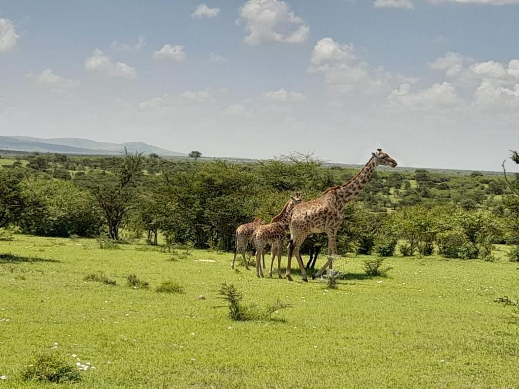
MasaiMara.ke logo

MasaiMara.ke is a conservation-led guide to the Masai Mara National Reserve and the Greater Mara ecosystem, written by local guides of the Sekenani Tour Guides Association.

© 2026 MasaiMara.ke · Bookings: Bookings@MasaiMara.ke

🦁 Private mid-range safari · 3 days / 2 nights

3 Days Masai Mara Mid-Range Safari from Nairobi

Travel from Nairobi in a private 4×4 Land Cruiser, stay for two nights at Masai Mara Sopa Lodge on a full-board basis, and spend a full day exploring Masai Mara National Reserve with a professional safari guide.

From $350 per person · Masai Mara Sopa Lodge · Private Land Cruiser · Full board · Park fees excluded
$350 from per person
3 days from Nairobi
2 nights at Sopa Lodge
4×4 private Land Cruiser
50% deposit to confirm
⭐ Safari overview

This package combines the affordability of a short road safari with the comfort, facilities and reliable full-board service of an established mid-range Masai Mara lodge.

Your safari starts in Nairobi with pickup from a hotel, residence, JKIA or Wilson Airport. You travel to the Masai Mara in a private 4×4 Land Cruiser, removing the need to change vehicles before entering wildlife-viewing areas.

Accommodation is at Masai Mara Sopa Lodge , an established mid-range lodge in the Oloolaimutia Hills on the eastern side of the Mara. The package includes two nights on a full-board basis, with breakfast, lunch and dinner arranged around the safari itinerary.

Day 2 is reserved for a full-day game drive inside Masai Mara National Reserve. A packed lunch allows you to stay in the reserve rather than returning to the lodge during productive wildlife-viewing hours.

This package is especially suitable for couples, families and small groups who want more comfort than a budget tented camp without moving into luxury-safari pricing.

Travelers prioritizing the lowest possible price can compare the 3-Day Masai Mara Budget Safari . Guests wanting two full game-drive days should consider the 4-Day Masai Mara Safari .

Private safari Land Cruiser used for the 3-day Masai Mara Sopa Lodge safari
A private Land Cruiser is used for the Nairobi road journey and Masai Mara game drives.
Mid-range safari lodge accommodation in an African wilderness setting
The package combines a traditional lodge stay with private safari transport and guiding.
Sunset over the African savannah during a Masai Mara safari
Two nights in the Mara allow time for both early-morning and late-afternoon wildlife viewing.
💵 2026 package prices

3-Day Masai Mara Sopa Lodge Safari Prices

These are complete safari-package prices, not accommodation-only rates. They include private Land Cruiser transport from Nairobi, two nights at Masai Mara Sopa Lodge, full-board meals, safari guiding, vehicle costs and the standard game-drive itinerary.

Best-value season
$537 pp for 2 sharing

Green Season

Travel from 1 April to 31 May 2026. Best for lower rates, green landscapes, fewer vehicles and value-focused travelers.

Balanced value
$612 pp for 2 sharing

Mid Season

Applies from 2 January to 31 March, 1–30 June and 1 November to 21 December 2026.

Peak wildlife period
$768 pp for 2 sharing

High Season

Applies from 1 July to 31 October and 22 December 2026 to 1 January 2027.

Travelers and Rooms Green Season Total Green PP Mid Season Total Mid PP High Season Total High PP
1 traveler in single room $935 $935 $1,033 $1,033 $1,235 $1,235
2 travelers sharing twin/double room $1,074 $537 $1,224 $612 $1,536 $768
3 travelers sharing triple room $1,159 $387 $1,349 $450 $1,747 $583
4 travelers in 2 twin/double rooms $1,399 $350 $1,699 $425 $2,323 $581

Prices are rounded to the nearest dollar and are based on the standard private Land Cruiser itinerary. Park-entry fees, optional activities, holiday supplements, drinks and tips are excluded. Final price is reconfirmed before deposit payment.

📆 Seasonal pricing

Which Price Season Applies to Your Safari?

Masai Mara Sopa Lodge uses three 2026 seasonal bands. Your check-in dates determine the package price.

Season 2026 Travel Dates Safari Conditions Best For
Green 1 April–31 May 2026 Green scenery, possible rain, fewer visitors and lower lodge costs Value, landscapes, photographers and repeat visitors
Mid 2 January–31 March;
1–30 June;
1 November–21 December 2026
Strong resident wildlife with balanced demand and pricing Couples, families and first-time safari travelers
High 1 July–31 October 2026;
22 December 2026–1 January 2027
Peak migration demand, busy sightings and limited room availability Great Migration travel and peak wildlife season
Holiday dates: Easter and festive-season stays may attract additional lodge supplements. The exact supplement will be shown in your final quotation before booking.
✅ Package inclusions

What Is Included and Excluded?

This is a private mid-range safari package with accommodation, transport and guiding arranged together.

Included

  • Private Nairobi pickup and drop-off at a hotel, residence, JKIA or Wilson Airport.
  • Private 4×4 Land Cruiser for the Nairobi–Mara journey and safari itinerary.
  • Two nights at Masai Mara Sopa Lodge.
  • Full-board lodge meals according to the itinerary.
  • Full-day Masai Mara game drive on Day 2.
  • Arrival-day wildlife viewing subject to route, timing and park-entry arrangements.
  • Professional English-speaking driver-guide.
  • Drinking water in the safari vehicle.
  • Vehicle fuel, insurance and driver costs.
  • Vehicle and driver park-entry charges.

Excluded

  • Guest Masai Mara park-entry fees.
  • Hot-air balloon safari.
  • Maasai village visit unless added to the quote.
  • Alcoholic drinks, soft drinks and bar purchases.
  • Tips for the driver-guide and lodge staff.
  • Travel insurance and medical evacuation cover.
  • Kenya eTA and international flights.
  • Extra meals or activities outside the listed itinerary.
  • Holiday supplements where applicable.
  • Personal expenses and souvenirs.
🗓️ Detailed itinerary

3 Days Masai Mara Sopa Lodge Safari Itinerary

The itinerary uses Day 2 as the main reserve day, while Day 1 and Day 3 handle the Nairobi road journey without making the safari feel rushed.

Day 1 Nairobi to Masai Mara Sopa Lodge
Nairobi Great Rift Valley Narok Sekenani Oloolaimutia Hills Masai Mara Sopa Lodge

Your safari begins with an early pickup from your Nairobi hotel, residence, JKIA or Wilson Airport. The recommended departure time is normally between 6:30 AM and 7:30 AM, depending on the pickup location.

Travel west from Nairobi through the Great Rift Valley. An optional stop can be made at a Rift Valley viewpoint for photographs, refreshments and a short briefing about the route.

Continue through Narok town and toward the eastern side of the Masai Mara. Your Land Cruiser then follows the access route toward the Sekenani and Oloolaimutia areas.

Arrive at Masai Mara Sopa Lodge, check in and enjoy lunch if your arrival time permits. The afternoon can be used for relaxation, swimming, lodge orientation or an optional wildlife-viewing drive.

Day 1 reserve entry is not automatically included in the quoted package. Guests who want an afternoon reserve game drive can add it, subject to arrival time and the applicable park-entry fee.

Meals: Lunch and dinner · Accommodation: Masai Mara Sopa Lodge
Day 2 Full-Day Masai Mara National Reserve Game Drive
Oloolaimutia Gate Sekenani Plains Keekorok Talek Plains Paradise Plains River Routes

Have an early breakfast before departing for a full-day game drive in Masai Mara National Reserve. Enter through the most practical gate based on road conditions and the guide’s planned route.

The morning drive focuses on predator activity and open-plains wildlife. Possible areas include the Oloolaimutia sector, Sekenani Plains, Keekorok grasslands, Hammerkop Plains, Talek routes and productive lion or cheetah territories.

Your guide adjusts the route around current wildlife reports, weather, road conditions and recent predator movement. Likely sightings include lions, elephants, buffalo, giraffes, zebras, wildebeest, topi, gazelles, hyenas, warthogs and raptors.

A packed picnic lunch allows you to remain inside the reserve. Where time and conditions permit, the drive may extend toward Paradise Plains, Lookout Hill, Talek River or other central Mara wildlife areas.

Continue with afternoon game viewing as temperatures begin to fall. Lions and other predators may become more active again in the late afternoon. Return to Masai Mara Sopa Lodge before or around sunset.

Meals: Breakfast, packed lunch and dinner · Accommodation: Masai Mara Sopa Lodge
Day 3 Masai Mara Sopa Lodge to Nairobi
Masai Mara Sopa Lodge Narok Great Rift Valley Nairobi JKIA / Wilson drop-off

Enjoy breakfast at the lodge and check out. Subject to your preferred departure time, an optional cultural visit or short morning activity can be arranged before leaving the Mara.

Begin the road journey to Nairobi through Narok and the Great Rift Valley. Comfort, refreshment and souvenir stops can be arranged along the way.

Drop-off is available at a Nairobi hotel, private residence, Wilson Airport or JKIA. Travelers connecting to a flight should allow enough time for road conditions, Nairobi traffic, airport check-in and security.

Meals: Breakfast
🏨 Lodge experience

Why Stay at Masai Mara Sopa Lodge?

Masai Mara Sopa Lodge is a good mid-range choice for travelers who value lodge facilities, spacious rooms, full-board dining and easy access to the eastern side of the reserve.

Established Safari Lodge

A long-established Mara property with a traditional lodge atmosphere, landscaped grounds and a large central public area.

Full-Board Dining

Breakfast, lunch and dinner are included, with a packed lunch used for the full-day game drive.

Swimming Pool

The pool provides a comfortable place to relax after the Nairobi road journey or between safari activities.

Family-Friendly Rooms

Twin, double and triple arrangements make the lodge practical for couples, friends and families.

Room Arrangement Bed Configuration Best For
Double room One large king-size bed Couples and solo travelers wanting a larger bed
Twin room Two queen-size beds Friends, siblings and adults sharing
Triple room Two queen-size beds plus one standard single bed Three adults or selected family arrangements

Room type and bed configuration remain subject to lodge availability at the time of confirmation.

🍽️ Full-board meals

Meals Included in the Safari Package

Safari Day Included Meals Dining Plan
Day 1 Lunch and dinner Lodge lunch subject to arrival time, followed by buffet or set-menu dinner.
Day 2 Breakfast, packed lunch and dinner Breakfast before departure, picnic lunch in the reserve and dinner at the lodge.
Day 3 Breakfast Breakfast before checkout and departure for Nairobi.
Dietary requirements: Vegetarian meals and common special-diet requests can usually be accommodated with advance notice. Share allergies and dietary needs when requesting your quote.
🦓 Wildlife experience

What You May See on This Safari

One full day inside Masai Mara National Reserve can produce excellent wildlife sightings, although individual species can never be guaranteed.

Big Cats

Lions are a major focus. Cheetahs are possible on open plains, while leopards may be found around drainage lines and riverine woodland.

Elephants and Buffalo

Elephants, buffalo, giraffes and mixed plains-game herds are regularly encountered across eastern and central Mara routes.

Migration Wildlife

During migration months, wildebeest and zebra concentrations may move through the wider Mara ecosystem. River crossings are never guaranteed.

African elephants that may be seen during a Masai Mara game drive
Elephants are among the principal wildlife highlights of a Masai Mara safari.
Open African savannah wildlife habitat during a Masai Mara safari
Open grasslands support lions, cheetahs, herbivore herds and raptors.
Giraffes on the African savannah during a Kenya safari
Giraffes, zebras, topi and gazelles are frequently seen on Mara plains.
👨‍👩‍👧 Family pricing

Children and Family Safari Bookings

Family quotes are prepared individually because children’s lodge accommodation, transport, meals and park fees are calculated differently.

Children Aged 0–3

The lodge accommodation component is normally free when sharing with adults. Park, transport and activity rules are confirmed separately.

Children Aged 4–12 Sharing

The lodge accommodation component is generally discounted when a child shares with one or more adults. Vehicle and park costs still apply.

Children in Their Own Room

A higher lodge charge applies when children occupy a separate room. A tailored family quotation will show the full package cost.

For an accurate family quote: include each child’s age, preferred room arrangement and whether the family wants one or two rooms.
🎟️ Reserve fees

Masai Mara Park Fees Are Excluded

Guest park-entry fees are paid separately because rates differ by travel season, nationality, residency category and age.

The standard package normally requires one principal park-entry day for the full-day Day 2 safari. Adding an afternoon game drive on Day 1 or a morning drive on Day 3 may create another park-entry charge.

Review the current Masai Mara entry-fee guide before travel.

Park-fee planning

  • Day 1: No reserve fee in the base itinerary unless an afternoon reserve game drive is added.
  • Day 2: Main reserve-entry day for the full-day game drive.
  • Day 3: No reserve entry in the standard return itinerary.
  • Children: Age-based park discounts are calculated separately.
➕ Add-ons

Customize Your Mid-Range Safari

Add-On Best For Booking Note
Hot-air balloon safari Honeymoons, photographers and special occasions Subject to availability; normally starts before sunrise.
Maasai village visit Cultural experience Can be added on Day 1 or Day 3 depending on timing.
Day 1 afternoon reserve drive Guests wanting more wildlife time Requires sufficient arrival time and additional park-entry planning.
Day 3 sunrise drive Photography and predator-focused guests May require another park-entry period.
Private room upgrade Friends or family members wanting separate rooms Priced according to room occupancy and season.
Lake Nakuru or Naivasha extension First-time Kenya visitors Compare longer Masai Mara safari packages .
📊 Package comparison

Budget vs Mid-Range vs 4-Day Safari

Package Accommodation Game-Drive Time Best For
3-Day Budget Safari Kambu Mara Camp One full-day game drive Lowest price and simple tented-camp experience
3-Day Mid-Range Sopa Safari Masai Mara Sopa Lodge One full-day game drive Pool, lodge amenities, full-board comfort and private Land Cruiser
4-Day Masai Mara Safari Kambu Mara Camp or upgrade Two full-day game drives More wildlife depth, photography and migration-focused travel
🗺️ Road route

Nairobi to Masai Mara Sopa Lodge

The safari travels from Nairobi through the Great Rift Valley and Narok to the eastern side of the Masai Mara.

Outbound route

Nairobi → Great Rift Valley → Narok → Sekenani / Oloolaimutia area → Masai Mara Sopa Lodge

Return route

Masai Mara Sopa Lodge → Narok → Great Rift Valley → Nairobi hotel, residence, Wilson Airport or JKIA

📩 Booking steps

How to Book the Safari

  • Email: Bookings@MasaiMara.ke
  • Send your preferred dates.
  • State the number of adults and children.
  • Include children’s ages.
  • Choose single, twin, double or triple rooms.
  • Share your Nairobi pickup and drop-off location.
  • Add dietary needs and optional activities.
  • Confirm with the required deposit.

Suggested enquiry message

Hello MasaiMara.ke, I would like a quote for the 3-Day Masai Mara Mid-Range Safari staying at Masai Mara Sopa Lodge. Our dates are [dates]. We are [number] adults and [number] children aged [ages]. We need [single/twin/double/triple] rooms. Pickup is from [location]. Please confirm availability, package price, park fees and deposit steps.

💳 Payment and cancellation

Booking Terms

Payment

  • A deposit is required after lodge and vehicle availability are confirmed.
  • MasaiMara.ke normally requests a 50% safari-package deposit.
  • The lodge may impose earlier balance-payment requirements during high-demand periods.
  • Payment options may include Pesapal, card and M-Pesa.
  • Final payment deadlines are shown on the booking confirmation.

Cancellation

  • Cancellation rules differ between green, mid and high seasons.
  • High-season bookings have stricter cancellation deadlines.
  • No-shows are non-refundable.
  • Payment-processing, card and bank fees may be non-refundable.
  • The exact cancellation schedule is supplied before deposit payment.
❓ Frequently asked questions

3-Day Masai Mara Mid-Range Safari FAQs

How much does the 3-day Masai Mara mid-range safari cost?
The package starts from approximately $350 per person for four travelers during green season. For two people sharing, prices start from approximately $537 per person in green season, $612 in mid season and $768 in high season.
Where do guests stay?
Guests stay for two nights at Masai Mara Sopa Lodge on a full-board basis.
Is this a private safari?
Yes. The listed package uses a private Land Cruiser and private driver-guide for your group.
Are Masai Mara park fees included?
No. Guest park-entry fees are paid separately because the applicable amount varies by season, residency and age.
Are meals included?
Yes. The package includes lunch and dinner on Day 1, breakfast, packed lunch and dinner on Day 2, and breakfast on Day 3.
Can children join this safari?
Yes. Family quotations are calculated using the children’s ages, room arrangement, lodge child policy, park fees and transport requirements.
Can we be picked up from JKIA?
Yes. JKIA pickup and final drop-off can be arranged. Share your flight number, arrival time and onward-flight details when booking.
Is a full-day game drive included?
Yes. Day 2 includes a full-day game drive with a packed lunch.
Can we add an afternoon game drive on Day 1?
Yes, provided your Nairobi departure and Mara arrival time allow it. Additional park-entry charges may apply.
Can we add a balloon safari?
Yes. A Masai Mara balloon safari can be added subject to availability and itinerary timing.
What is the difference between green, mid and high season?
Green season has the lowest lodge costs and fewer visitors. Mid season provides balanced pricing and strong resident wildlife. High season covers peak migration and festive periods, when demand and prices are highest.
Is three days enough for Masai Mara?
Three days is enough for a short, rewarding safari with one full reserve day. Four days is better for travelers wanting two full game-drive days and broader wildlife coverage.

Book the 3-Day Masai Mara Sopa Lodge Safari

Send your travel dates, number of adults and children, preferred room arrangement and Nairobi pickup location. MasaiMara.ke will confirm Sopa Lodge availability and send a detailed safari quotation.

Email Bookings@MasaiMara.ke
[chbs_booking_form booking_form_id=”23598″]
Scroll to Top